
Adaptive map layer visibility control

a map layer and visibility control technology, applied in maps/plans/charts, instruments, computing, etc., can solve the problems of regions not displaying optimally, users would have a very difficult time locating tracts in the state of wyoming

Inactive Publication Date: 2009-06-18
SOCIAL EXPLORER
View PDF7 Cites 83 Cited by
  • Summary
  • Abstract
  • Description
  • Claims
  • Application Information

AI Technical Summary

Benefits of technology

[0012]In various embodiments, turning the layer on or off according to the visibility value includes utilizing the visibility value to obtain a corresponding optimal scale, and then turning the layer on if the scale of the current map view is greater than the corresponding optimal scale. In certain embodiments, a set of optimal scales may be provided that associates a plurality of visibility values or visibility value ranges with a corresponding plurality of optimal scale values or scale value ranges. The visibility value may then be used to select the corresponding scale value that is then used as the corresponding optimal scale.
[0013]Another aspect provides

Problems solved by technology

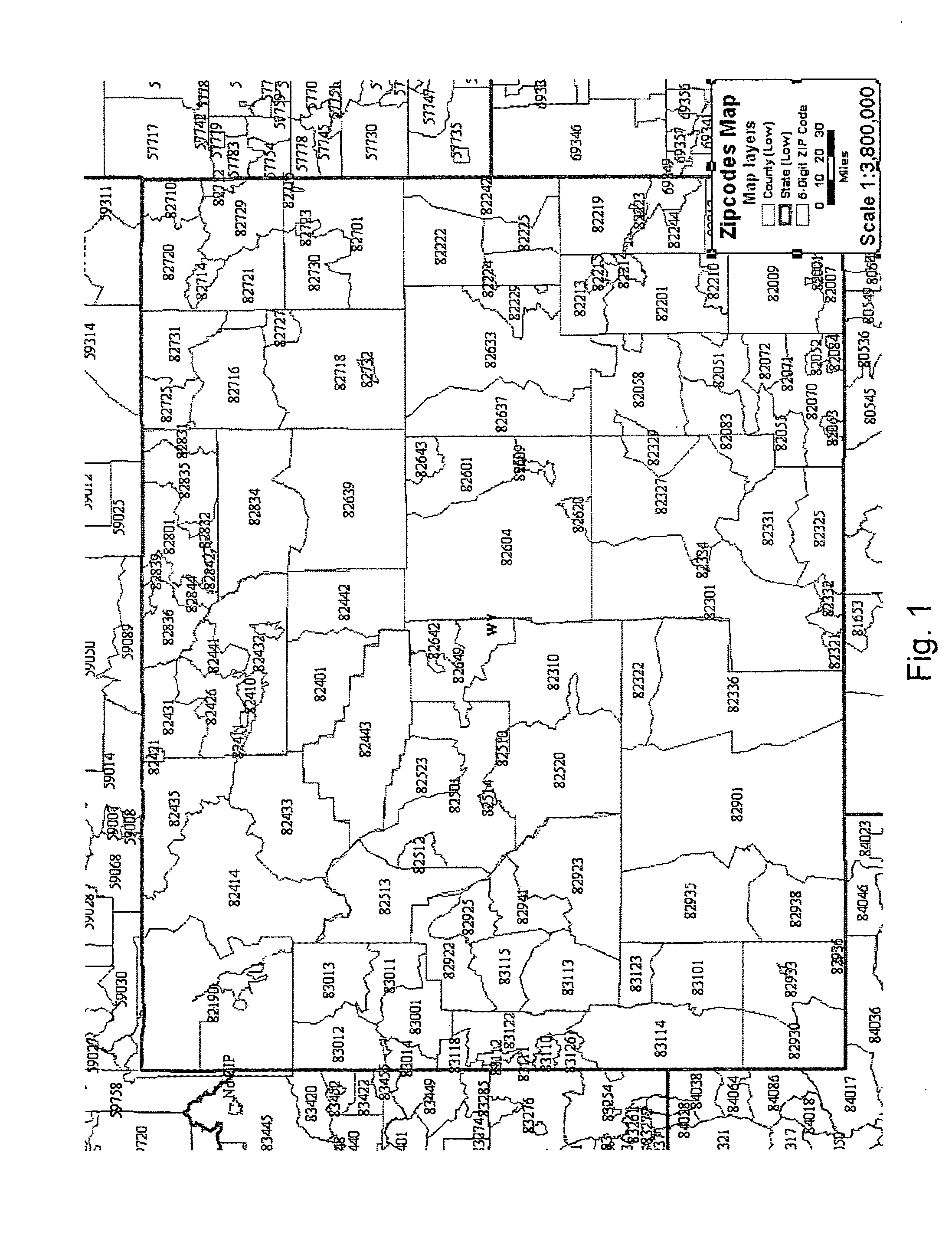
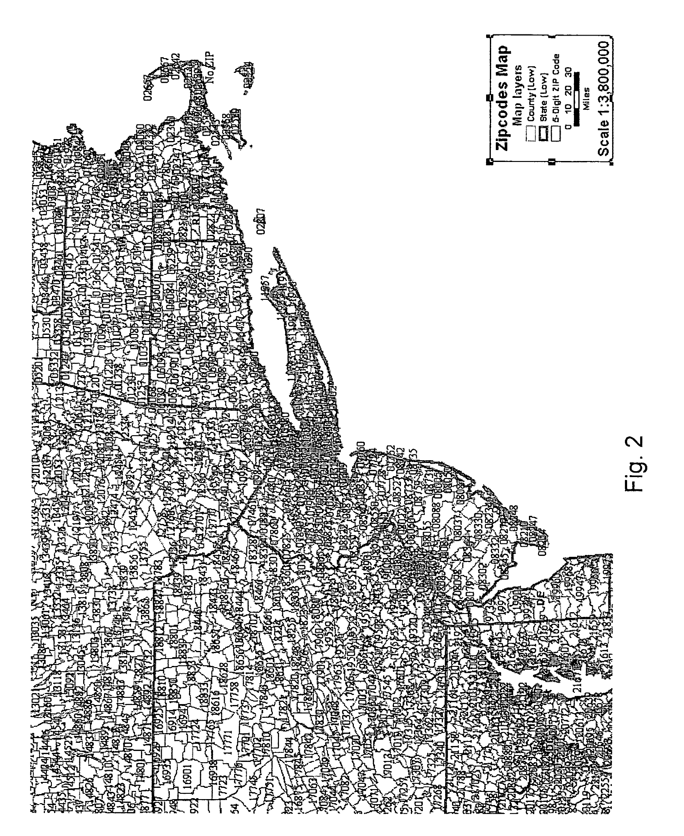
Displaying census tract outlines at the suggested scale of 2 miles per inch may work fine for New York City, but at that scale a user would have a very hard time locating tracts in the state of Wyoming.
The disparity between these two regions is so great that any attempt at bridging them would result in at least one of the regions not displaying optimally.

Method used


Image

  • Adaptive map layer visibility control
  • Adaptive map layer visibility control
  • Adaptive map layer visibility control

Examples


Embodiment Construction

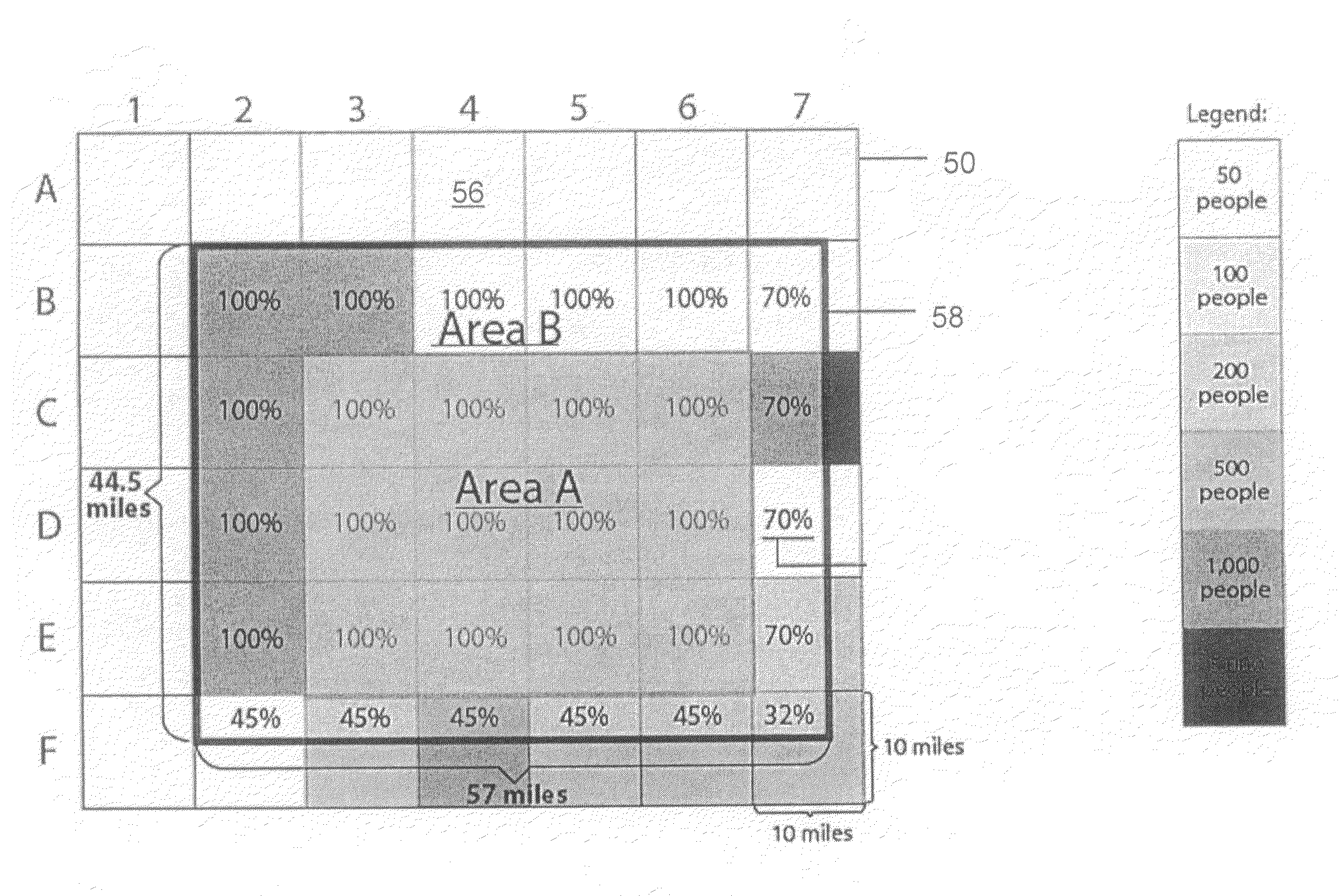
[0030]Various non-limiting embodiments disclosed herein disclose methods and related systems that provide adaptive scaling to allow map designers or users of interactive mapping systems to control the scale at which a layer will be turned on or turned off based upon a visibility value computed from data within the area being viewed. If, for example, the user is looking at Wyoming, one set of optimal scales would apply, whereas another set of optimal scales would apply for New York City. As a result, the map view is optimized for the region being viewed.

[0031]In various embodiments, a visibility value is used to determine when a layer is turned on or off. The visibility value may be computed, for example, using either geographic density (such as features per unit area), population density (object instances per unit area), an absolute count value of the features present in the current view, or any other suitable function of features or data present within the current view. Therefore, ...


PUM


Abstract

The instant application provides a method and related system that adaptively turns layers on and off based upon a visibility value extracted from a respective layer or related database. Map data is first portioned by a grid and the visibility value for a layer is computed for each grid element. For a given map view, the visibility value of all grid elements within the view is used to compute an overall average visibility value for the layer in the current map view. The layer is then activated based upon the average visibility value as compared to a table of optimal scales.

Description

STATEMENT REGARDING FEDERALLY FUNDED RESEARCH[0001]The research leading to the present invention was supported in part by National Science Foundation Grant No. 0226279. Accordingly, the U.S. Government may have certain rights in this invention.FIELD OF THE INVENTION[0002]The present invention relates generally to mapping methods and systems. More particularly, the present invention discloses a method and related system that adaptively controls the display of one or more layers on a map.BACKGROUND OF THE INVENTION[0003]Vector based maps are usually composed of multiple geographic vector layers. Each layer of the map provides geographic information, such as country boundaries, state boundaries, city locations, roads, geographic features and other geographical information. The display of these layers is controlled by a respective style, which may include line color, thickness and visibility, and which also indicates the scale at which the respective layer becomes visible and when the l...

Claims


Application Information

Patent Timeline
IPC IPC(8): G06F3/14
CPCG09B29/007G09B29/005
Inventor LACEVIC, AHMEDBEVERIDGE, ANDREW
Owner SOCIAL EXPLORER
Learn More