Method of Collecting Information for a Geographic Database for use with a Navigation System
a geographic database and information collection technology, applied in the field of navigation system operation, can solve the problems of end users being confused as to their orientation and where to turn
- Summary
- Abstract
- Description
- Claims
- Application Information
AI Technical Summary
Problems solved by technology
Method used
Image
Examples
Embodiment Construction
[0020]I. Navigation System
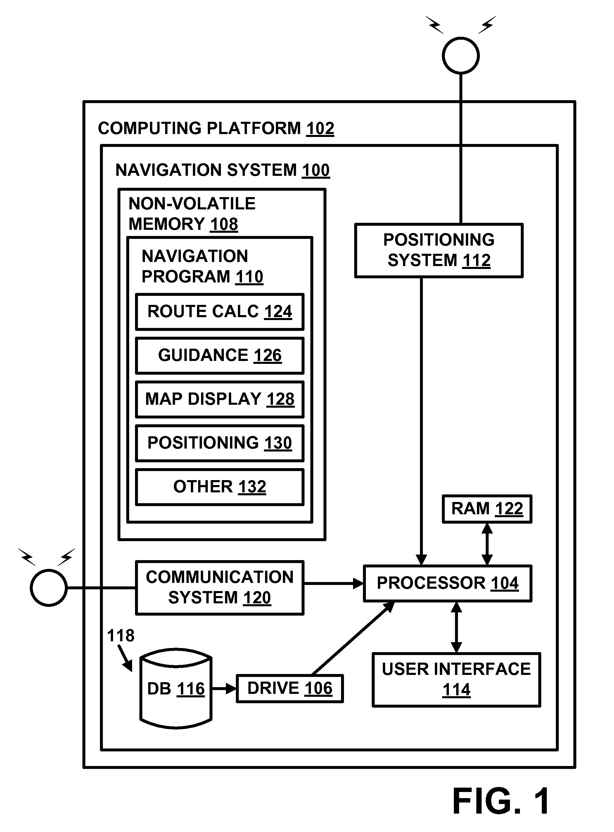
[0021]FIG. 1 is a block diagram of a navigation system 100 associated with a computing platform 102, such as an in-vehicle navigation device, a personal navigation device, a mobile computer, mobile telephone, personal digital assistant (PDA), personal computer, or any other computer, according to an exemplary embodiment. The navigation system 100 is a combination of hardware and software components. In one embodiment, the navigation system 100 includes a processor 104, a drive 106 connected to the processor 104, and a non-volatile memory storage device 108 for storing navigation application software programs 110 and possibly other information.
[0022]The navigation system 100 also includes a positioning system 112. The positioning system 112 may utilize GPS-type technology, a dead reckoning-type system, or combinations of these or other systems, all of which are known in the art. The positioning system 112 may include suitable sensing devices that measure the...
PUM
 Abstract
Description
Claims
Application Information
 - R&D
- Intellectual Property
- Life Sciences
- Materials
- Tech Scout
- Unparalleled Data Quality
- Higher Quality Content
- 60% Fewer Hallucinations
Browse by: Latest US Patents, China's latest patents, Technical Efficacy Thesaurus, Application Domain, Technology Topic, Popular Technical Reports.
© 2025 PatSnap. All rights reserved.Legal|Privacy policy|Modern Slavery Act Transparency Statement|Sitemap|About US| Contact US: help@patsnap.com


