
Method For Remote Identification And Characterization of Hydrocarbon Source Rocks Using Seismic and Electromagnetic Geophysical Data

a geophysical data and seismic wave technology, applied in the field of hydrocarbon exploration, can solve the problems of large uncertainties, essentially unknown source adequacy, and inability to definitively identify the presence of adequate source rocks

Active Publication Date: 2011-05-12
EXXONMOBIL UPSTREAM RES CO
View PDF20 Cites 75 Cited by
  • Summary
  • Abstract
  • Description
  • Claims
  • Application Information

AI Technical Summary

Problems solved by technology

In undrilled or poorly explored basins, source adequacy is essentially unknown and is a major exploration risk.
However, these approaches have large uncertainties, and generally have not definitely identified the presence of adequate source rocks.
Source rocks typically occupy a relatively small fraction of total shale volume, and may not have clear seismic reflection boundaries within the shale interval, so their detection can be difficult.
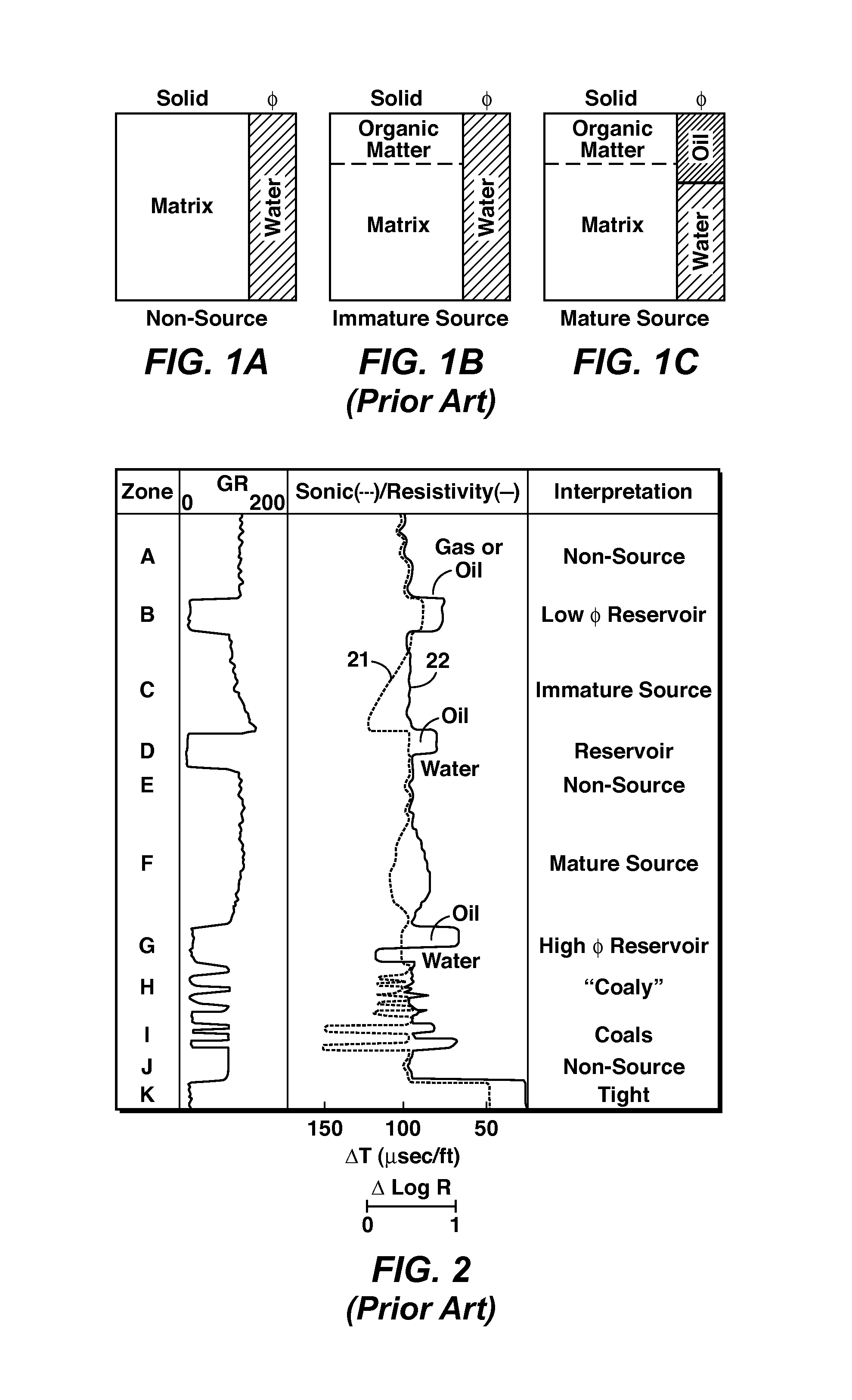
It is difficult to differentiate the two zones from the sonic log alone, but the resistivity log distinguishes them.

Method used


Image

  • Method For Remote Identification And Characterization of Hydrocarbon Source Rocks Using Seismic and Electromagnetic Geophysical Data
  • Method For Remote Identification And Characterization of Hydrocarbon Source Rocks Using Seismic and Electromagnetic Geophysical Data
  • Method For Remote Identification And Characterization of Hydrocarbon Source Rocks Using Seismic and Electromagnetic Geophysical Data

Examples


Embodiment Construction

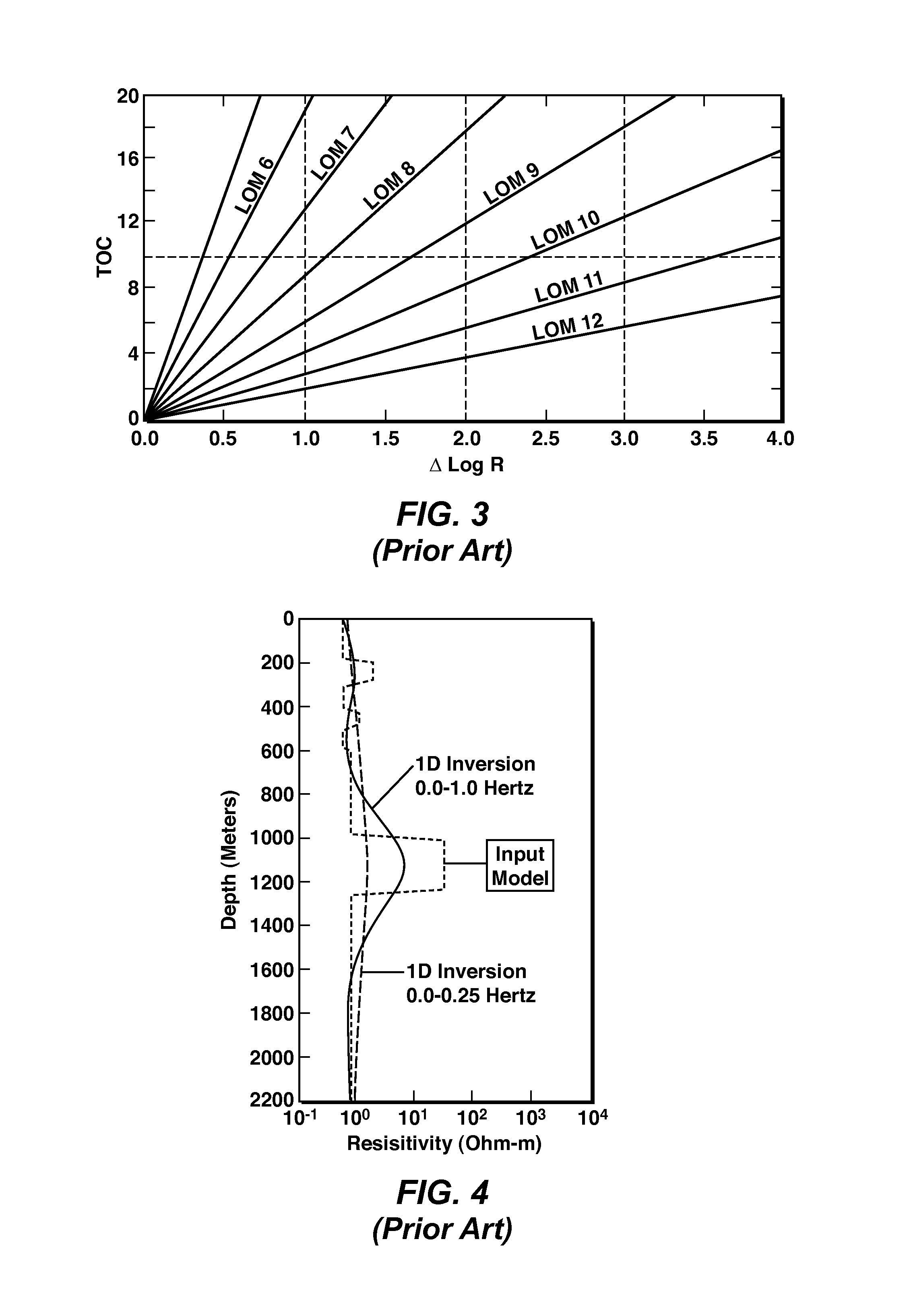
[0025]The present invention extends the well known DeltaLogR well-based method for estimating hydrocarbon source rock TOC, so that it is performed using seismic and electromagnetic geophysical data acquired remotely from the subsurface hydrocarbon source rock. Formation interval velocities derived from the seismic data, and formation resistivity data derived from the electromagnetic data (preferably controlled-source electromagnetic (“CSEM”) survey data), are used instead of well log sonic and resistivity data from wells, respectively, to produce a new Remote DeltaLogR (or “RDeltaLogR”) response. This new response is interpreted in conjunction with the overall character of the seismic reflection data (including continuity, geometry, and reflection amplitude) in cross-section, map, and volume views to further distinguish source rock from hydrocarbon reservoir rocks that can also exhibit an RDeltaLogR response, and from fine-grained non-source rocks such as low TOC shales. The present...


PUM


Abstract

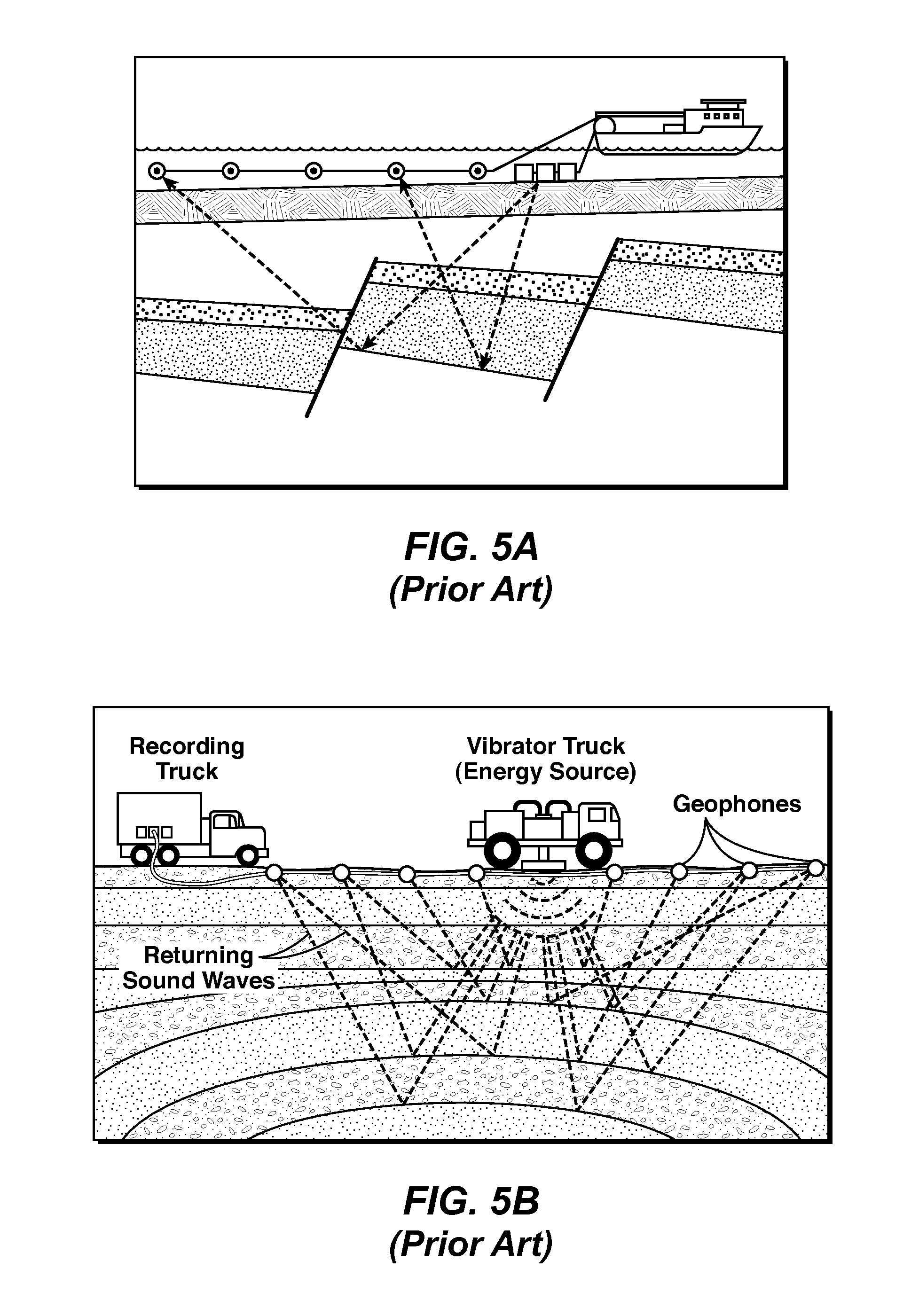
Method for assessing hydrocarbon source rock potential of a subsurface region without well log information. The method uses surface electromagnetic (121) and seismic (122) survey data to obtain vertical profiles of resistivity and velocity (123), which are then analyzed in the same way as well log data are analyzed by the well known DeltaLogR method (124).

Description

CROSS REFERENCE TO RELATED APPLICATION[0001]This application claims the benefit of U.S. Provisionl Application 61 / 259,459, filed Nov. 9, 2009, entitled Method for Remote Identification and Characterization of Hydrocarbon Source Rocks Using Seismic and Electromagnetic Geophysical data, the entirety of which is incorporated by reference herein.FIELD OF THE INVENTION[0002]This invention relates generally to the field of hydrocarbon exploration, and more particularly to identification and characterization of hydrocarbon (oil, gas, and natural-gas liquids) source rocks in onshore and offshore sedimentary basins, using combined seismic and electromagnetic geophysical data acquired at or near the surface of the earth, sea, or seafloor. The invention also relates to subsurface formation interval seismic velocity, bulk density, and electrical resistivity measured from well logs in a borehole as means to calibrate the seismic and electromagnetic geophysical data.BACKGROUND OF THE INVENTION[00...

Claims


Application Information

Patent Timeline
Patent Type & Authority Applications(United States)
IPC IPC(8): E21B43/00G01V3/12G01V1/30G06F19/00G06F7/60
CPCG01V2210/6163G01V11/00
Inventor SRNKA, LEONARD J.PASSEY, QUINN R.BOHACS, KEVIN M.CONVERSE, DAVID R.ZHU, YAPING
Owner EXXONMOBIL UPSTREAM RES CO
Learn More