

Method and system for automatically planning and scheduling a remote sensing satellite mission
a remote sensing satellite and automatic planning technology, applied in the direction of cosmonautic components, forecasting, cosmonautic parts, etc., can solve the problems of cumbersome process of selecting points of interest, consuming a large amount of time, and requiring huge investment of resources and tim
- Summary
- Abstract
- Description
- Claims
- Application Information
AI Technical Summary
Benefits of technology
Problems solved by technology
Method used
Image

Examples
Embodiment Construction
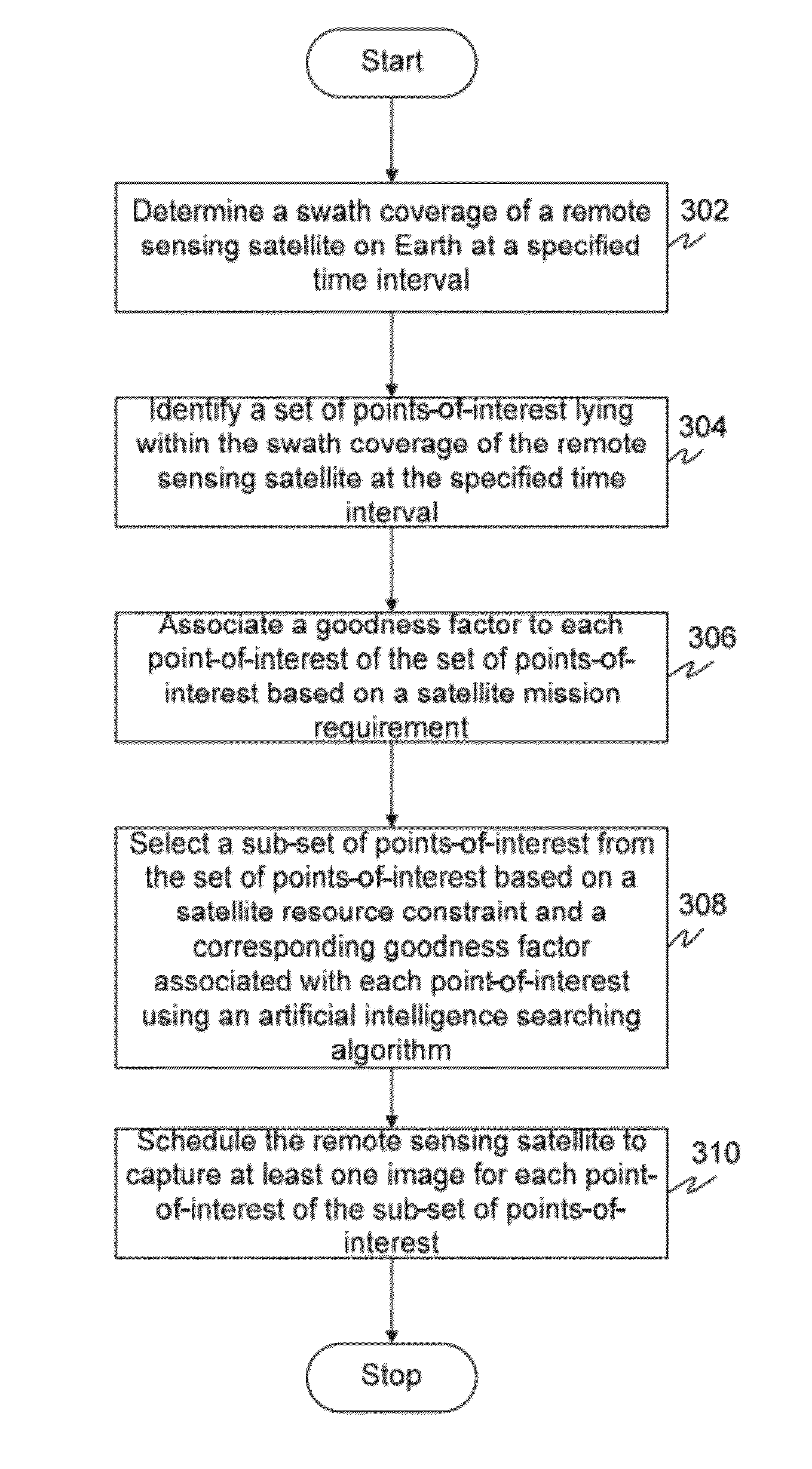
[0013]Before describing in detail embodiments that are in accordance with the invention, it should be observed that the embodiments reside primarily in combinations of method steps and apparatus components related to method and system for automatic planning and scheduling of a remote sensing satellite mission. Accordingly, the system components and method steps have been represented where appropriate by conventional symbols in the drawings, showing only those specific details that are pertinent to understanding the embodiments of the invention so as not to obscure the disclosure with details that will be readily apparent to those of ordinary skill in the art having the benefit of the description herein.
[0014]In this document, relational terms such as first and second, top and bottom, and the like may be used solely to distinguish one entity or action from another entity or action without necessarily requiring or implying any actual such relationship or order between such entities or...
PUM
 Abstract
Description
Claims
Application Information