Geography puzzle and game platform

a geography and game technology, applied in the field of puzzles and games, can solve the problems of difficult for students to grasp the physical relationship or features of various countries and continents with the current educational tools, difficult for students to learn the relationship between countries, country locations, and shapes of countries, and achieve the effect of effective geography education

Inactive Publication Date: 2013-07-11
WU MING YUAN
View PDF9 Cites 6 Cited by
  • Summary
  • Abstract
  • Description
  • Claims
  • Application Information

AI Technical Summary

Benefits of technology

[0011]To achieve these and other advantages and in order to overcome the disadvantages of the conventional methods in accordance with the purpose of the invention as embodied and broadly described herein, the present invention provides a geography puzzle and game platform with shaped puzzle pieces that attach to a base to provide an effective geography education tool and entertaining gaming system.
[0014]Also, in order to improve the effectiveness of learning, the puzzle pieces are formed in the shape of a land mass. For example, the puzzle piece is in the shape of a country, state, continent, province, region, etc. Some areas such as, for example, water, oceans, and seas are formed in the puzzle base during production of the puzzle base.
[0015]Additionally, the puzzle pieces are contoured to show mountains, mountain ranges, and terrain contours. This allows students to learn additional information.
[0016]The puzzle pieces of the geography puzzle and game platform further comprise data or information about the land mass or water mass such as country information, continent information, state information, province information, region information, territory information, etc. This further increases the amount of information the student can learn when using the geography puzzle and game platform.
[0017]When the data or information is provided on the outer side of the puzzle piece the student can easily reference the information. When the data or information is provided on the inner side of the puzzle piece the data is visible or is hidden and the student can challenge their memorization of the information.
[0018]The puzzle base further comprises markings or indicators such as longitudinal and latitudinal indicators, land mass location or outline, or water mass location or outline. These markings provide a visual prompting for the student and make the puzzle easier for beginning students or allow the student to learn additional longitudinal and latitudinal information.

Problems solved by technology

However, it can be difficult for students to grasp physical relationships or features of various countries and continents with the current educational tools.
However, it is difficult for students to learn relationships between countries, country locations, and shapes of countries as the countries printed on the map are fixed.
However, the conventional atlas has the same disadvantages as a single flat map.
While students can obtain a better sense of country location than with a map, the printed map of the globe is fixed and the student has difficulty learning country shape.
Furthermore, the conventional map and globe fail to provide an entertaining means of learning geography locations and facts.

Method used


Image

  • Geography puzzle and game platform
  • Geography puzzle and game platform
  • Geography puzzle and game platform

Examples


Embodiment Construction

[0047]Reference will now be made in detail to the preferred embodiments of the present invention, examples of which are illustrated in the accompanying drawings. Wherever possible, the same reference numbers are used in the drawings and the description to refer to the same or like parts.

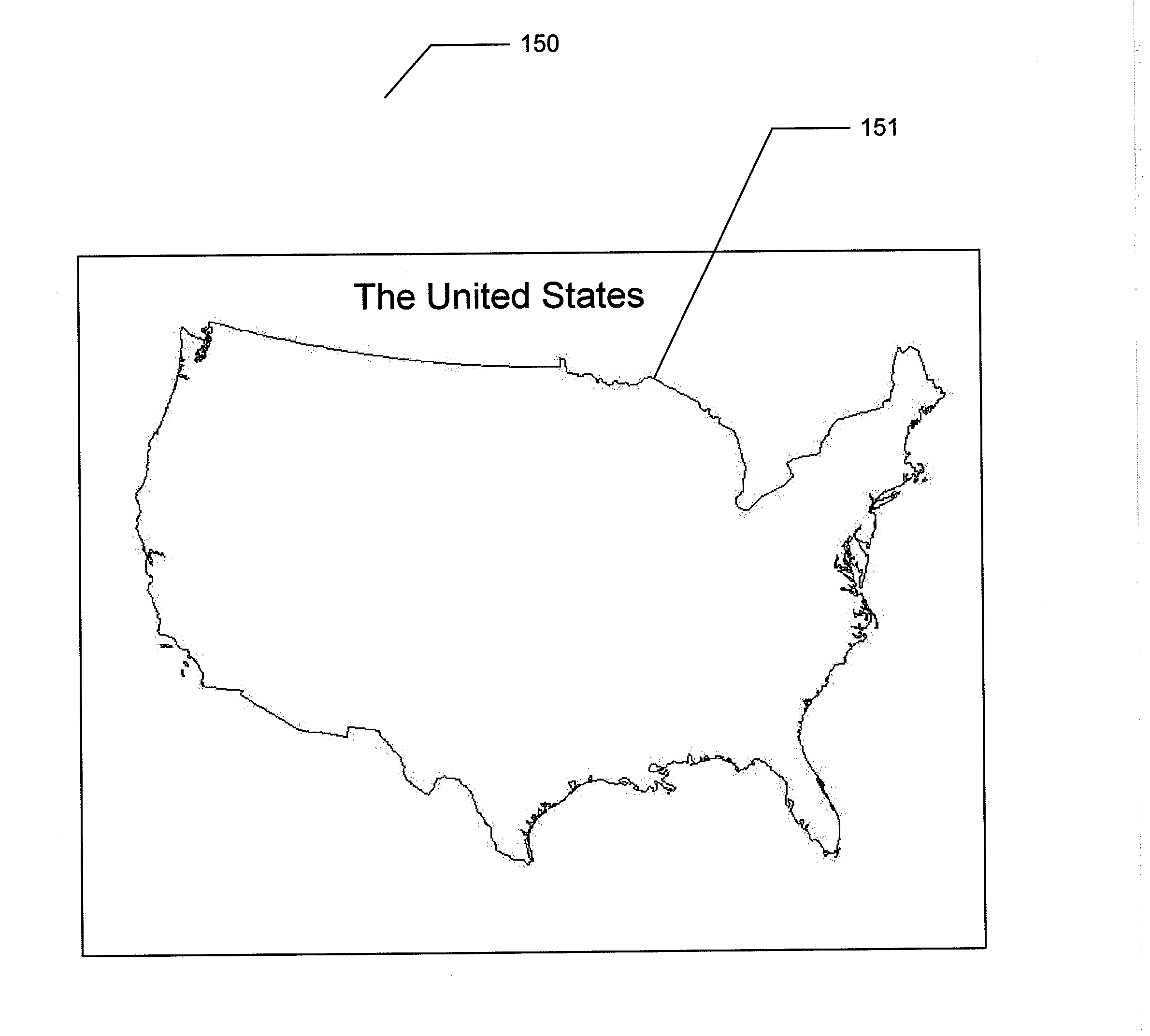
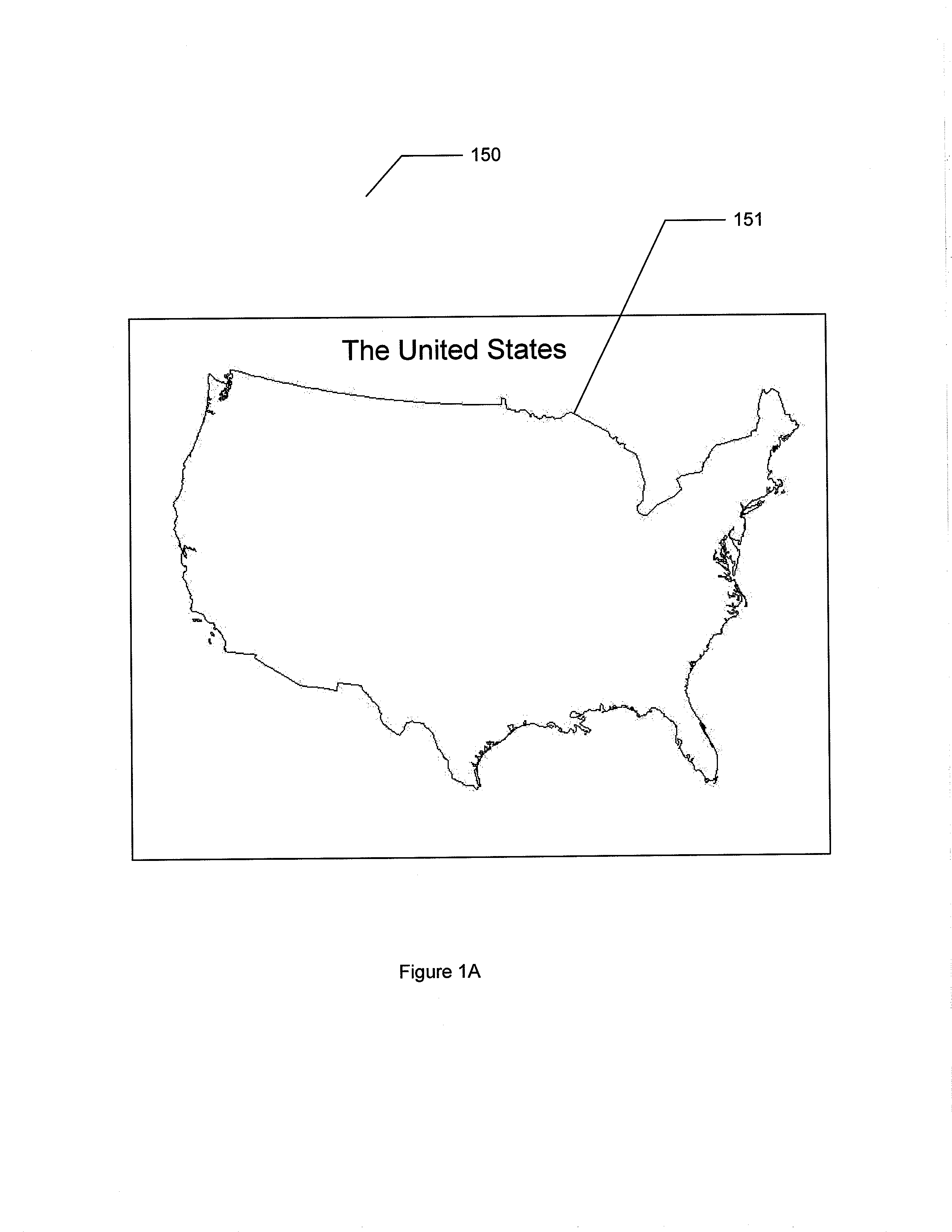
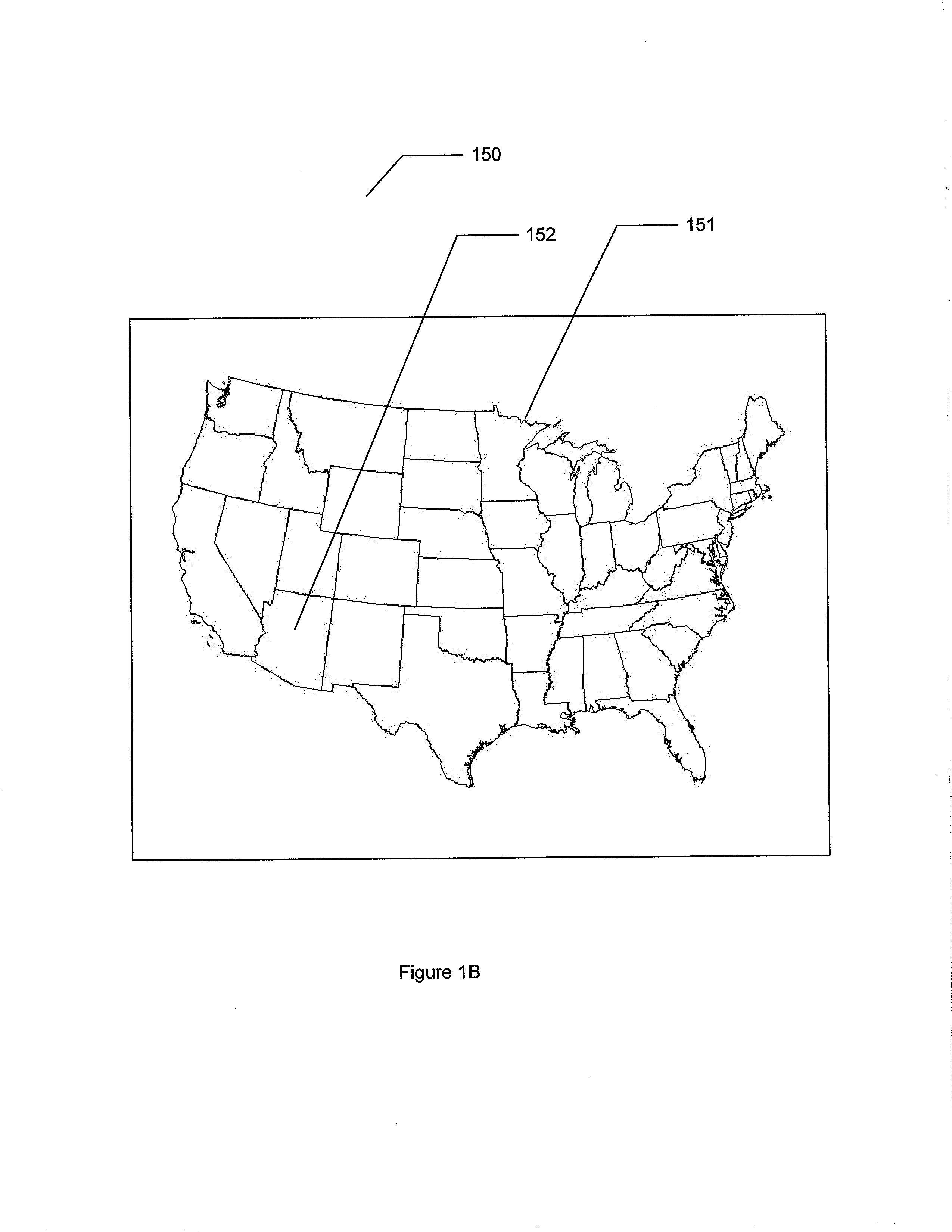
[0048]Refer to FIGS. 1A-1B, which are drawings illustrating a puzzle base of a geography puzzle and game platform according to embodiments of the present invention.

[0049]The geography puzzle and game platform 100 of the present invention comprises a puzzle base 150. The puzzle base 150 comprises a rigid or semi-rigid base for the geography puzzle and game platform 100 and allows puzzle pieces to attach magnetically to the puzzle base 150.

[0050]In the embodiment illustrated in FIG. 1A the puzzle base 150 comprises a puzzle outline 151 to show the boarder of the puzzle and indicate the subject of the puzzle. In the embodiment illustrated in FIG. 1A the puzzle outline 151 indicates that the subject of t...


PUM


Abstract

A geography puzzle and game platform for learning geography and geographical information is disclosed. The geography puzzle and game platform comprises a puzzle base and a plurality of puzzle pieces. The puzzle pieces are arranged on the puzzle base by a user and are held to the puzzle base by magnetism. The puzzle pieces are formed in the shape of specific land masses. Metallic material or magnetic material is provided on the puzzle pieces or the puzzle base to allow the puzzle pieces to magnetically attach to puzzle base. A display is provided for displaying puzzle and game information and a speaker is provided for emitting audio information related to the puzzle or game. Each puzzle piece comprises a puzzle piece identification for uniquely identifying the puzzle piece. A plurality of sensors in the puzzle base detects the puzzle piece identification of the puzzle piece.

Description

BACKGROUND OF THE INVENTION[0001]1. Field of the Invention[0002]The present invention relates to puzzles and games. More specifically, the present invention discloses a puzzle with shaped puzzle pieces that attach to a puzzle base to provide an effective geography education tool and entertaining game platform.[0003]2. Description of the Prior Art[0004]The study of geography is a fundamental of education. However, it can be difficult for students to grasp physical relationships or features of various countries and continents with the current educational tools.[0005]Traditionally, students study geography using a flat two-dimensional map. The conventional flat two-dimensional map is typically a printed piece of paper containing outlines of various countries.[0006]When used as a learning tool, students must solely rely on memorization in order to learn the various countries on the map. However, it is difficult for students to learn relationships between countries, country locations, an...

Claims


Application Information

Patent Timeline
Patent Type & Authority Applications(United States)
IPC IPC(8): A63F9/06
CPCA63F3/00694A63F2003/0047A63F3/04A63F3/0434A63F3/0457A63F9/10A63F2009/2489A63F2009/1033A63F2009/1083A63F2009/2486A63F2009/242A63F2009/2439A63F2009/247A63F2003/0439
Inventor WU, MING-YUAN
Owner WU MING YUAN
Why Eureka
Try Eureka