

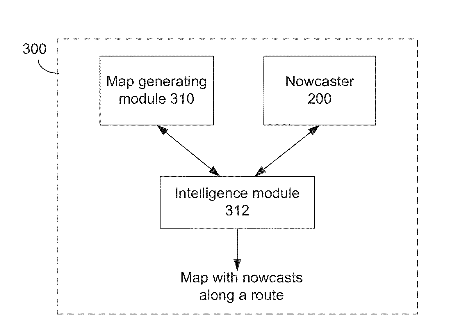
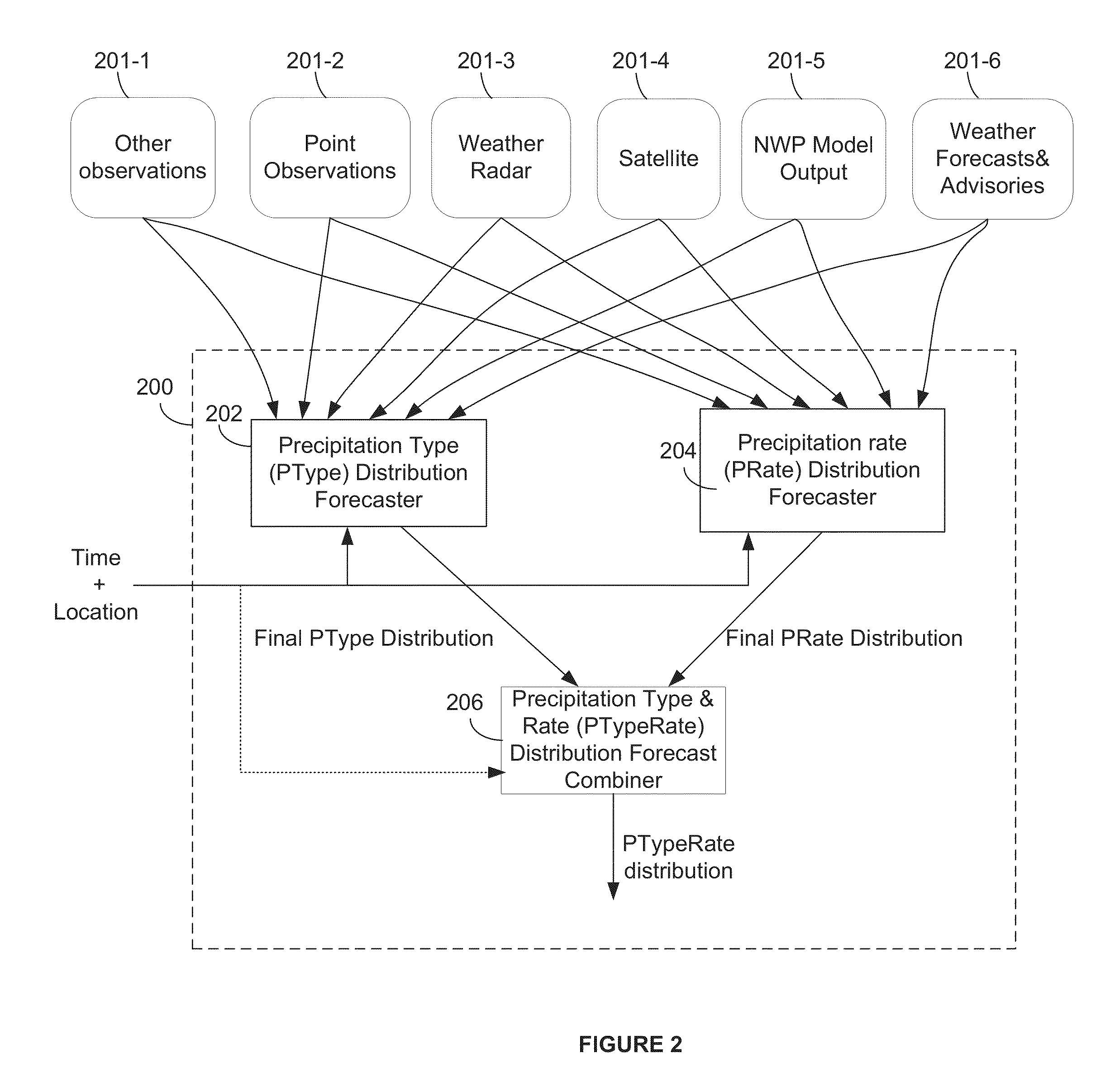
Method and system for displaying nowcasts along a route on a map
a map and route technology, applied in the field of system for determining weather forecasts, can solve the problems of inability for users to know if the forecast is accurate, inaccurate forecasts for a precise location, etc., and achieve the effect of less precision and variation in position
- Summary
- Abstract
- Description
- Claims
- Application Information
AI Technical Summary
Benefits of technology
Problems solved by technology
Method used
Image

Examples
Embodiment Construction
[0048]The embodiments will now be described more fully hereinafter with reference to the accompanying drawings, which form a part hereof, and which show, by way of illustration, specific embodiments by which the embodiments may be practiced. The embodiments are also described so that the disclosure conveys the scope of the invention to those skilled in the art. The embodiments may, however, be embodied in many different forms and should not be construed as limited to the embodiments set forth herein.
[0049]Among other things, the present embodiments may be embodied as methods or devices. Accordingly, the embodiments may take the form of an entirely hardware embodiment, an entirely software embodiment, an embodiment combining software and hardware aspects, etc. Furthermore, although the embodiments are described with reference to a portable or handheld device, they may also be implemented on desktops, laptop computers, tablet devices or any computing device having sufficient computing...
PUM
 Abstract
Description
Claims
Application Information