

Generating Reduced Resolution Textured Model From Higher Resolution Model
a textured model and higher resolution technology, applied in the field of display three-dimensional models, can solve the problems of inefficient space texturing of coarse resolution models, inability to apply the texture used for the higher resolution model to the lower resolution model, and increase or decrease the complexity etc., to achieve the effect of simplifying the texture of a three-dimensional model and the lower resolution version
- Summary
- Abstract
- Description
- Claims
- Application Information
AI Technical Summary
Benefits of technology
Problems solved by technology
Method used
Image

Examples
Embodiment Construction
I. Overview
II. Generating a Textured Three-Dimensional Model
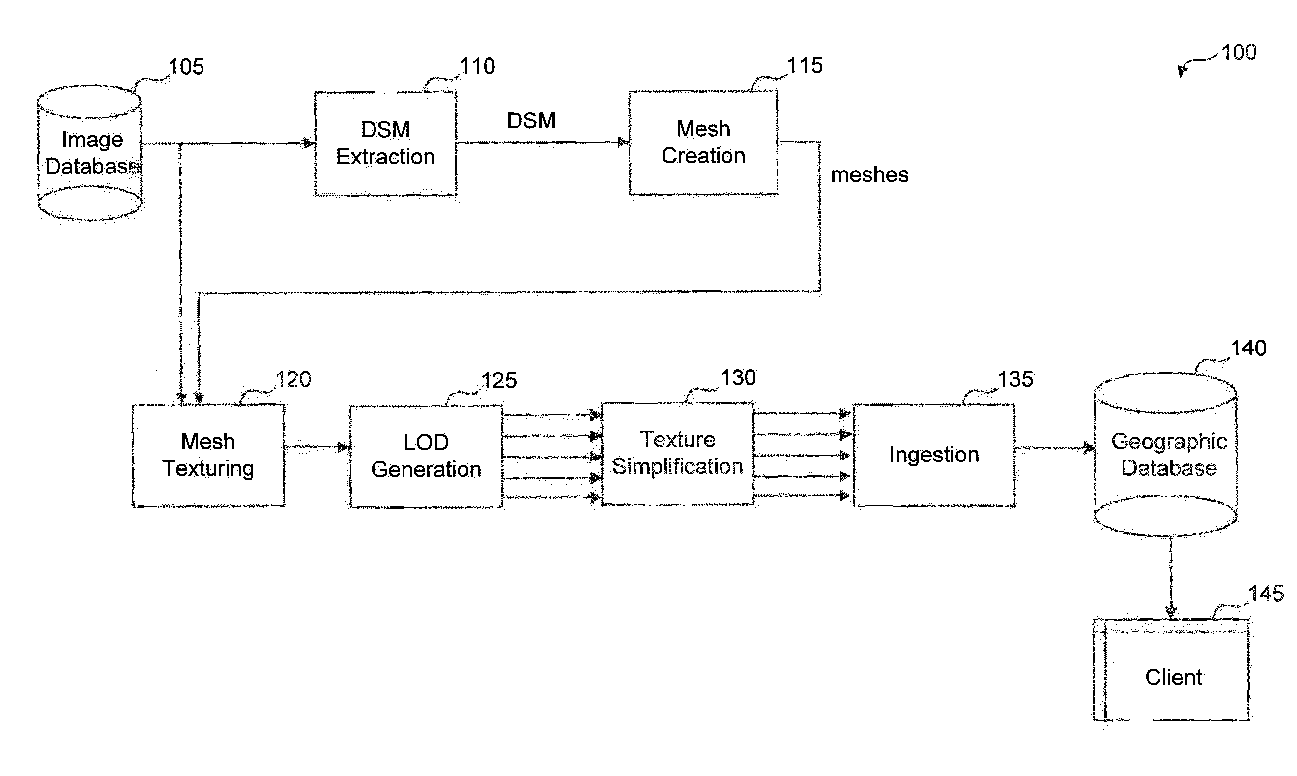
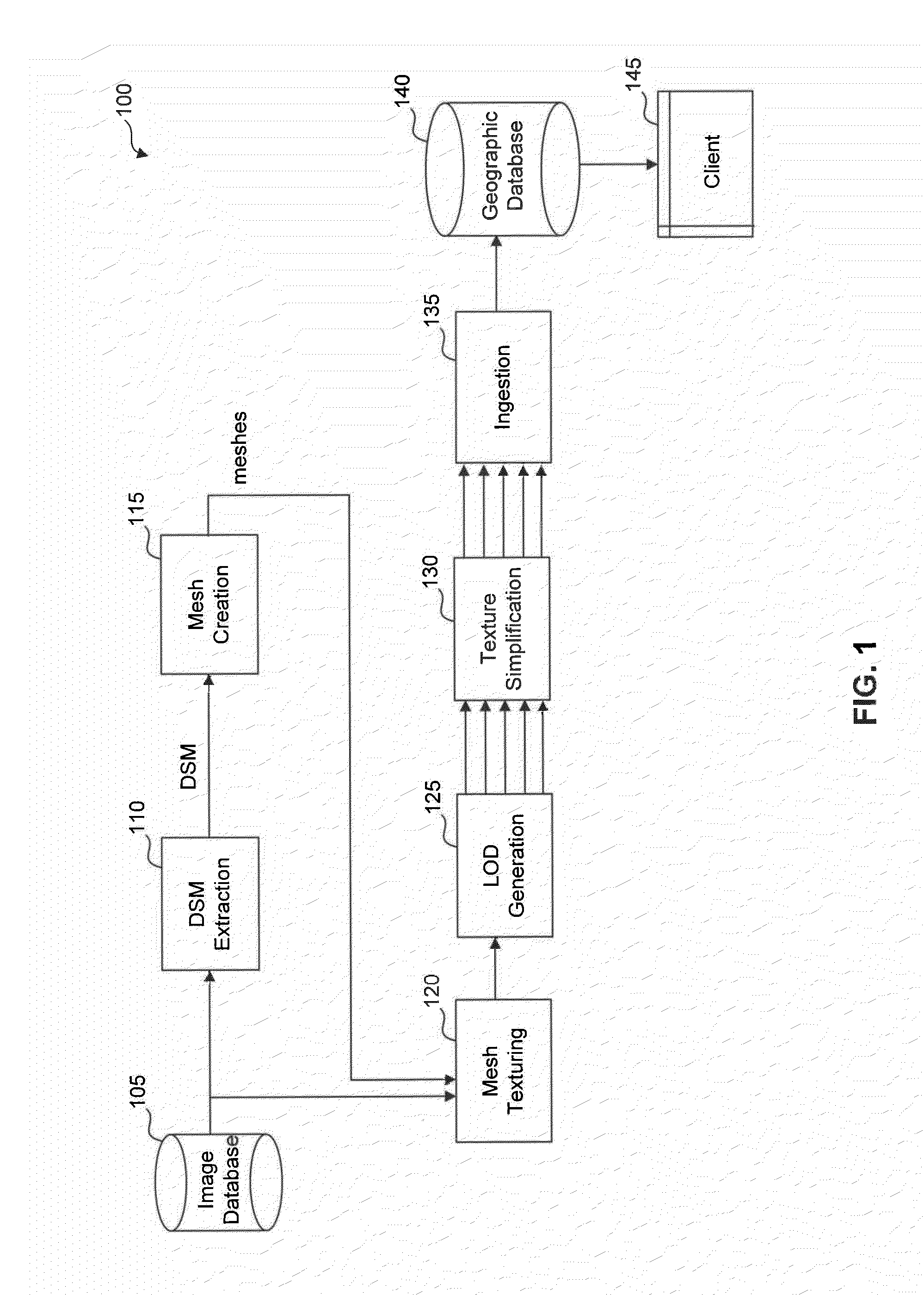
[0024]A. Data Extraction
[0025]B. Mesh Creation
[0026]C. Texture and Simplified Models
[0027]D. Texture Simplification
[0028]E. Render Appropriate Version of the Three-Dimensional Model
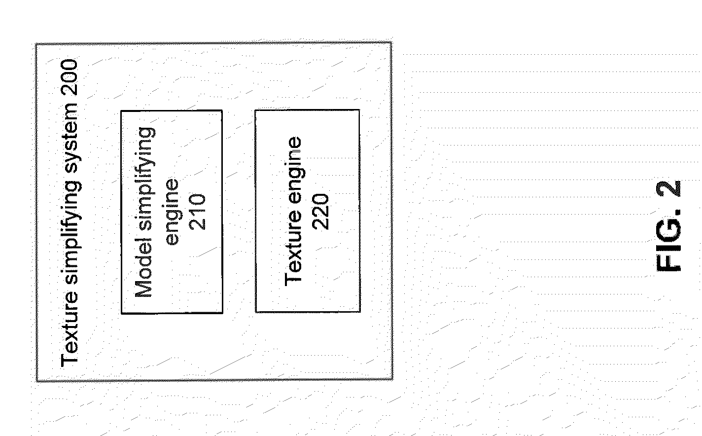
III. Example Texture Simplifying System
[0029]A. Model Simplification
[0030]B. Texture Simplification
VI. Example Method
V. Example Computer Embodiment
I. OVERVIEW
[0031]This description generally relates to generating textured meshes at multiple levels of geometry and texture resolution.
[0032]Generating a lower resolution version of a given textured three-dimensional model may be useful. For example, a series of different resolution models may be generated from one source model so that the resolution appropriate for the current viewpoint is rendered on the screen. Displaying the lower resolution model is less computationally expensive than displaying the higher resolution model. Further, it is useful to reduce not only the complexity of the three-dime...
PUM
 Abstract
Description
Claims
Application Information