
Illustrating elevations associated with a mine worksite

a technology for illustrating elevations and worksites, which is applied in the direction of instruments, maps/plans/charts, and editing/combining figures or text, etc., can solve the problems of difficult monitoring or comprehending elevations associated with worksites, and difficulty in assessing the status of work don

Active Publication Date: 2015-12-03
CATERPILLAR OF AUSTRALIA
View PDF3 Cites 5 Cited by
  • Summary
  • Abstract
  • Description
  • Claims
  • Application Information

AI Technical Summary

Benefits of technology

The present disclosure allows for the combination of different features described herein in any way. The term "comprise" and its variations, such as "comprising" and "comprised", are not intended to exclude further additives, components, integers, or steps.

Problems solved by technology

However, it can be difficult to assess the status of work that has been done or that needs to be done in fulfilling this objective, because elevations associated with the worksite may be difficult to monitor or comprehend.

Method used


Image

  • Illustrating elevations associated with a mine worksite
  • Illustrating elevations associated with a mine worksite
  • Illustrating elevations associated with a mine worksite

Examples


Embodiment Construction

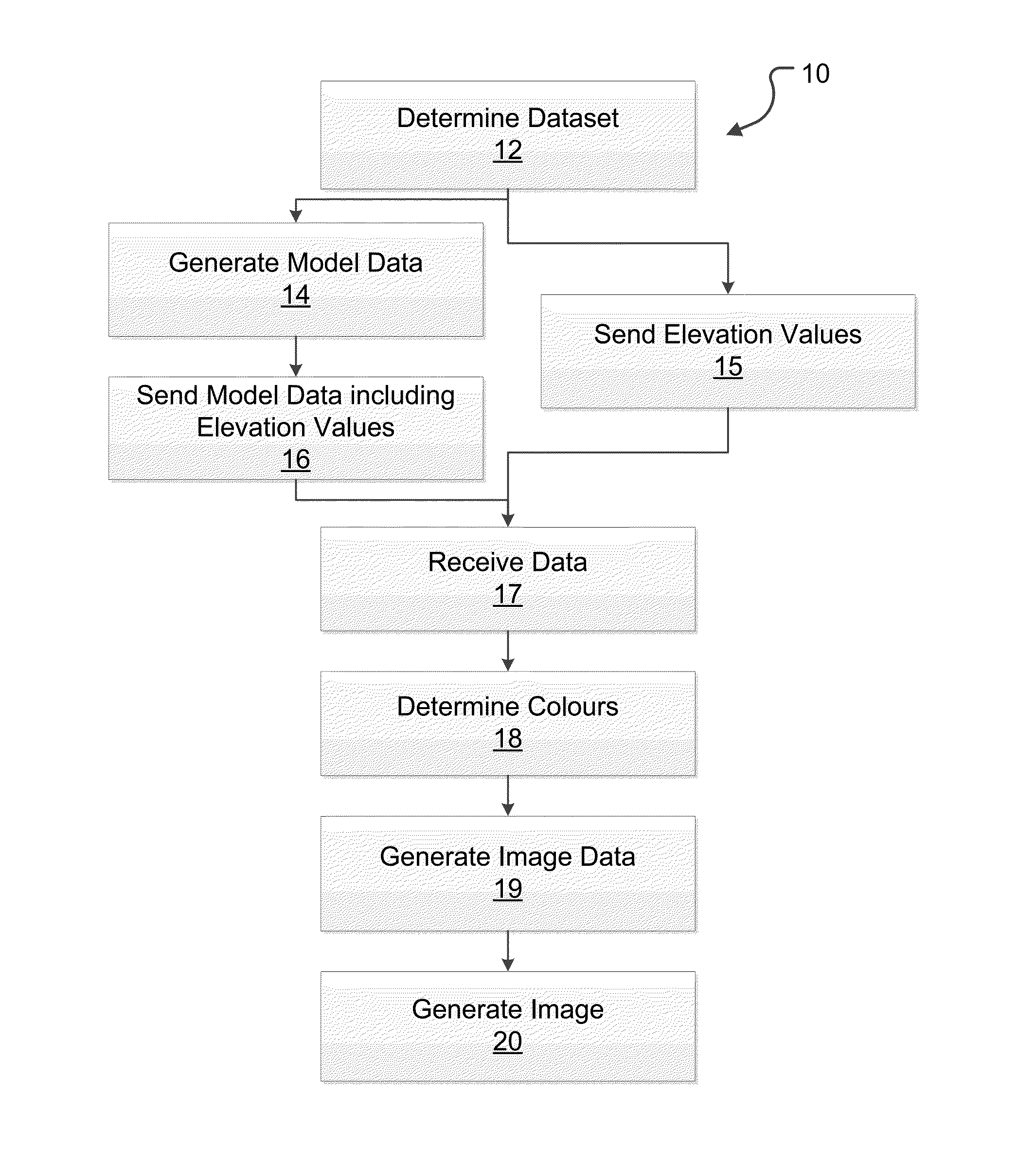
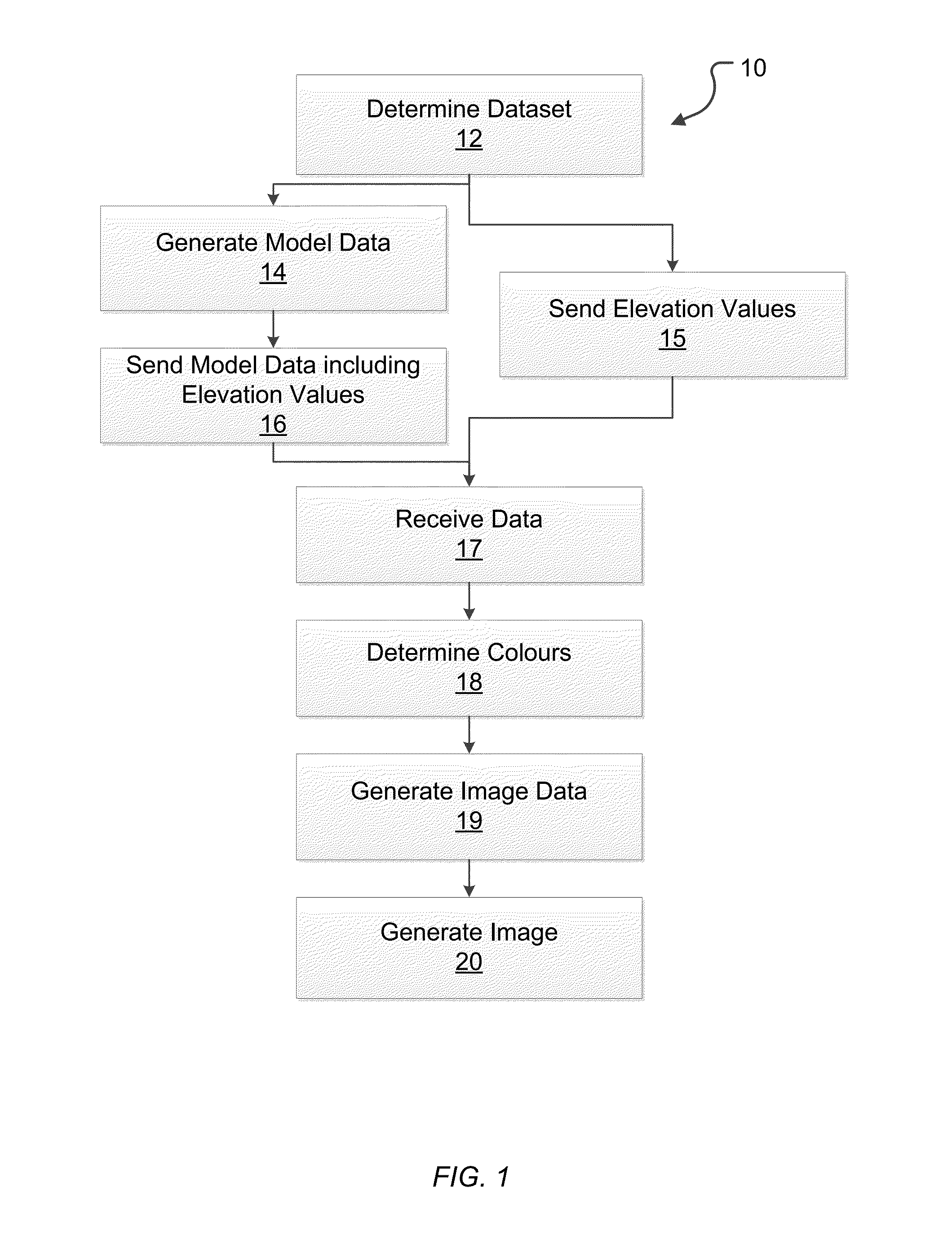
[0022]An exemplary process 10 for performing a computer-implemented method for illustrating elevations and work status for an area of interest in a mine worksite is illustrated in FIG. 1. Process 10 derives a 3-dimensional (3D) model for comparing differences between the input two elevation models for the area of interest.

[0023]A first of the elevation models is an elevation map of a surface of the mine worksite. The elevation map is comprised of recorded data that is based on measurements taken for the surface. Therefore the elevation map represents an actual elevation topography possessed by the worksite. The recorded data includes elevation values, each of which define an altitude for a corresponding position in grid of position coordinates. The position coordinates may, for example, represent longitude and latitude coordinates, or east / west and north / south distances from a reference location. The altitudes defined by the elevation values may be defined with respect to an absolut...


PUM


Abstract

Disclosed herein is a method and computing system for illustrating elevations in an image corresponding to an area of interest that is at least a portion of a mine worksite. The method includes determining, by a selection, a first dataset that includes a plurality of elevation values defining an elevation topography for a first area of interest. The method further includes, for each of the at least a portion of the elevation values in the first dataset, determining a corresponding colour for illustrating the elevation value according to a scale of colours. The scale spans a defined range of altitudes. Each colour in the scale is definable by a hue; and at least one parameter for influencing at least one of a lightness and a darkness of the colour. The colour scale is defined to progress through a spectrum of hues across the defined range of altitudes. The method also includes generating a first image portraying at least a 3-dimensional, non-plan view of the elevation topography for the first area of interest, illustrating the at least a portion of the elevation values of the first dataset in the corresponding determined colours.

Description

FIELD OF THE INVENTION[0001]The present disclosure relates to methods and systems for Illustrating elevations associated with a mine worksite.BACKGROUND OF THE INVENTION[0002]In the mining industry, mine operators need to prepare infrastructure for vehicle and equipment access, and for transporting ore and other materials. Such infrastructure includes roads, drill holes, and other features created by manipulating of the topography of the worksite. The creation of such infrastructure involves designing an intended topography for the worksite and manipulating the worksite, by cutting away parts of the worksite that are above an intended elevation (above grade) and by filling areas of the worksite below an intended elevation (below grade) in order to meet the specification tolerances of the design. However, it can be difficult to assess the status of work that has been done or that needs to be done in fulfilling this objective, because elevations associated with the worksite may be dif...

Claims


Application Information

Patent Timeline
IPC IPC(8): G06F17/50
CPCG06F17/5004G06F30/13G06T7/90G01C11/00G06T11/60G06T17/05G09B29/00G06F18/00
Inventor BLANCHARD, GLEN PETER
Owner CATERPILLAR OF AUSTRALIA
Learn More