Ranging system using active radio frequency (RF) nodes

a radio frequency and active technology, applied in the field of terrestrial positioning and ranging, can solve the problems of unreliable or unavailable gps positioning and other location services within buildings, significant limitations in resolution and reliability of available technologies in a variety of environments

Active Publication Date: 2016-01-07
CORVUS TECH
View PDF8 Cites 103 Cited by
  • Summary
  • Abstract
  • Description
  • Claims
  • Application Information

AI Technical Summary

Benefits of technology

[0006]In another example, this technology can be used for communicating between an end user node and a control station controller used in determining a location of the end user node relative to a beacon. One method can include the controller transmitting an inquiry message to the end user node with a minimum received signal strength indicator (RSSI) message. The minimum RSSI message can include a RSSI threshold for transmitting a reply message from the end user node. The controller can receive a reply message from the end user node including a measured RSSI of the inquiry message at the end user node when the measured RSSI of the inquiry message exceeds the RSSI threshold.
[0007]In another example, a control station controller for a ranging system can include a transmitting module and a receiving module. The transmitting module can be configured to transmit an inquiry message to the end user node with minimum received signal strength indicator (RSSI) message. The minimum RSSI message can include a RSSI threshold for transmitting a reply message from the end user node. The receiving module can be configured to receive a reply message from the end user node including a measured RSSI of the inquiry message at the end user node when the measured RSSI of the inquiry message exceeds the RSSI threshold.
[0008]In another example, this technology can be used for communicating between an end user node and a control station controller used in determining a location of the end user node relative to a beacon. One method can include the end user node receiving an inquiry message from the controller with minimum received signal strength indicator (RSSI) message. The minimum RSSI message can include a RSSI threshold for transmitting a reply message from the end user node. The end user node can mea

Problems solved by technology

GPS positioning and other location services within buildings can be unreliable or unavailable.
Particularly, GPS positioning and other location services may be unreliable or unavailable inside buildings and structures, including large industrial buildings, buildings with rooms, buildings with multiple floors, or ou

Method used


Image

  • Ranging system using active radio frequency (RF) nodes
  • Ranging system using active radio frequency (RF) nodes
  • Ranging system using active radio frequency (RF) nodes

Examples


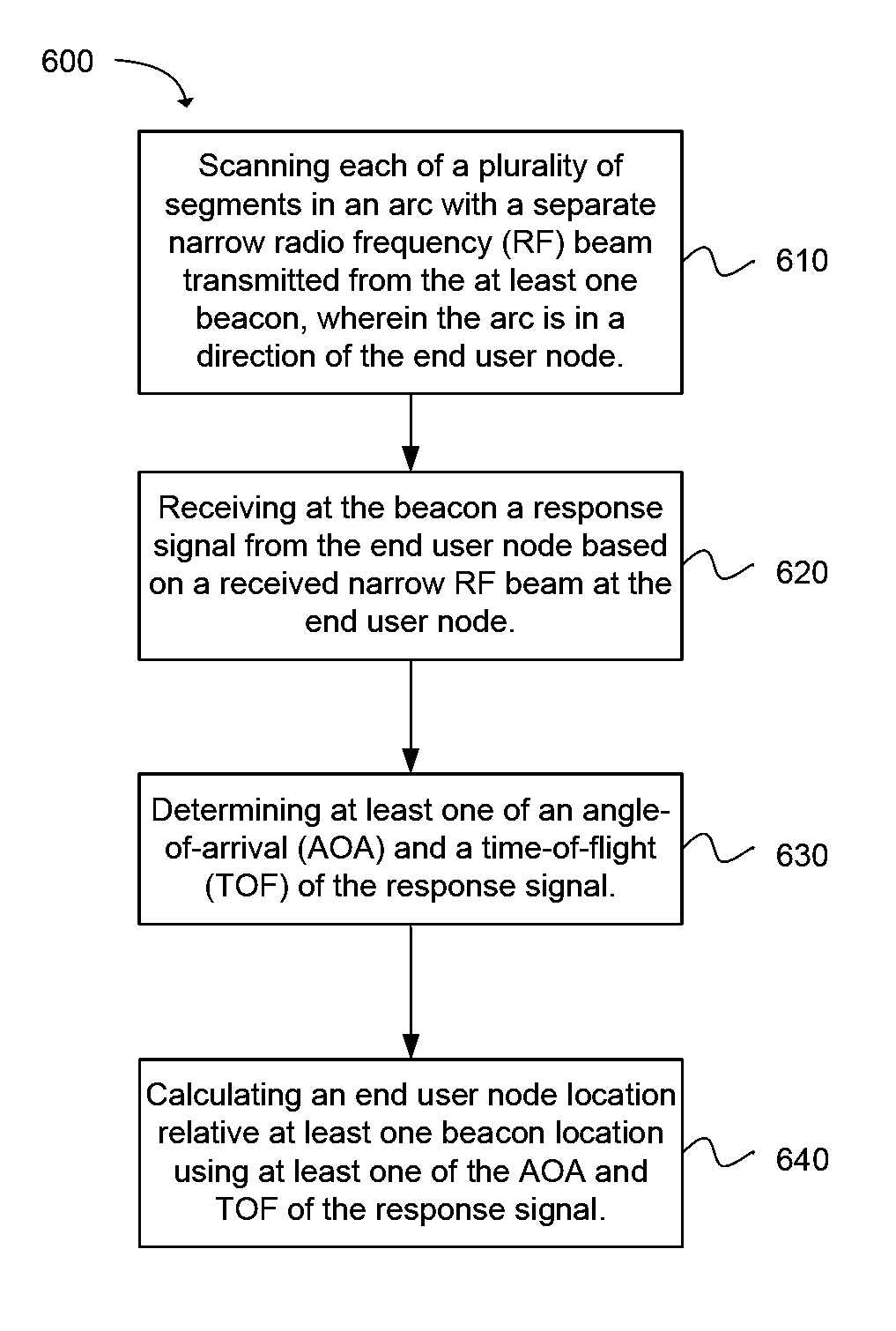
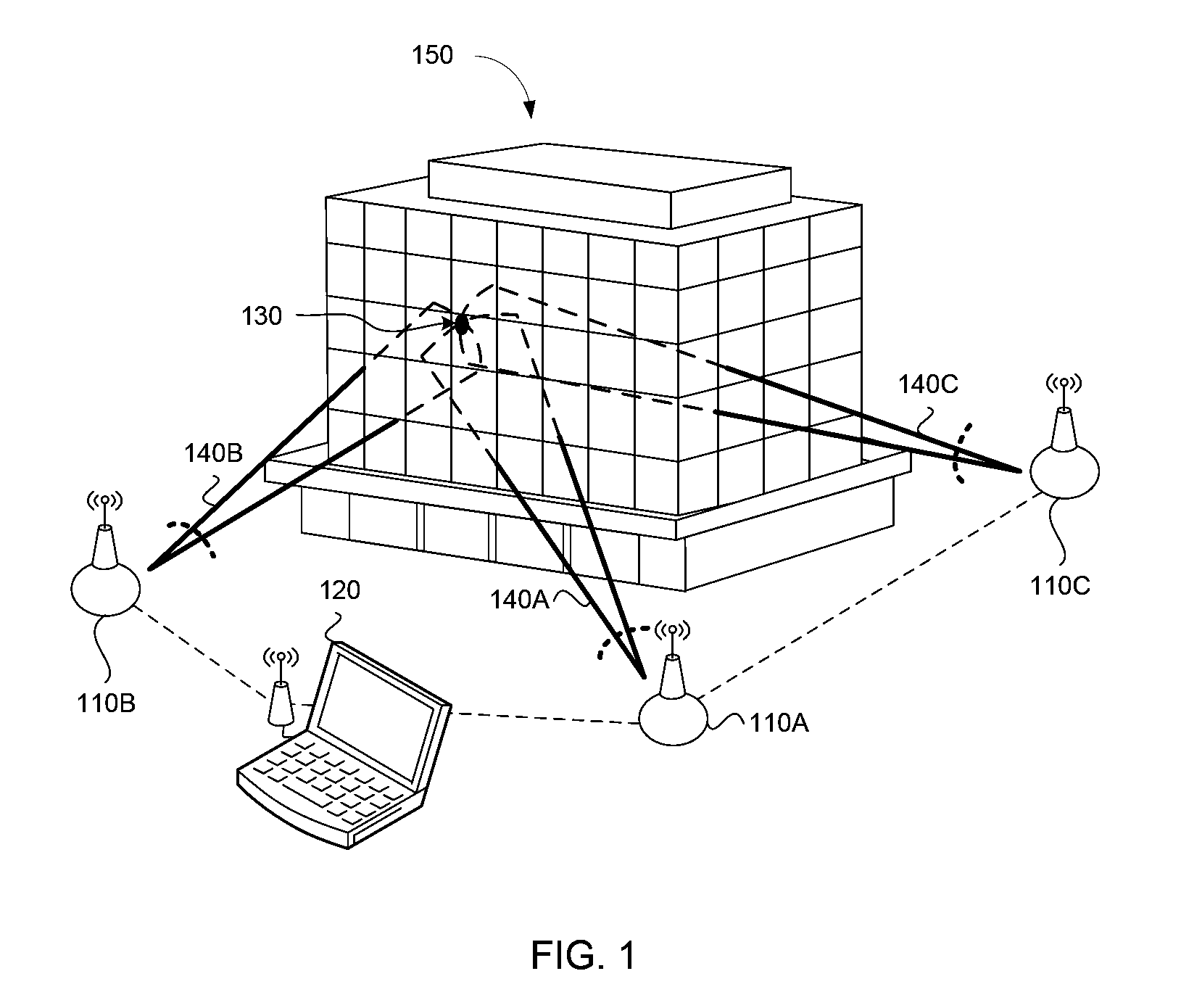
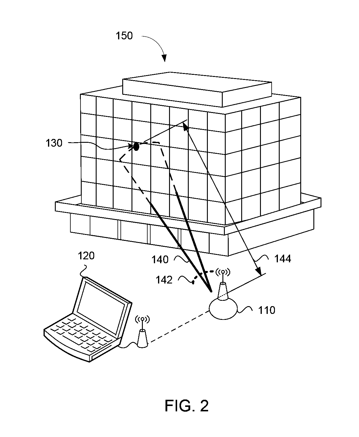
Embodiment Construction

[0037]It is to be understood that this disclosure is not limited to the particular structures, process steps, or materials disclosed, but is extended to equivalents as would be recognized by those ordinarily skilled in the relevant arts. Alterations and further modifications of the illustrated features, and additional applications of the principles of the examples, which would occur to one skilled in the relevant art and having possession of this disclosure, are to be considered within the scope of the disclosure. It should also be understood that terminology employed herein is used for the purpose of describing particular embodiments only and is not intended to be limiting. The same reference numerals in different drawings represent the same element.

[0038]It must be noted that, as used in this specification and the appended claims, the singular forms “a,”“an,” and “the” include plural referents unless the context clearly dictates otherwise. Thus, for example, reference to “an apert...


PUM


Abstract

A ranging system includes at least one beacon and a control module. The at least one beacon is configured to scan each segment in a plurality of segments of an arc with a narrow radio frequency (RF) beam and receive a response signal from an end user node in at least one segment. Each segment of the arc is scanned at a specified time interval. The control module is configured to communicate with the at least one beacon. The control module is further configured to calculate at least one of an angle-of-arrival (AOA) and a time-of-flight (TOF) of a response signal from the end user node to the beacon and generate an end user node location relative to a beacon location.

Description

RELATED APPLICATIONS[0001]This application is a continuation-in-part of U.S. patent application Ser. No. 13 / 430,521, filed Mar. 26, 2012 which is a continuation of International Patent Application No. PCT / US12 / 26667 filed Feb. 25, 2012, and of International Patent Application No. PCT / US12 / 26666 filed Feb. 24, 2012 which claims the benefit of U.S. Provisional Patent Application Ser. No. 61 / 446,470, filed Feb. 24, 2011 and U.S. Provisional Patent Application Ser. No. 61 / 446,474, filed Feb. 24, 2011, each of which are incorporated herein by reference.FIELD OF THE INVENTION[0002]The present invention relates generally to terrestrial positioning and ranging. Accordingly, the present invention involves the fields of radio frequency based perimeter positioning and ranging and messaging.BACKGROUND[0003]Satellite navigation systems, such as the global positioning system (GPS) available to military, civil, commercial, and scientific users, enable a receiver to determine a location from rangin...

Claims


Application Information

Patent Timeline
IPC IPC(8): H04W64/00G01S3/46
CPCG01S3/46H04W64/00H04W64/006
Inventor LUNDGREEN, JOHN C.RAY, BRIAN E.ROSENBAUM, GLEN VAR
Owner CORVUS TECH
Why Eureka
Try Eureka