Method for transmitting information on position on digital map and device used for the same

a technology of position information and digital map, applied in the field of transmitting position information of digital map, can solve the problems of huge social cost, map data includes errors and errors, and the maintenance cost is enormous, and achieve the effect of promoting matching efficiency

Inactive Publication Date: 2005-08-16
PANASONIC INTELLECTUAL PROPERTY CORP OF AMERICA
View PDF79 Cites 52 Cited by
  • Summary
  • Abstract
  • Description
  • Claims
  • Application Information

AI Technical Summary

Benefits of technology

[0036]Further, the method and the apparatus for restoring data at equal intervals from

Problems solved by technology

Although the database of the digital map is formed by several companies in Japan, due to a difference in basic drawings and digitizing technology, the map data includes error and the error differs by the digital map

Method used


Image

  • Method for transmitting information on position on digital map and device used for the same
  • Method for transmitting information on position on digital map and device used for the same
  • Method for transmitting information on position on digital map and device used for the same

Examples


first embodiment

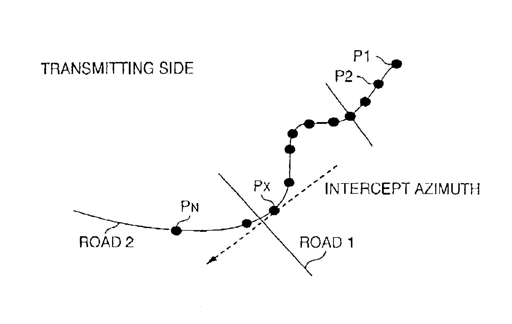
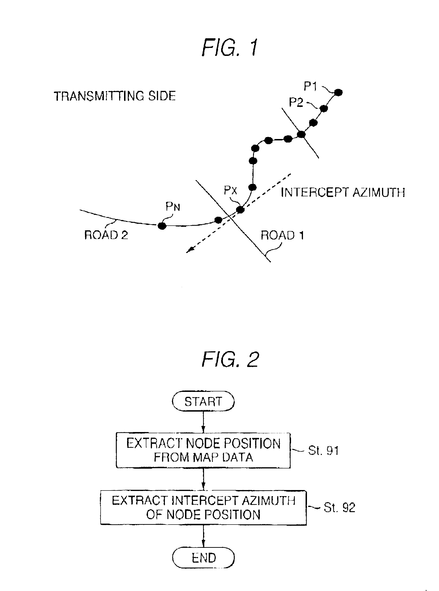
[0091]In First Embodiment, an explanation will be given of a method of transmitting position information for promoting accuracy of map matching for specifying a road section on a receiving side by transmitting shape data by adding intercept azimuth information thereto.

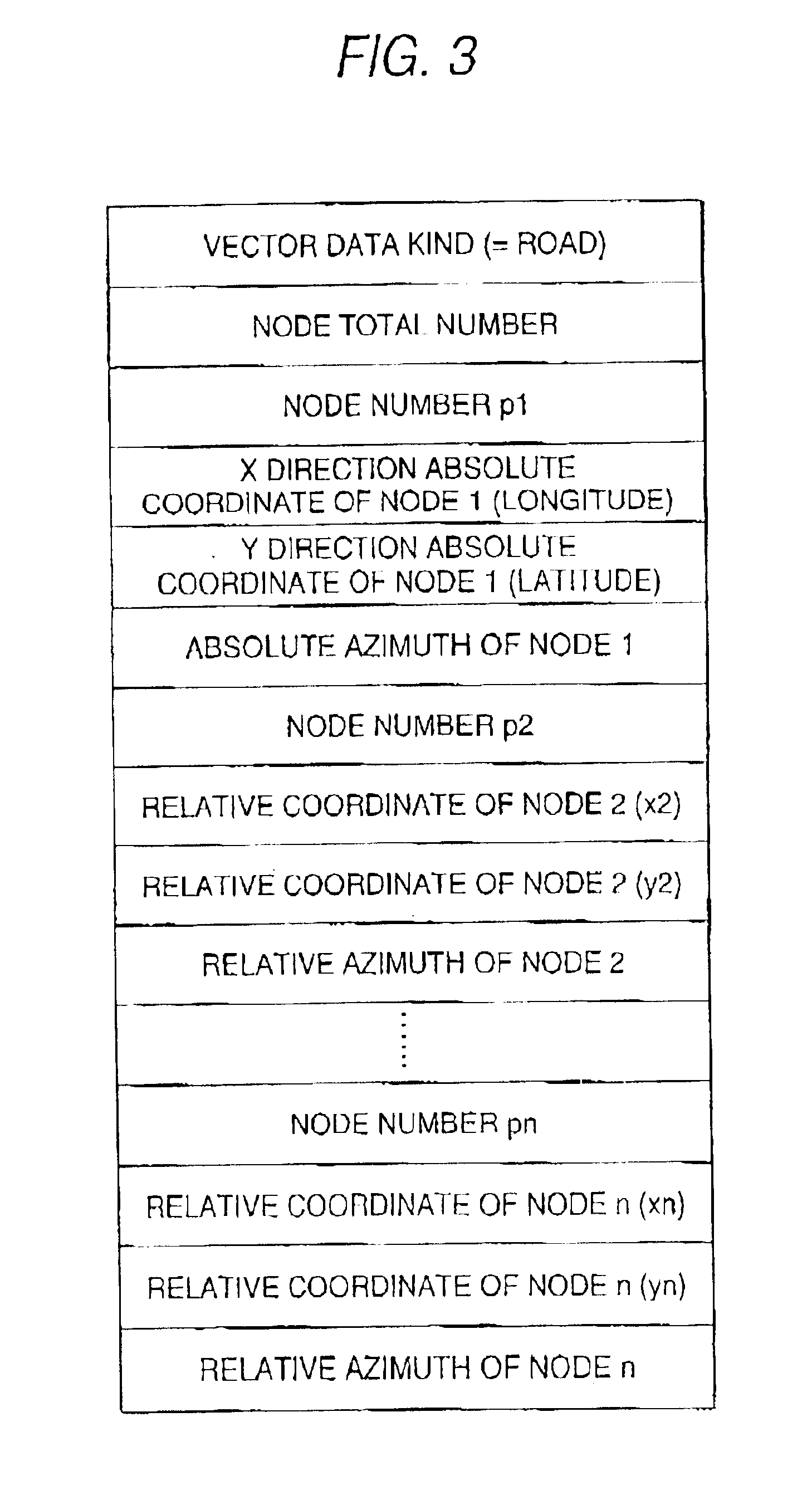
[0092]An explanation will be given of an example of a case of transmitting longitude data and latitude data of respective spots indicated by black circles as shape data in order to transmit a road shape from P1 to PN of a road 2 shown in FIG. 1. Here, the black circles represent nodes and interpolation points of nodes on the roads included in a digital map database. A node is set in correspondence with a crossroads, an inlet or an outlet of a tunnel, an inlet or an outlet of a bridge, a boundary of administrative sections or the like and is attached with a node number. An interpolation point is a point set for reproducing a road shape between nodes. In this case, a node and an interpolation point are inclusively referr...

second embodiment

[0109]In Second Embodiment, an explanation will be given of a method of transmitting position information for transmitting shape data by adding data of height.

[0110]FIG. 6 schematically shows vector data series representing a road in the case of representing digital map data in three dimensions of longitude, latitude and height.

[0111]In this case, the transmitting side transmits node series information of shape data by including X direction coordinate (longitude), Y direction coordinate (latitude) and Z direction coordinate (altitude) of respective node as shown by FIG. 7.

[0112]On the receiving side, similar to the intercept azimuth information of First Embodiment, in matching, candidate points can be narrowed down by referring to Z direction coordinate of matching candidate points selected based on distances on X-Y plane and transmitted positions on the digital map can accurately and swiftly be recognized.

[0113]Further, although Z direction coordinate of respective node is represen...

third embodiment

[0115]According to Third Embodiment, an explanation will be given of a method of transmitting position information for reducing a transmitted data amount by approximating shape data by a function.

[0116]In a vector data series from P1 to Pn shown in FIG. 9(a), shapes from P1 through Pm1 and Pm1 through Pm2, are approximated by a basic function F (h, r1, r2) such as a cosine curve shown in FIG. 9(c). Notations h, r1 and r2 designate parameters of the function.

[0117]By executing the approximation, as shown by FIG. 9(b), P1 through Pm2 can be represented by coordinates data of P1, Pm1 and Pm2, a function approximating an interval of P1 through Pm1 indicated by F (a, b, c) and parameters thereof and a function approximating an interval of Pm1 through Pm2 indicated by F (d, e, f) and parameters thereof to thereby enable to reduce the data amount.

[0118]FIG. 10 shows node series information in this case.

[0119]On the receiving side, when the shape data is received, between P1 and Pm2, there ...


PUM


Abstract

A method of transmitting position information of a digital map capable of transmitting a position on a digital map efficiently and accurately in which a transmitting side transmits position information including coordinate series information for specifying a vector shape on a digital map and a receiving side execute map matching by the coordinate series information to the thereby identify the vector shape on the digital map, the coordinate series information is transmitted by adding azimuth information of a coordinate point included in the information thereto. By transmitting shape data by adding the azimuth information thereto, accuracy of matching can be promoted and necessary time for matching can be shortened.

Description

TECHNICAL FIELD[0001]The present invention relates to a method of transmitting position information of a digital map and an apparatus utilized for the method, particularly, enabling to transmit a position on a digital map efficiently and precisely.BACKGROUND ART[0002]In recent years, vehicles mounted with navigation vehicle-mounted apparatus have rapidly been increased. The navigation vehicle-mounted apparatus holds a data base of a digital map and displays traffic jam or position of traffic accident on a map based on traffic jam information or traffic accident information provided from a traffic information center or the like, further, executes search for route by adding these information to conditions therefor.[0003]Although the database of the digital map is formed by several companies in Japan, due to a difference in basic drawings and digitizing technology, the map data includes error and the error differs by the digital maps of the respective companies.[0004]In the case of tra...

Claims


Application Information

Patent Timeline
IPC IPC(8): G01C21/30G01C21/28G09B29/10G09B29/00G01C21/00G01C21/34G08G1/0969
CPCG01C21/30G09B29/10G08G1/0969G08G1/01
Inventor ADACHI, SHINYA
Owner PANASONIC INTELLECTUAL PROPERTY CORP OF AMERICA
Why Eureka
Try Eureka