

Navigation device for displaying dated map data
a navigation device and map data technology, applied in navigation instruments, computer control, instruments, etc., can solve the problems of difficulty in determining whether a facility such as a road, a building or the like displayed on the map is of the present time or once existed in the past, and the difficulty inherent in the conventional navigation devi
- Summary
- Abstract
- Description
- Claims
- Application Information
AI Technical Summary
Problems solved by technology
Method used
Image

Examples
first embodiment
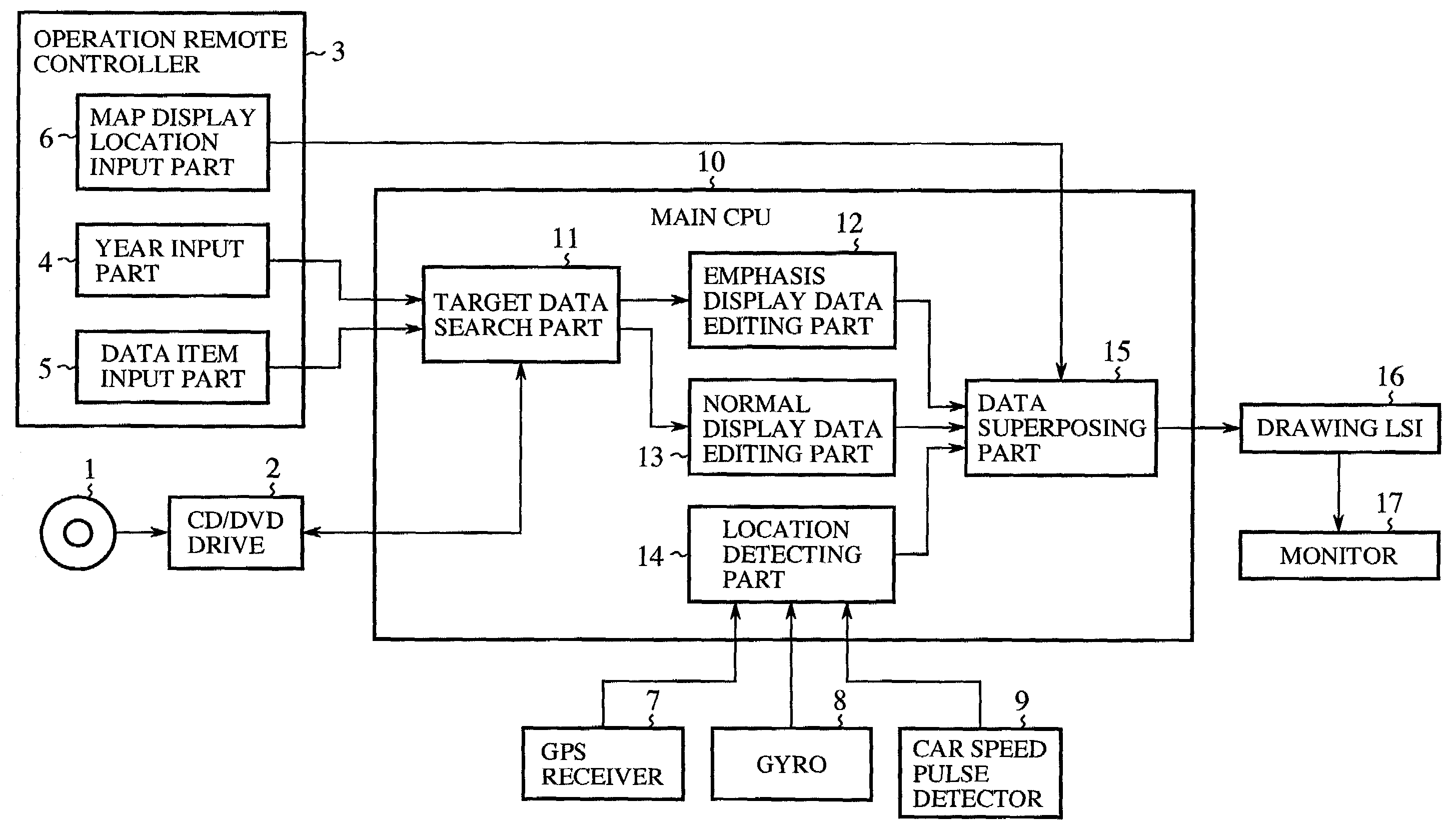
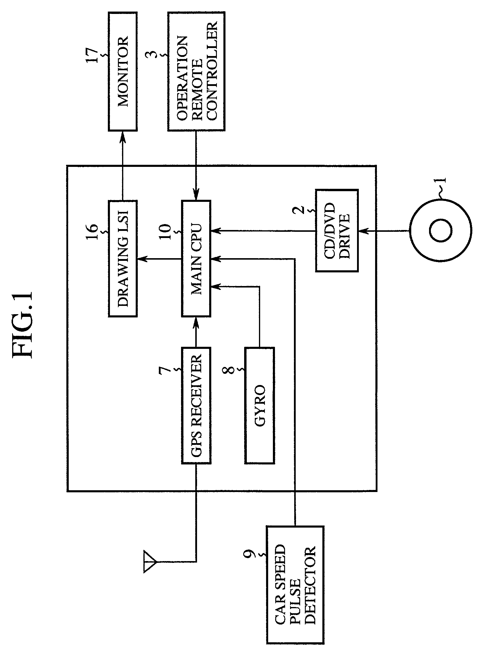
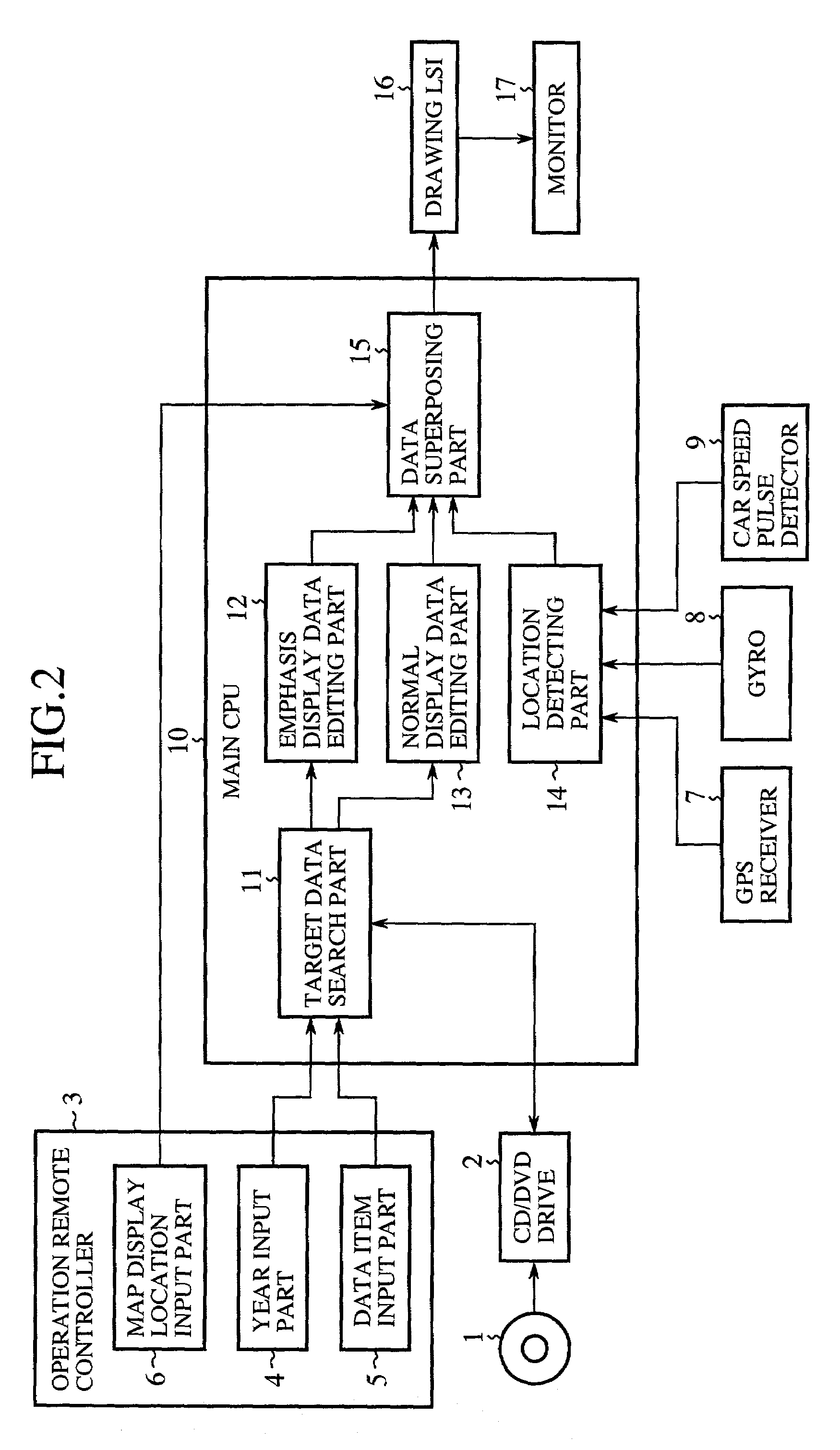
[0026]FIG. 1 is a schematic diagram showing a navigation device according to the first embodiment of the invention; and FIG. 2 shows a detailed constitution of the same. In the drawings, a reference numeral 1 denotes a disk (map storing means) such as a CD or a DVD for storing map data of a plurality of calendar years; 2 a CD / DVD drive for reading map data from the disk 1 under instruction from a main CPU 10; 3 an operation remote controller (specifying means) for specifying a calendar year (hereinafter may be referred to just as a “year”), a data item or the like to be displayed; 4 a year input part for inputting the year to be displayed; 5 a data item input part for inputting, among data items included in the map data, a data item to be displayed with emphasis (e.g., road information, facility information, address information, or telephone number information); and 6 a map display location input part for inputting an area of a map displayed on a screen.
[0027]A reference numeral 7 d...
second embodiment
[0043]In the first embodiment, the map data of the specified year was edited to be emphasis display data, and the latest map data was edited to be normal display data. However, the map data of the specified year may be edited to be displayed in the normal display mode, and the latest map data may be edited to be displayed in the weak mode. This arrangement is advantageous similarly to the first embodiment.
[0044]FIG. 5 is an explanatory view illustrating a map displayed on the monitor 17. In the drawing, reference numerals 31 to 33 denote roads normally displayed; 23 a road weakly displayed; 35 a facility (e.g., petrol station) normally displayed; and 36 a facility weakly displayed.
third embodiment
[0045]In the first embodiment, the map data of the specified year was edited to be emphasis display data, and the latest map data was edited to be normal display data. However, the map data of the specified year may be edited to be normal display data, and only the map of the specified year may be displayed.
[0046]FIG. 6 is an explanatory view illustrating a map displayed on the monitor 17. In the drawing, reference numerals 41 to 43 denote roads normally displayed; and 45 a facility (e.g., petrol station) normally displayed.
PUM
 Abstract
Description
Claims
Application Information