A high-precision semantic mapping method for driverless automobiles

A self-driving car and semantic map technology, applied in image data processing, 3D image processing, instruments, etc., can solve problems such as the inability to apply advanced driver assistance systems, limit the development of driverless cars, etc., and achieve the goal of ensuring safety Effect

Pending Publication Date: 2019-03-01
张亮
View PDF8 Cites 30 Cited by
  • Summary
  • Abstract
  • Description
  • Claims
  • Application Information

AI Technical Summary

Problems solved by technology

[0005] Existing vector map production methods limit the development of driverless cars and cannot be applied to intelligent traffic management, advanced driver assistance systems (ADAS) and other fields

Method used


Image

  • A high-precision semantic mapping method for driverless automobiles

Examples


Embodiment Construction

[0014] It should be noted that, in the case of no conflict, the embodiments in the present application and the features in the embodiments can be combined with each other. The present invention will be further described in detail below in conjunction with the drawings and specific embodiments.

[0015] If there are directional indications (such as up, down, left, right, front, back...) in the embodiments of the present invention, they are only used to explain the relative positions of the components in a certain posture (as shown in the drawings) relationship, motion, etc., if the particular pose changes, the directional indication changes accordingly.

[0016] In addition, in the present invention, the descriptions involving "first", "second" and so on are only for the purpose of description, and should not be understood as indicating or implying their relative importance or implicitly indicating the quantity of the indicated technical features. Thus, the features defined as ...


PUM


Abstract

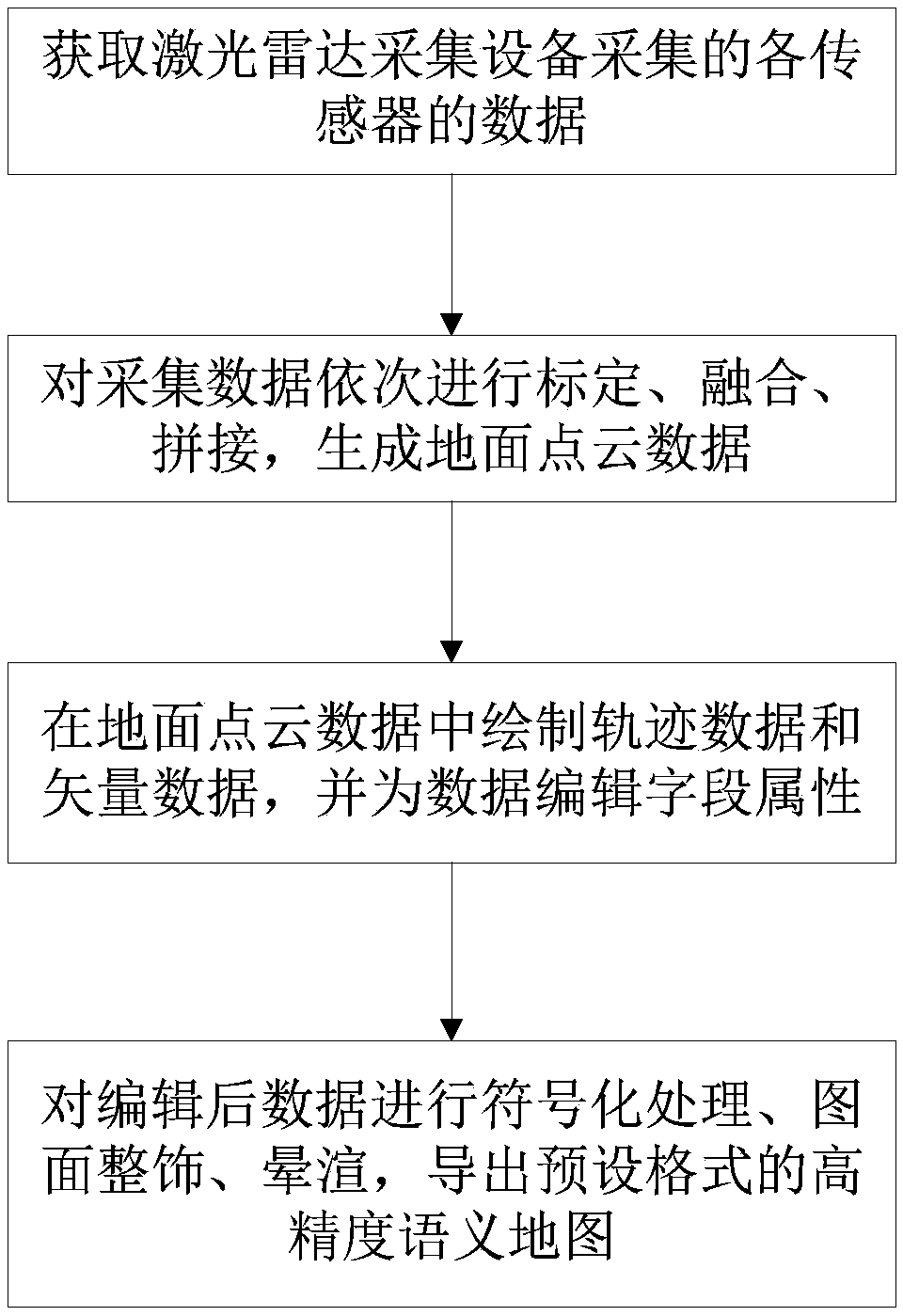
The embodiment of the invention discloses a high-precision semantic mapping method for a driverless automobile. The driverless automobile is equipped with a laser radar device. The making method comprises the following steps: 1, collecting sensor data by utilizing a laser radar 2, sequentially calibrating, fusing and splice that collected data to generate ground point cloud data; 3, draw that track data of the vehicle traveling along the road and the vector data contain the road information in the point cloud data, and editing field attributes for the drawn data; Step 4: Export a high-precision semantic map in the specified format. The high-precision semantic map produced by the embodiment of the invention contains rich semantic information, such as lane lines, road edges and trajectories,provide lane-level road information compared with traditional vector maps, which provides data basis for local path planning of driverless vehicles, and further helps to ensure the safety of driverless vehicles.

Description

technical field [0001] The invention relates to the technical field of high-precision map production, in particular to a high-precision semantic map production method for unmanned vehicles. Background technique [0002] Traditional electronic maps mainly rely on satellite images, and then GPS positioning. This method can achieve meter-level accuracy. For unmanned driving, it is necessary to finely define high-precision maps with centimeter-level accuracy. Satellites and GPS alone cannot guarantee the safety of unmanned vehicles. As an advanced measurement method, the vehicle-mounted mobile measurement system has the characteristics of fast, dynamic, active and high-precision, and can collect large-area three-dimensional road information. The so-called refined definition means that various traffic elements in the traffic scene need to be formatted and stored, including lane lines, road edges, and road signs. [0003] The main service object of high-precision maps is not hum...

Claims


Application Information

Patent Timeline
Patent Type & Authority Applications(China)
IPC IPC(8): G06T15/00
CPCG06T15/005
Inventor 张亮伍坤熊伟成
Owner 张亮
Why Eureka
Try Eureka