

Detecting roads in aerial images using feature-based classifiers
a feature-based classifier and aerial image technology, applied in scene recognition, instruments, computing, etc., can solve the problem of time-consuming and labor-intensive manual road detection in aerial images
- Summary
- Abstract
- Description
- Claims
- Application Information
AI Technical Summary
Benefits of technology
Problems solved by technology
Method used
Image

Examples
Embodiment Construction
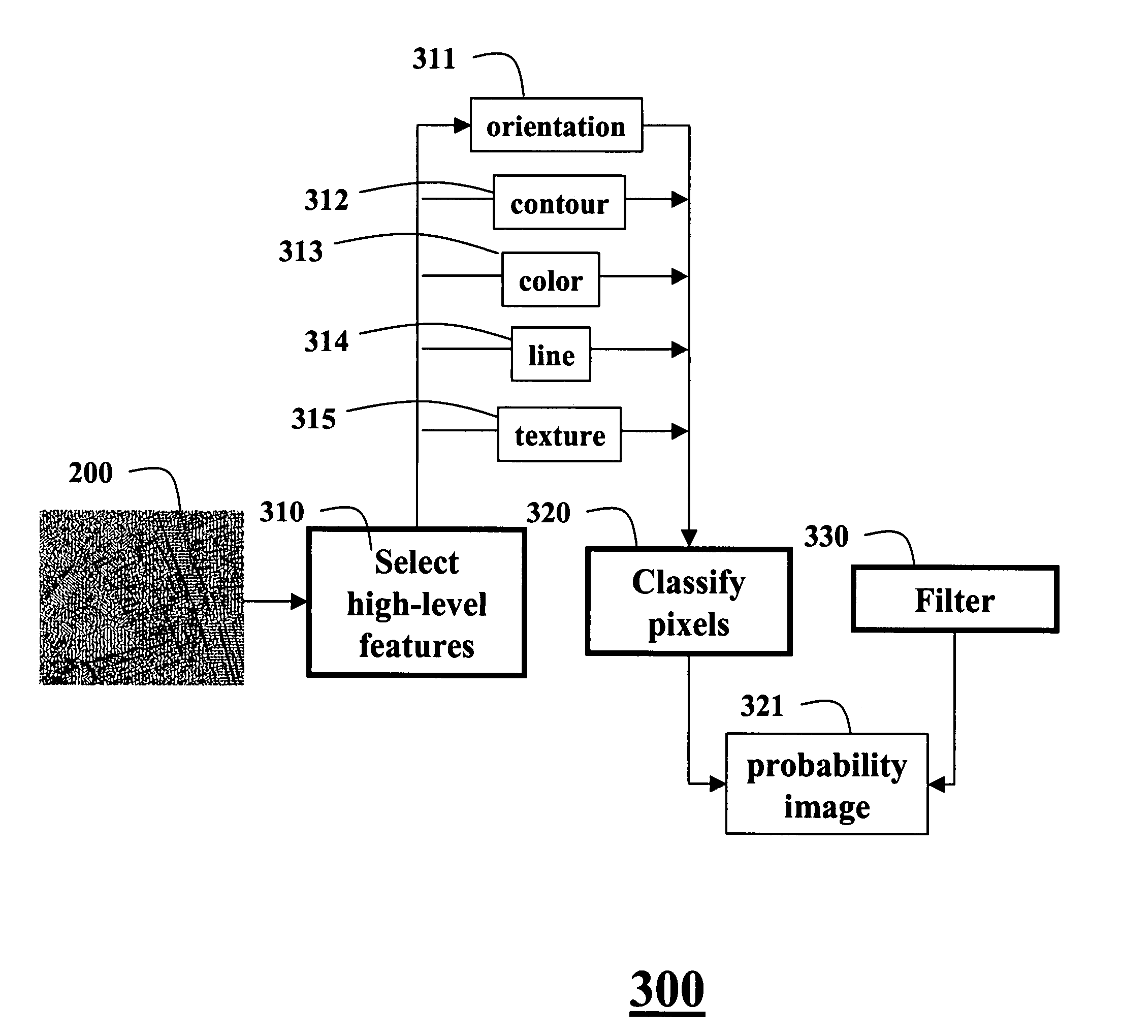
[0016]Characteristics of Road Features
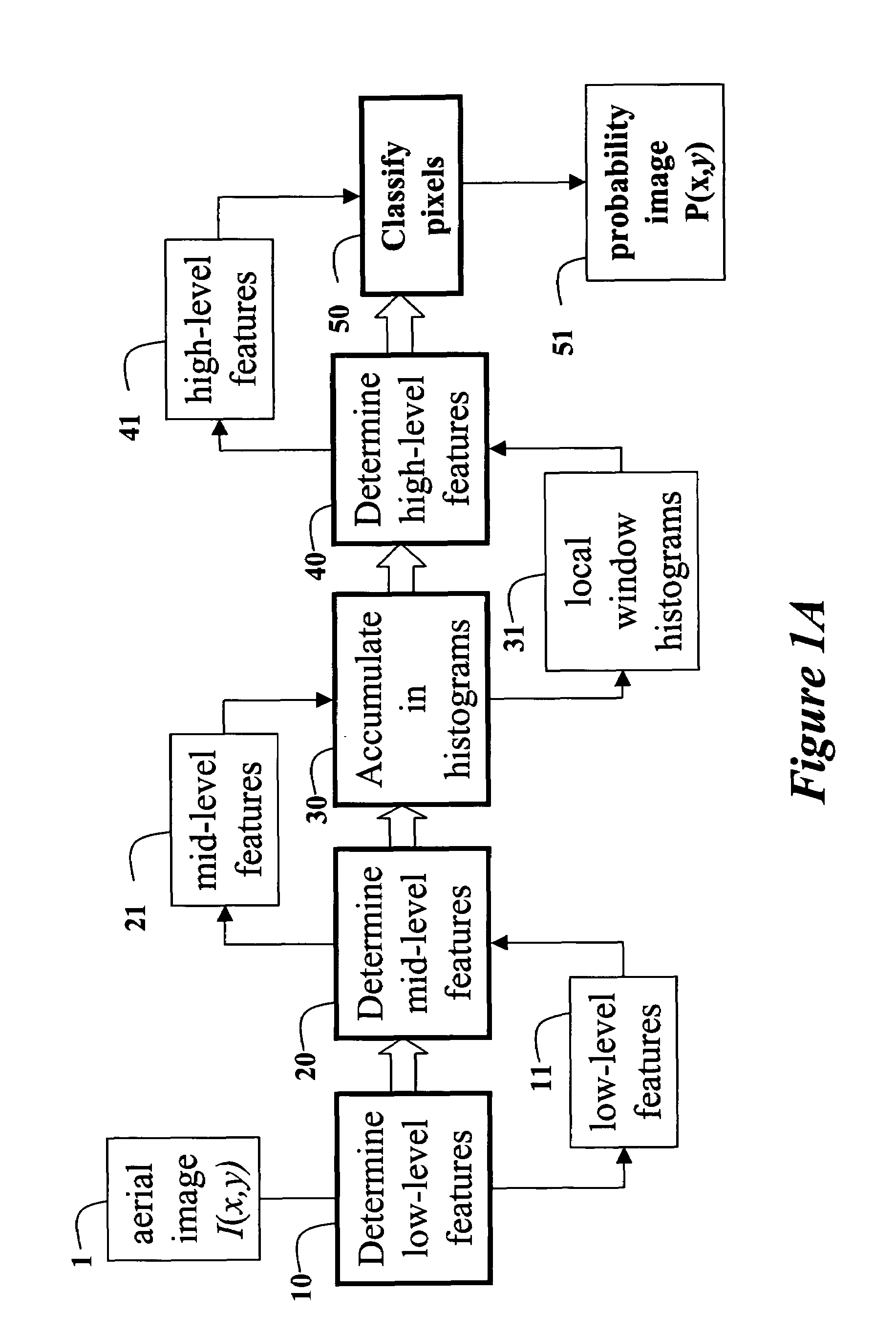
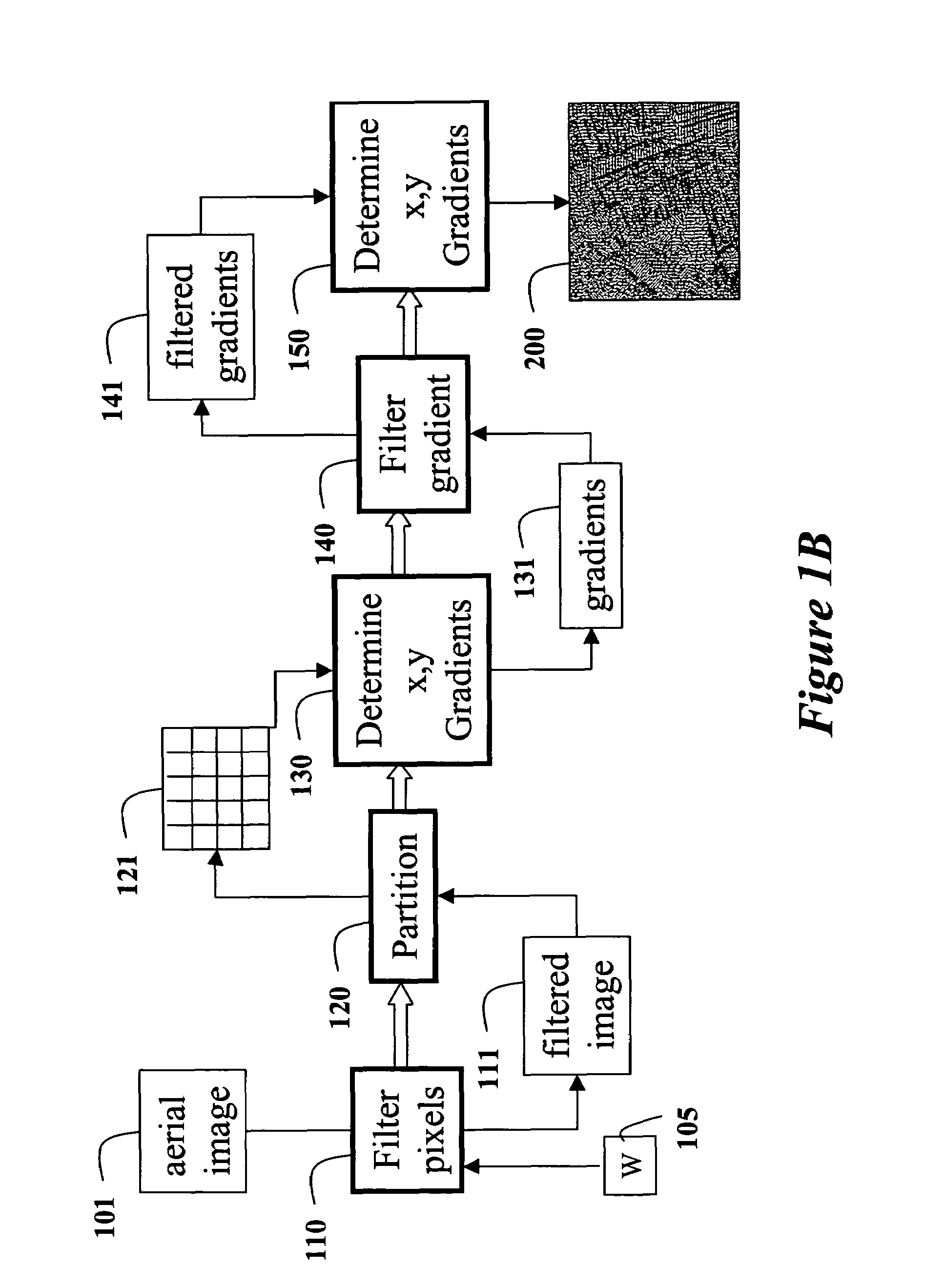
[0017]Our invention provides a method for detecting roads in aerial images of ground topology. We rely on relationships between physical characteristics and visual characteristics of the ground topology. We use features of the visual characteristics to classify image pixels as probably being road pixels or non-road pixels. The physical characteristics can generally be categorized as geometrical, textural, and contextual.
[0018]The width of a road is relatively constant and has an upper bound, which is dependent on the importance of the road. In our aerial images of ground topology, the upper bound of the width is about thirty pixels. It should be noted that this value can be adjusted according to the application and the types of aerial images used, e.g., images acquired by low-flying helicopters, high-flying reconnaissance planes, or satellites. The local curvature of a road is changed in a continuous manner, with an upper bound depending on the ...
PUM
 Abstract
Description
Claims
Application Information