
Method and apparatus for azimuth determination

a technology of azimuth determination and method, applied in the direction of instruments, measurement devices, surveying and navigation, etc., can solve the problem of needing to know the site latitud

Active Publication Date: 2014-06-24
TOPCON POSITIONING SYST INC
View PDF13 Cites 1 Cited by
  • Summary
  • Abstract
  • Description
  • Claims
  • Application Information

AI Technical Summary

Problems solved by technology

The main drawback of this method is the need to know the latitude and longitude of the observer's position, and accurate registration of the instant of observation, using Universal Time.
A limitation of this method is the need to know the site latitude.

Method used


Image

  • Method and apparatus for azimuth determination
  • Method and apparatus for azimuth determination
  • Method and apparatus for azimuth determination

Examples


Embodiment Construction

[0025]Reference will now be made in detail to the preferred embodiments of the present invention, examples of which are illustrated in the accompanying drawings.

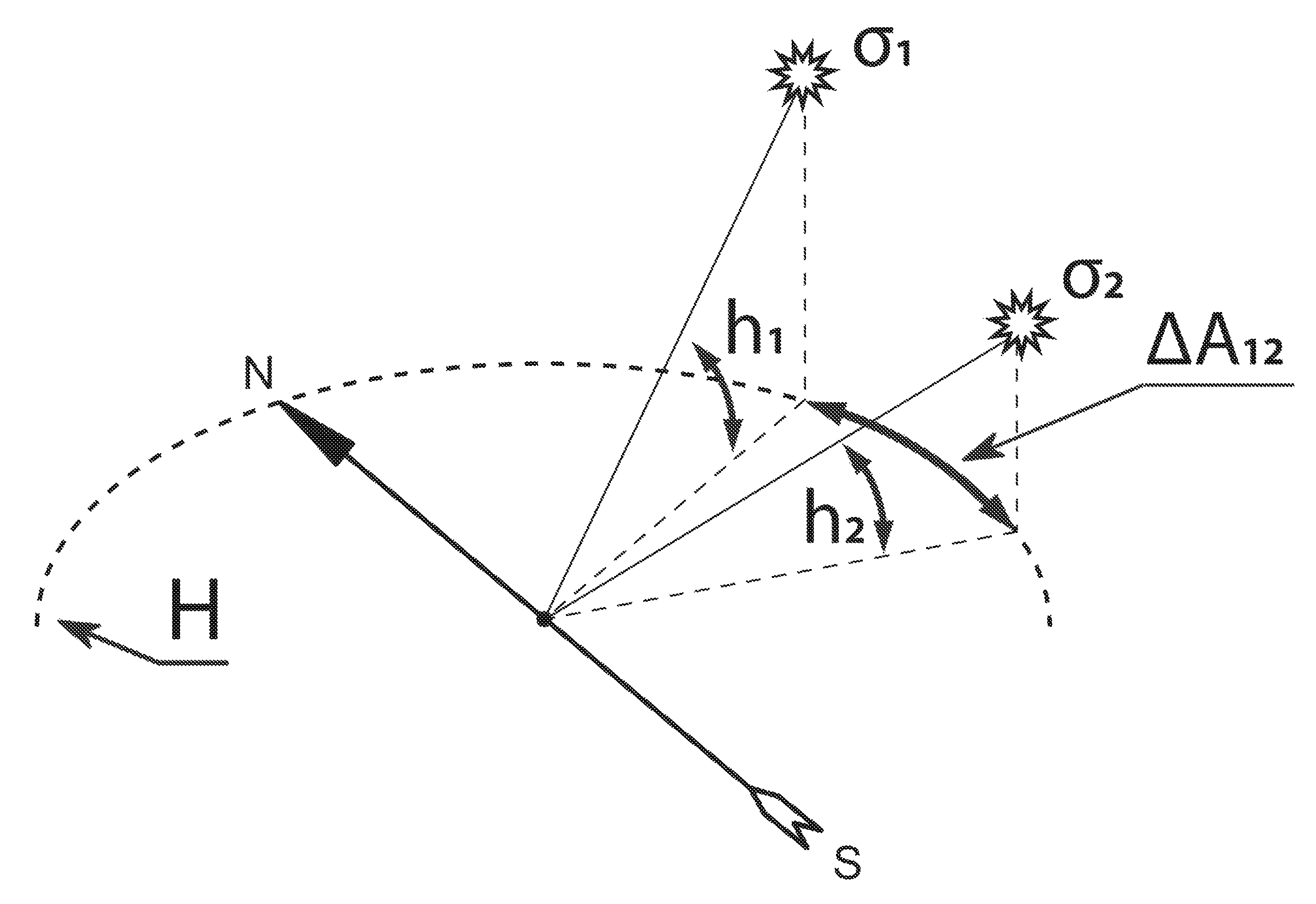
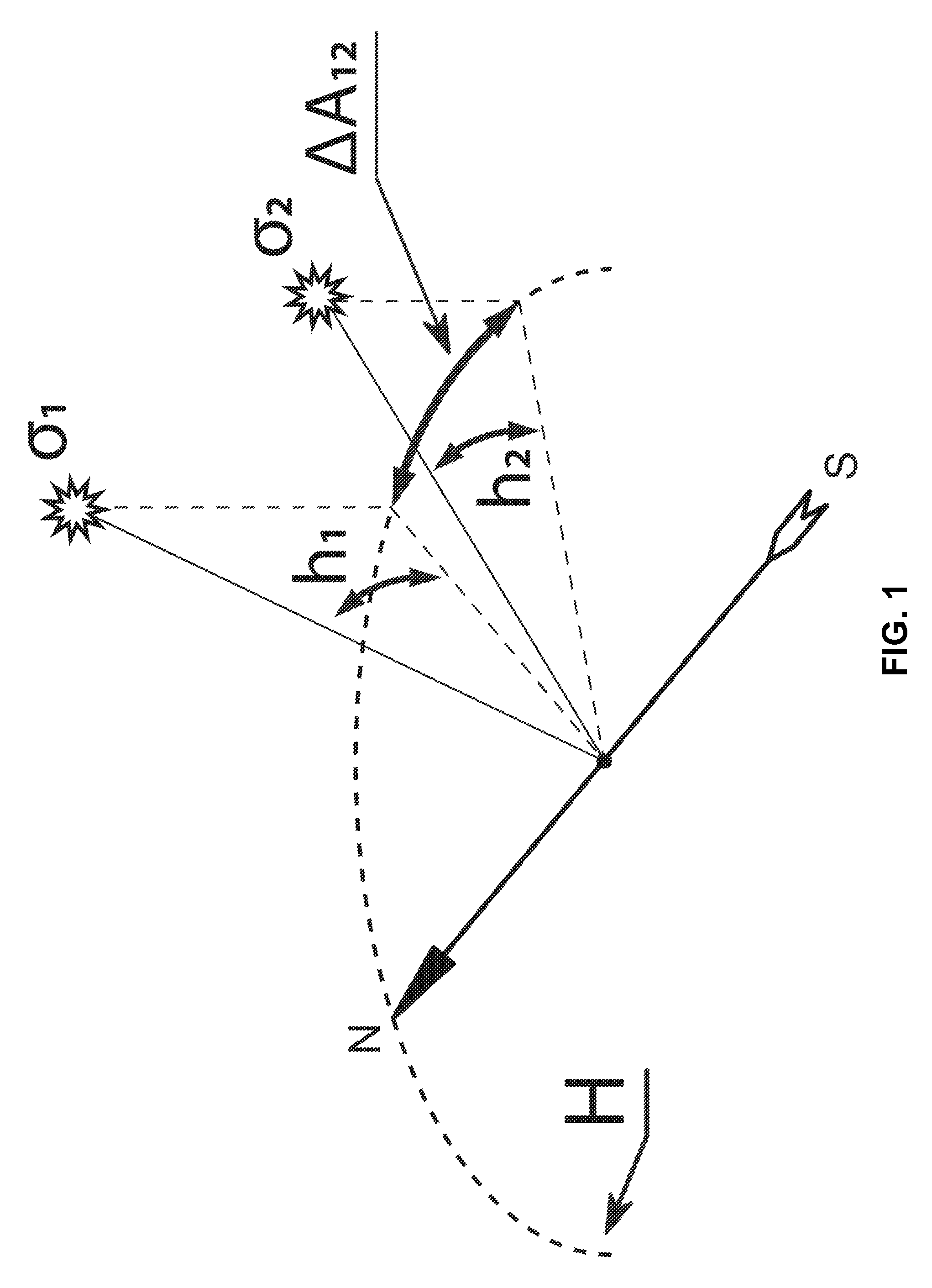
[0026]FIG. 1 shows a method of determining elevation angles over the horizon and horizontal angles between the celestial bodies. In FIG. 1:

[0027]H is the horizon line,

[0028]σ1 and σ2 are the celestial bodies in view;

[0029]h1 and h2 are the measured elevations over the horizon;

[0030]ΔA12 is the measured horizontal angle between celestial bodies.

[0031]Direction NS (North-South) shows the north-south line (direction of the local astronomical meridian). The apparatus of determining the azimuth is mounted and fixed on an object and oriented relative to the local horizon or the vertical zz′ from the zenith to nadir.

[0032]Among celestial bodies over the horizon two or more bodies σ with known coordinates are chosen.

[0033]The apparatus line of sight is aimed at the celestial bodies in turn.

[0034]Elevation angles over the horizon hσ ...


PUM


Abstract

A method of azimuth determination includes determination of local star time and latitude, where the azimuth determination unit is fixed at an object and oriented relative to the local horizon or the vertical; two or more celestial bodies with known coordinates are selected among visible celestial bodies and the line of sight is aimed at celestial bodies in turn, after that elevations over the horizon or zenith ranges to celestial bodies, horizontal angles between bodies are measured and measured times are recorded; and local star time, site latitude and azimuth are calculated. An apparatus for azimuth determination comprising an orientation unit to orient relative to the local horizon or the vertical line, an optical unit to aim at point light sources, a horizontal angle measurement unit, an elevation measurement unit, a time measurement unit and a computation unit, characterized in that orientation, aiming, angle and time measurement units are connected to a computation unit. The computation unit calculates azimuth, latitude and local star time based on horizontal and elevation angles of point light sources, such as celestial bodies, and measurement times.

Description

CROSS-REFERENCE TO RELATED APPLICATIONS[0001]This application is a U.S. National Phase of PCT / RU2010 / 000623, filed on Oct. 26, 2010, which is incorporated herein by reference in its entirety.FIELD OF THE INVENTION[0002]The present invention relates to methods and apparatus of determining heading azimuths, as well as to celestial navigation.BACKGROUND OF THE INVENTION[0003]A method of determining an azimuth using a celestial body, for example, Polaris, according to its hour angle, is known (see U.S. Pat. No. 1,942,548). The main drawback of this method is the need to know the latitude and longitude of the observer's position, and accurate registration of the instant of observation, using Universal Time.[0004]Another method of determining the azimuth by measuring a horizontal angle between Polaris and an auxiliary star is also known (see U.S. Pat. No. 1,512,601). A limitation of this method is the need to know the site latitude.[0005]The objective of the present invention is to elimin...

Claims


Application Information

Patent Timeline
Patent Type & Authority Patents(United States)
IPC IPC(8): G01C1/08
CPCG01C21/02
Inventor LUPOVKA, VALERY
Owner TOPCON POSITIONING SYST INC
Learn More