Ground buildings recognition positioning method

A technology for identifying positioning and buildings, applied in character and pattern recognition, instrumentation, computing, etc.

Inactive Publication Date: 2008-01-30
HUAZHONG UNIV OF SCI & TECH
View PDF0 Cites 17 Cited by
  • Summary
  • Abstract
  • Description
  • Claims
  • Application Information

AI Technical Summary

Problems solved by technology

[0005] The present invention provides a method for identifying and locating ground buildings, aiming at solving the problem of identifying and locating ground buildings from different viewpoints, different scales, and different heights, for front-view identification of ground buildings

Method used


Image

  • Ground buildings recognition positioning method
  • Ground buildings recognition positioning method
  • Ground buildings recognition positioning method

Examples


Embodiment Construction

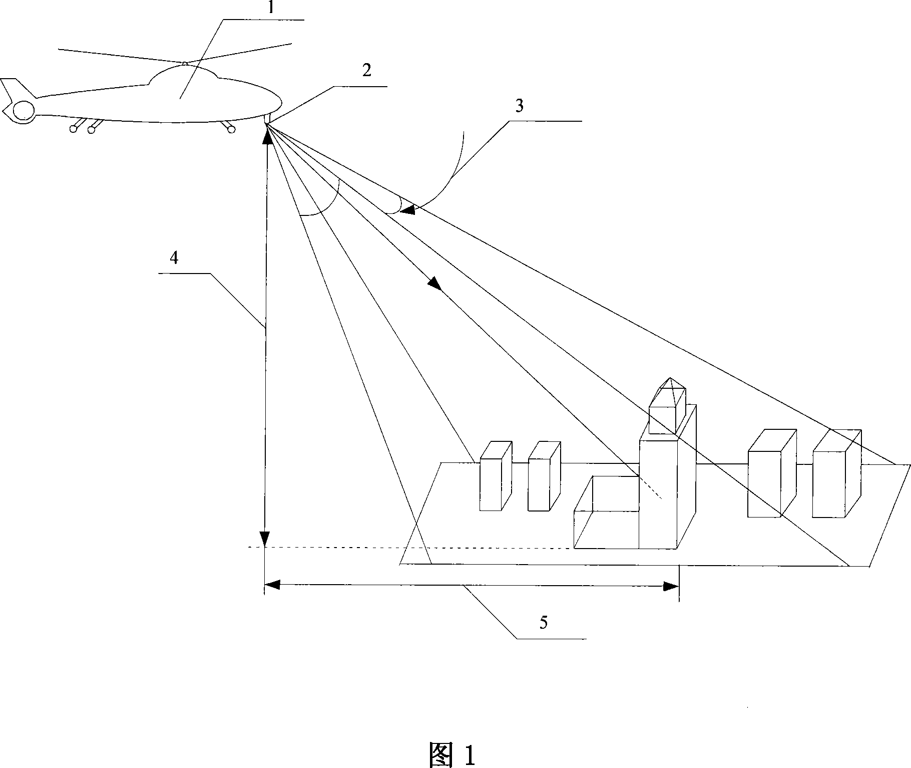
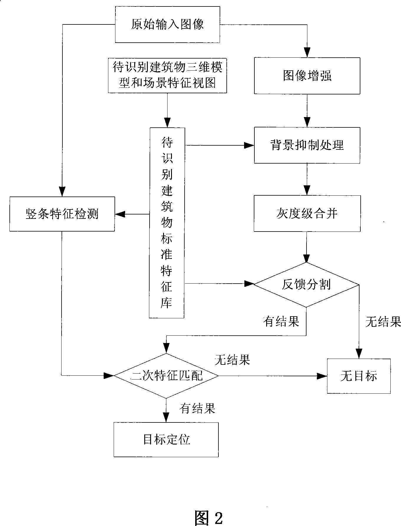
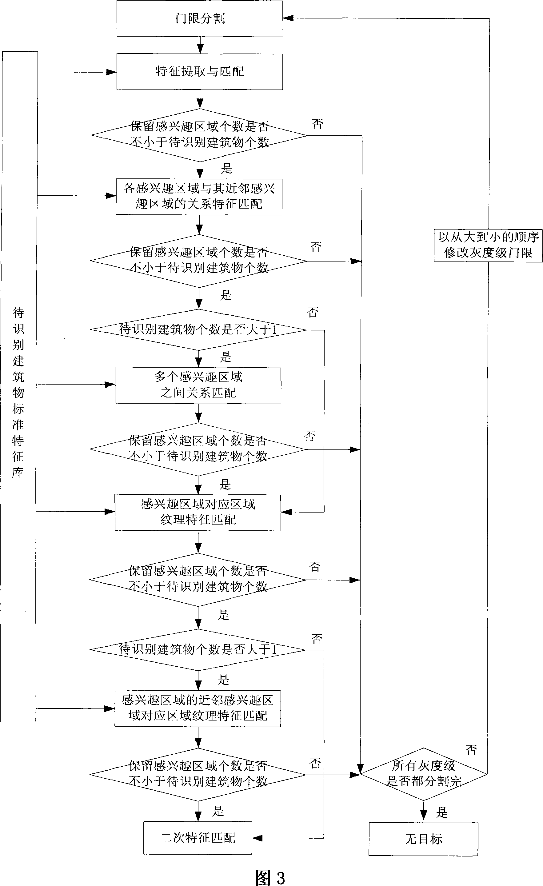
[0089] The helicopter front-view three-dimensional ground building identification and positioning schematic diagram is shown in Figure 1, and the steps of the present invention will be described below with reference to Figure 2's front-view telecommunications building as an example:

[0090] (1) Construct a standard feature library in advance, and extract feature quantities from three types of feature views: shape feature views, scene feature views, and texture feature views of telecom buildings from different viewpoints and scales. The shape feature views of telecom buildings are shown in Figure 4. Telecom buildings The scene feature view is shown in Figure 5, and the telecommunications building texture feature view is shown in Figure 6.

[0091] Construct the standard feature library of the telecommunications building on the ground with an imaging distance of 6km and an imaging height of 1km in the direction of 45° east by north

[0092] (1.1) Calculate each feature quantity...


PUM


Abstract

A recognizing and positioning method of ground buildings belongs to the imaging automatic target recognition field, which aims at solving the problem of recognition and positioning from different viewpoints and from different scales, and different heights, and to be used in forward looking ground buildings. The invention constructs a ground building standard feature library in advance. The sequence includes: an enhanced image procedure, a background suppression processing procedure, a gray level merge procedure, a feedback and segmentation procedure, a vertical bar feature detection procedure, and a quadratic character matching procedure. The invention further extracts characteristic quantity to match with the standard characteristic, considers recognizing the veins and scene information of the buildings, and recognizes and positions the forward looking ground buildings, aiming at the characteristic of ground buildings, and making use of mathematical morphology to extract structure information of image. The novel method has high precision of recognition, good reliability, and is used in fields such as urban planning, supervision, aircraft contact navigation, collision-avoidance to recognize the forward looking ground buildings of different viewpoints, different scales and different heights.

Description

technical field [0001] The invention belongs to the field of imaging automatic target recognition, and in particular relates to a method for identifying and locating ground buildings, which is used for forward-looking recognition of ground buildings by aircraft. Background technique [0002] Buildings are important primitives of man-made targets, and their recognition can be used in urban planning, surveillance, aircraft navigation, collision avoidance and other fields. The ground background is complex, the size and shape of various buildings are different, and the imaging height and imaging angle of the moving platform load are variable, so the identification and positioning of ground buildings is a difficult task. [0003] Currently commonly used target detection and recognition methods can be divided into two categories, one is driven by bottom-up data, and the other is driven by top-down hypothesis testing. Regardless of the attributes of the target, the former first pe...

Claims


Application Information

Patent Timeline
Patent Type & Authority Applications(China)
IPC IPC(8): G06K9/00G06K9/62G06K9/46
Inventor 张天序路鹰杨效余
Owner HUAZHONG UNIV OF SCI & TECH
Why Eureka
Try Eureka