Navigation electronic map display equipment

An electronic map and display device technology, which is applied to measurement devices, surveying and navigation, road network navigators, etc., can solve the problems of poor display effect, inability to understand the road conditions of the community, etc., and achieve the effect of accurate display effect.

Inactive Publication Date: 2008-06-11
AUTONAVI
View PDF0 Cites 7 Cited by
  • Summary
  • Abstract
  • Description
  • Claims
  • Application Information

AI Technical Summary

Problems solved by technology

This display method is not in line with the actual situation. For users, it is impossible to understand the road conditions in the community, and the display effect is poor.

Method used


Image

  • Navigation electronic map display equipment
  • Navigation electronic map display equipment

Examples


Embodiment Construction

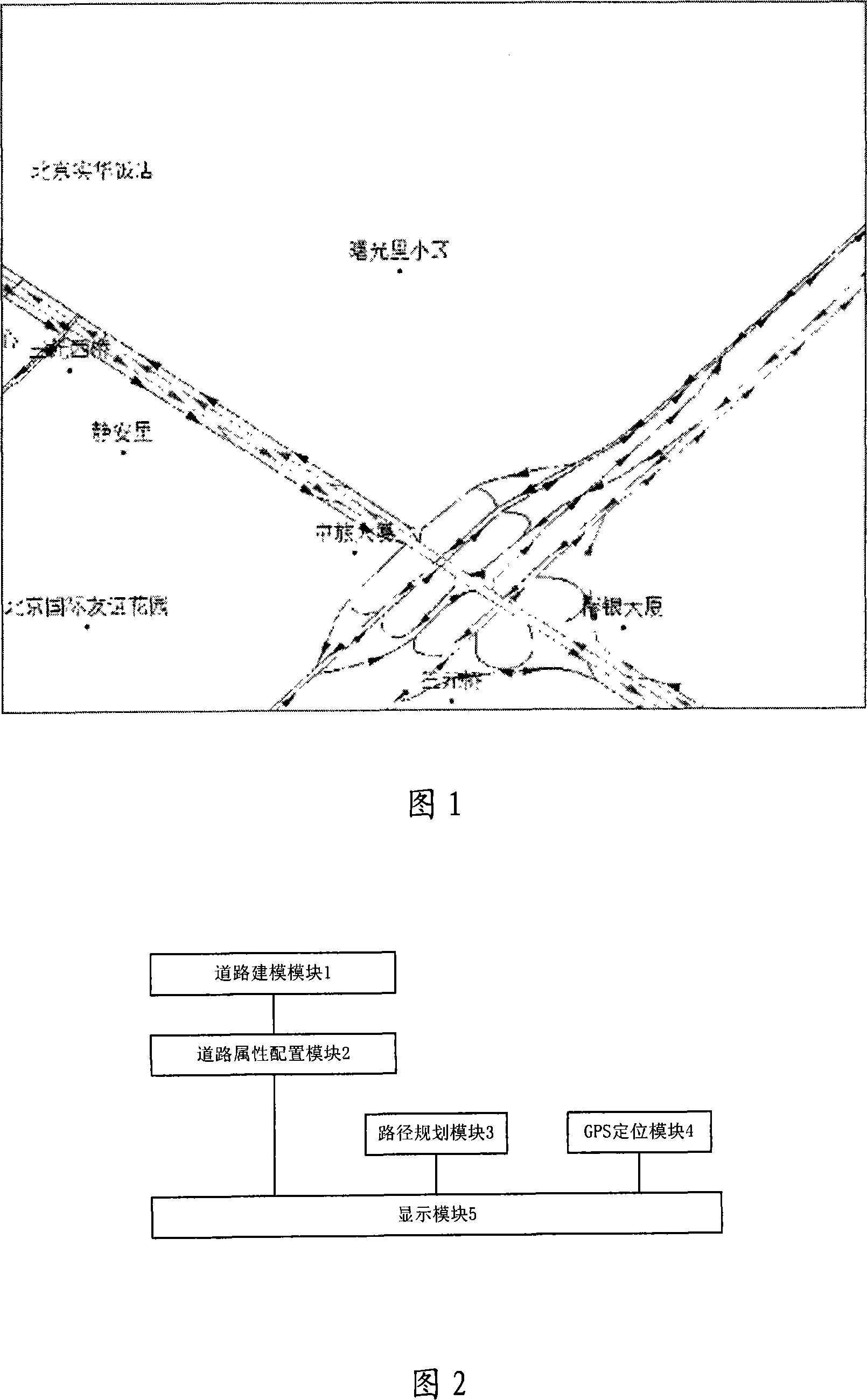
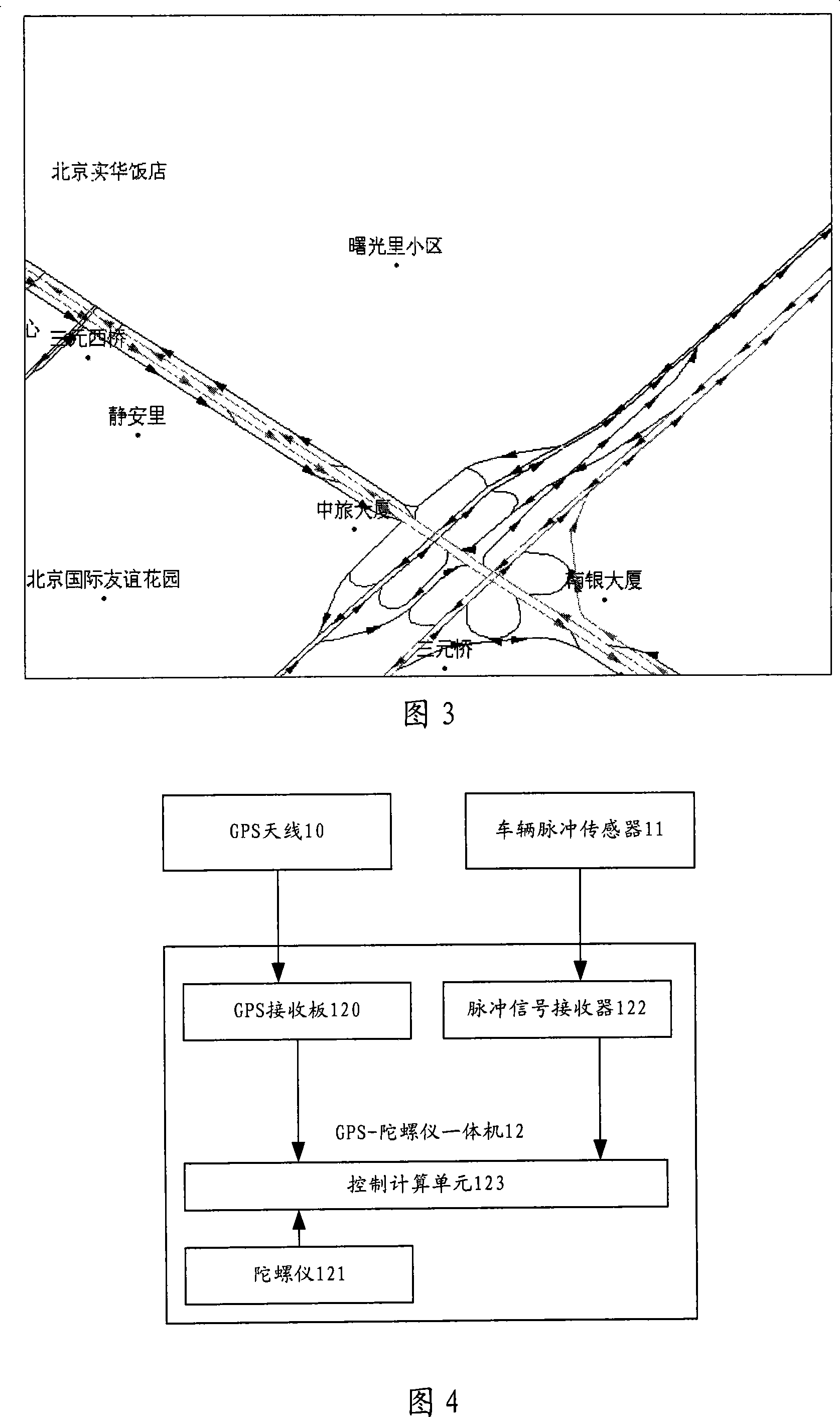
[0026] As shown in Figure 2, the voice navigation device of the expressway bifurcation point of the present invention comprises:

[0027] The road modeling module 1 is used to establish its corresponding network model for the roads in the electronic map according to the actual road conditions and establish a topological relationship diagram between the roads;

[0028] The road attribute configuration module 2 is used to assign public attributes or private attributes to the roads in the network model according to the actual conditions of the roads and store them in the navigation electronic map database;

[0029] Path planning module 3, used to determine the driving path of the vehicle;

[0030] GPS positioning module 4, for determining the current position of vehicle;

[0031] The display module 5 is used to display the roads with private attributes as the background according to the electronic map information around the current location of the vehicle determined by the route...


PUM


Abstract

The invention discloses a road modeling module as a guidance electronic map displaying device, used for building the corresponding network module for the road in the electronic map according to the actual situation of road and building the topological relation graph between roads; a road property deploying module, used for granting public property or private property to the road in the network module according to the actual situation of road and storing in the guidance electronic map database; a path programming module, used for fixing the driving track of vehicle; a GPS positioning module, used for fixing the current position of vehicle; a displaying module, used for display the electronic map information around the current position of vehicle fixed by the path programming path and the GPS positioning module by making the road of private property. By adopting the road deploying module, the property of the road is deployed into public property or private property, which makes the displaying effect more accurate.

Description

technical field [0001] The invention relates to the field of navigation electronic maps, in particular to a navigation electronic map display device. Background technique [0002] With the continuous development of vehicle navigation system application technology, vehicle navigation hardware and software are becoming more and more mature, and navigation data information has been gradually improved. In the existing car navigation system, the road attributes of the navigation electronic map include attribute information such as "road name", "road grade", "road width" and "number of lanes". According to these attribute information, the navigation system can realize Vehicle navigation functions such as information query, map display, route planning, and route guidance have greatly promoted the development of vehicle navigation system technology, making the vehicle navigation system more convenient and practical. [0003] The prior art navigation electronic map display device di...

Claims


Application Information

Patent Timeline
IPC IPC(8): G01C21/26G01C21/32G01C21/34G01C21/36G01C22/02G01S1/02G01S5/02G09B29/10G01S19/42
Inventor 姜德荣孙竹平
Owner AUTONAVI
Why Eureka
Try Eureka