
Broken layer accurate homing method for improving structure diagram precision

A technology of accuracy and structural drawing, applied in cross-section drawing, surveying equipment, surveying and navigation, etc., can solve problems such as drilling errors, achieve accurate homing, overcome discontinuity, and good control effects

Active Publication Date: 2008-12-24
BC P INC CHINA NAT PETROLEUM CORP +1
View PDF0 Cites 17 Cited by
  • Summary
  • Abstract
  • Description
  • Claims
  • Application Information

AI Technical Summary

Problems solved by technology

This inaccuracy often directly leads to errors in later drilling

Method used


Image

  • Broken layer accurate homing method for improving structure diagram precision
  • Broken layer accurate homing method for improving structure diagram precision
  • Broken layer accurate homing method for improving structure diagram precision

Examples


Embodiment Construction

[0051] specific implementation plan

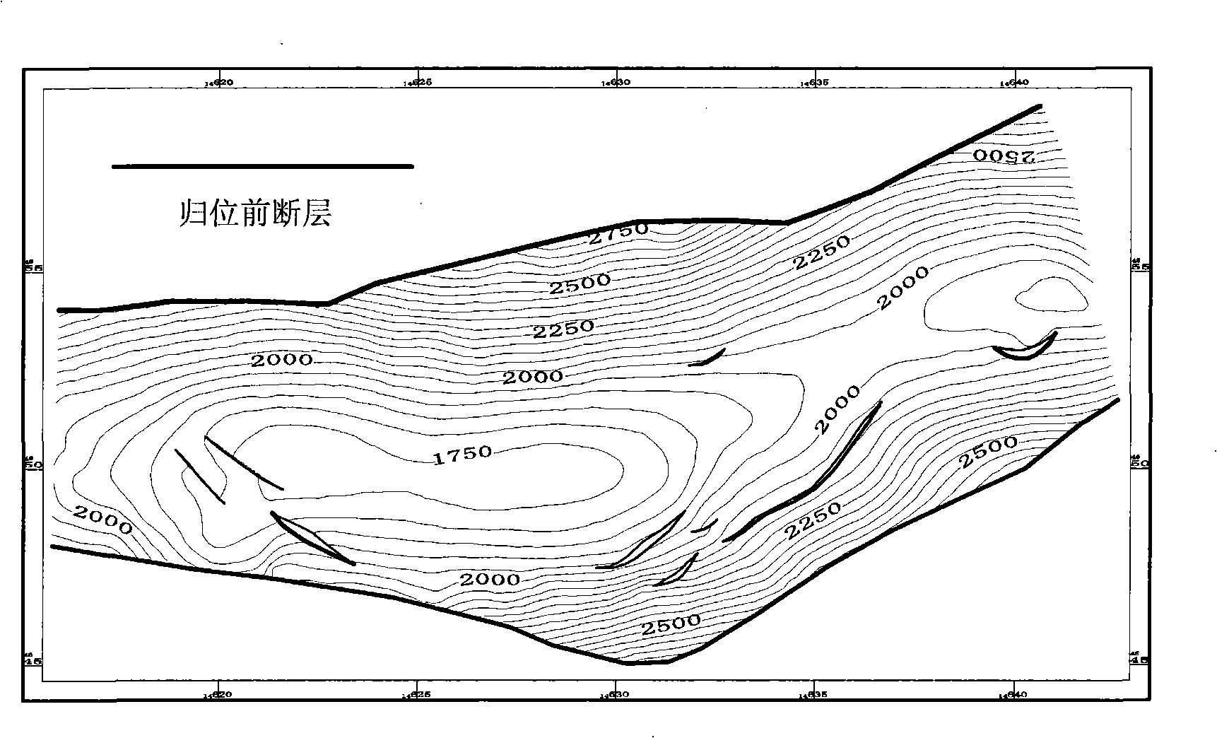
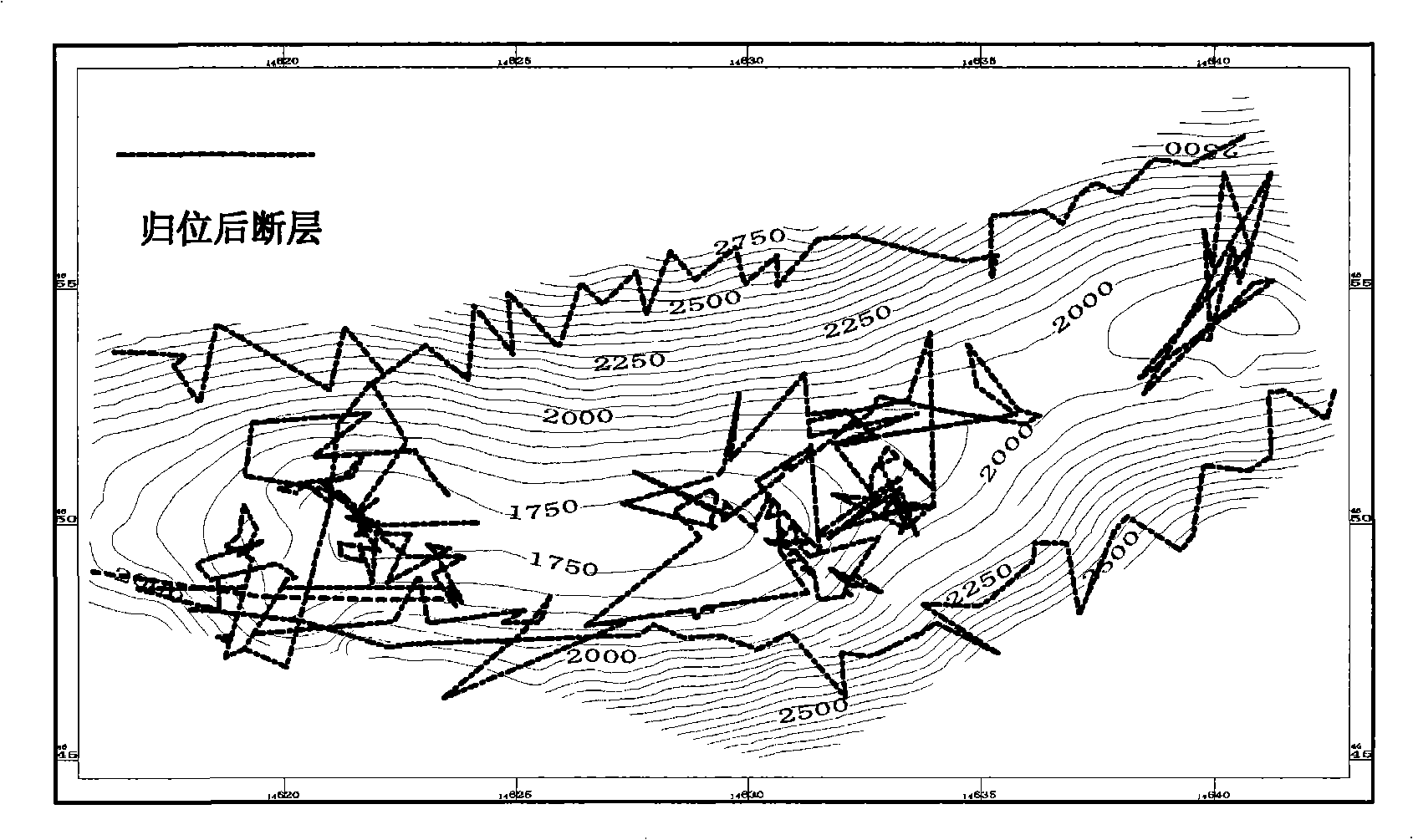
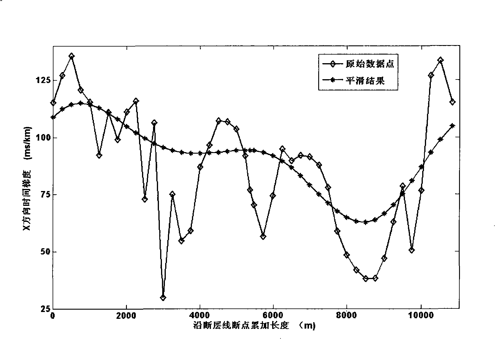
[0052] The patent of the present invention replaces the time gradient of the breakpoint position with the time gradient of the horizon data near the breakpoint position (30m--50m) to generate a new breakpoint, so as to realize the homing of each breakpoint of the two-dimensional seismic data fault. It overcomes the mapping deviation caused by using the stacking section faults to approximate the real fault positions of the underground structure in the original mapping process, and effectively improves the mapping accuracy and mapping effect of the two-dimensional seismic data.

[0053] Concrete realization process of the present invention is as follows:

[0054] 1) Collect the data to be homing. Pick up layer data from the two-dimensional seismic data in the work area, and then interpolate on the plane to form evenly distributed layer data; establish an initial model for homing;

[0055] 2) Select the fault to be homing, resample the faul...


PUM


Abstract

The invention relates to a fault precise homing method in the oil physical exploration seismic data interpretation for improving the precision of a structural map. The course is as follows: the re-sampling of an original fault is carried out at equal intervals along the fault line, and break points of a demarcation point of the upper and the lower disks of the fault are retained; the temporal gradients of the near layer location data points of the positions of all the break points of the fault on the X and the Y directions are calculated, the temporal gradients of the near layer location data points on the X and the Y directions are similarly equal to the temporal gradients of the break points; then the smoothing treatment is carried out, and the usual method is further adopted to carry out the homing calculation of the break points to obtain the positions of the break points after the homing. The fault precise homing method can improve the accuracy of the homing of the layer location data and overcome the deviation of a finished image caused by using a stack migration profile to be similarly equal to the position of the underground structural real fault during the original imaging process, thereby allowing the correction result of the whole space to be more accurate and more reasonable, and truly reflecting the shape of the underground structure.

Description

technical field [0001] The invention relates to oil exploration and development technology, in particular to a precise positioning method for faults that improves the accuracy of structural maps in interpreted maps of two-dimensional seismic data. Background technique [0002] In oil exploration, the seismic data formed after two-dimensional seismic information processing is often used for interpretation. The data formed in this way are arranged in traces in the horizontal direction, and there may be several traces. There are several discrete time domains in each trace vertically. The point data for , displayed as a seismic section plot. Two-dimensional seismic data interpretation is to identify and track horizons and faults from the obtained two-dimensional seismic data. After processing and analysis, a structural map is formed, and then a comprehensive evaluation of petroleum geology is carried out. [0003] Horizontal data and spatial homing of plane composite faults are...

Claims


Application Information

Patent Timeline
IPC IPC(8): G01V1/28G01V1/32G01C7/00
Inventor 徐广民岳伏生
Owner BC P INC CHINA NAT PETROLEUM CORP
Learn More