Northeast black soil fertility monitoring system

A soil fertility and monitoring system technology, applied in soil material testing, special data processing applications, instruments, etc., can solve problems such as inability to process and analyze data, no geographic coordinates, and scattered soil nutrient data management.

Inactive Publication Date: 2009-10-28
NORTHEAST INST OF GEOGRAPHY & AGRIECOLOGY C A S
View PDF0 Cites 0 Cited by
  • Summary
  • Abstract
  • Description
  • Claims
  • Application Information

AI Technical Summary

Problems solved by technology

[0006] The invention provides a soil fertility monitoring system for black soil in Northeast China to solve the problems of scattered management of soil nutrient data in

Method used


Image

  • Northeast black soil fertility monitoring system
  • Northeast black soil fertility monitoring system
  • Northeast black soil fertility monitoring system

Examples


Embodiment Construction

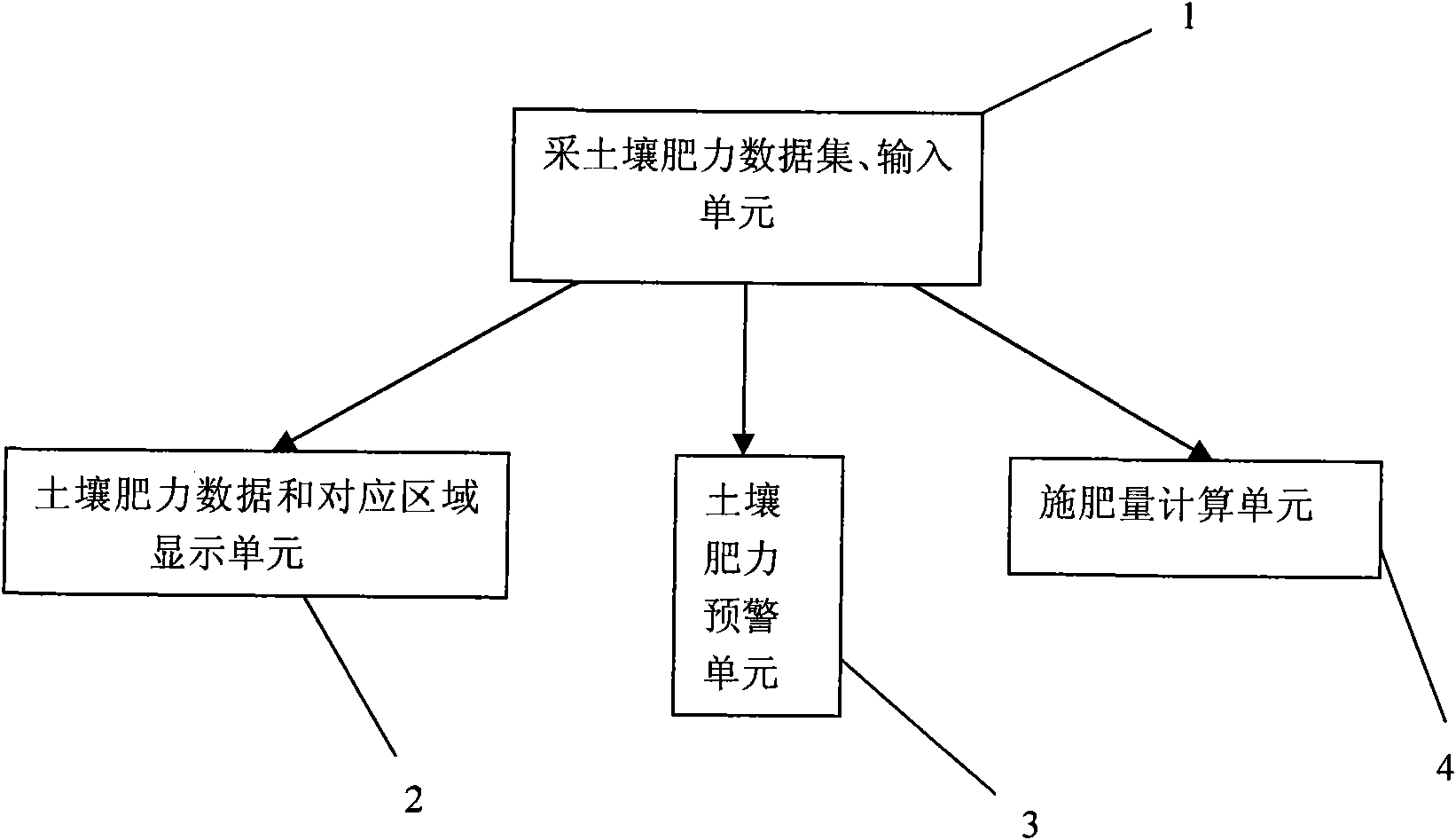
[0014] Combine below Figure 1 to Figure 3 The present invention will be described in detail. Northeast black soil soil fertility monitoring system, which consists of the following four parts:

[0015] Soil fertility data acquisition and input unit 1 to input soil fertility data in each region;

[0016] The soil fertility data and the corresponding area display unit 2, which links the soil fertility data with the geographical coordinates of the corresponding area, so as to facilitate retrieval and display;

[0017] Soil fertility early warning unit 3, to prompt that the soil nutrient value in a certain area is at the specified upper limit or lower limit;

[0018] The fertilization amount calculation unit 4 is used to provide the amount of fertilization in a certain area.

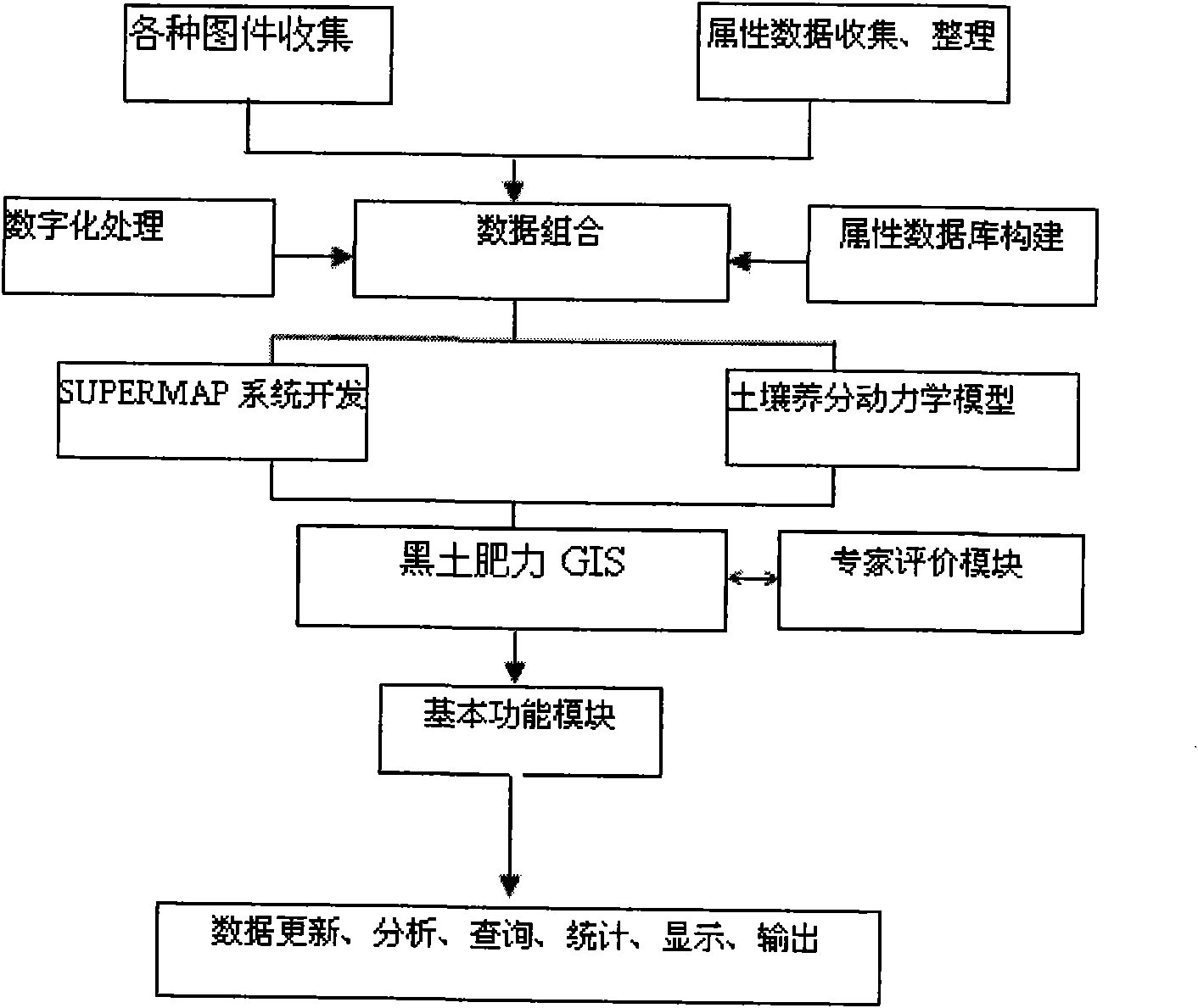
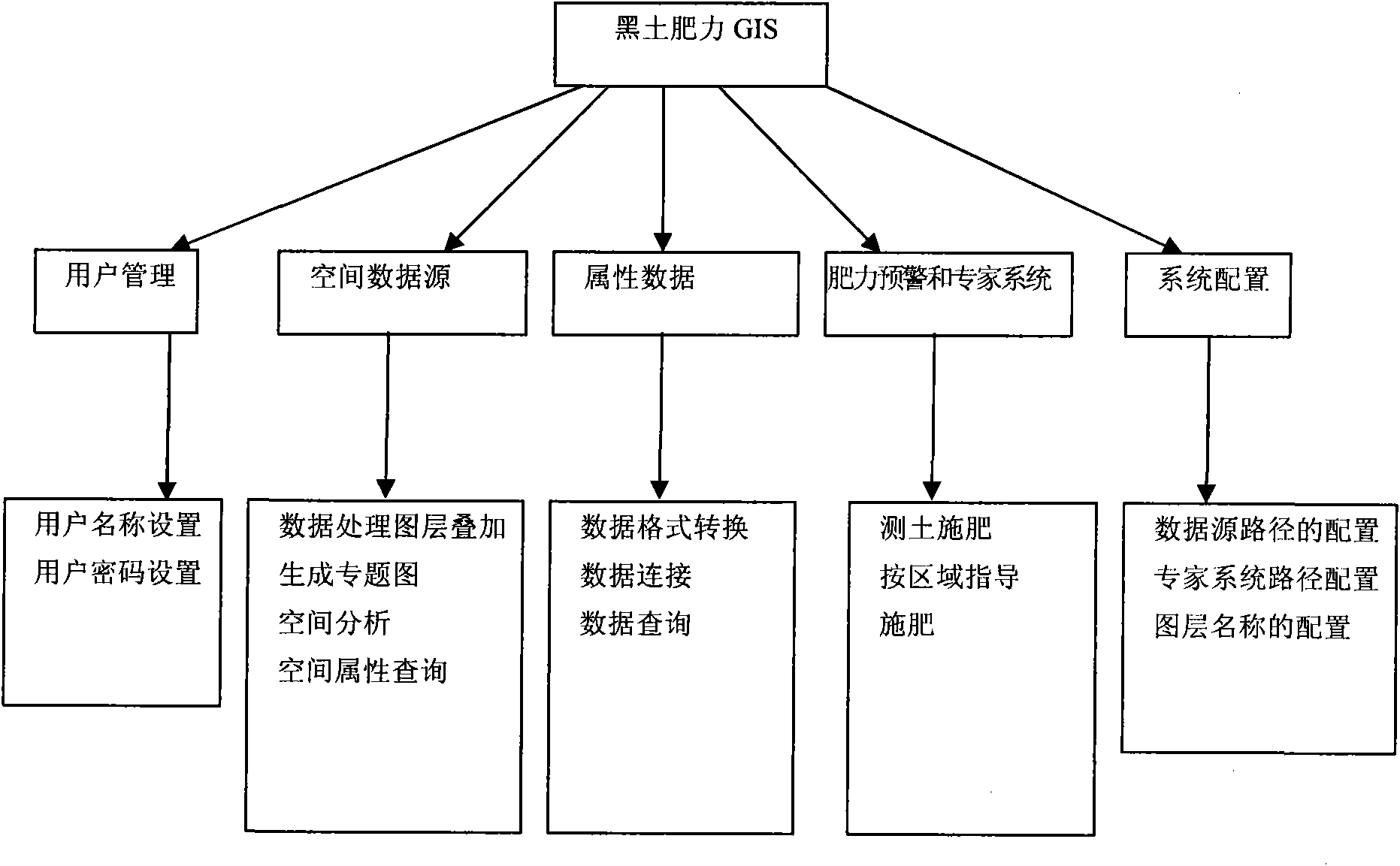
[0019] The system first collects and digitizes various related maps, organizes attribute data and inspects the quality, and then uses VB language programming on the GIS system software (SUPERMAP OBJECT) p...


PUM


Abstract

The invention discloses a monitoring system of soil nutrient change in northeast black soil region, which belongs to the field of agriculture information monitoring and solves the problems that management of soil nutrient data in the black soil region is dispersive, data and place are not unified, geographical coordinates are not accurate, and data is not reasonably scientifically processed and analyzed. The monitoring system comprises a soil fertility data acquisition and input unit (1) used for inputting soil fertility data of each area, a soil fertility data and corresponding area display unit (2) being convenient for transferring the display, a soil fertility prewarning unit (3) used for prompting that soil nutrient value in a certain area just in specified upper limit value or lower limit value, and a fertilizing amount counting unit (4) used for giving the fertilizing amount of a certain area. The specialist fertilizing guide system can guide area scientific fertilization, and provides a data support and informatization platform for precision agriculture, government decision and fertilization standard formulation.

Description

technical field [0001] The invention belongs to the field of agricultural information monitoring, and in particular relates to a monitoring system for soil nutrient changes in the northeast black soil region. Background technique [0002] Northeast black soil is mainly distributed in Jilin Province and Heilongjiang Province. According to soil census statistics, the total land area of ​​black soil is 5.956 million hectares, of which the cultivated land area is 4.438 million hectares. Many soil workers have conducted a large number of investigations and studies on black soil, especially the results of the second national soil census, which described the distribution and physical and chemical properties of black soil in detail, providing a strong theoretical basis for the subsequent fertilization formula , has made a great contribution to food production. More than 20 years after the second national soil census, with the support of a major project of the Chinese Academy of Sci...

Claims


Application Information

Patent Timeline
IPC IPC(8): G01N33/24G06F19/00
CPCY02A40/10
Inventor 赵军刘洪家葛翠萍尹升李宏雷
Owner NORTHEAST INST OF GEOGRAPHY & AGRIECOLOGY C A S
Why Eureka
Try Eureka