Method and device for integrating radar and geographic information data, and weather monitoring system

A technology of geographic information data and radar, which is applied in the field of fusion of radar and geographic information data, can solve the problems of little meaning in urban meteorological safety precautions, manual judgment of measurement work, etc., and achieve the effect of speeding up display and analysis

Inactive Publication Date: 2010-01-13
北京城市气象研究院
View PDF0 Cites 46 Cited by
  • Summary
  • Abstract
  • Description
  • Claims
  • Application Information

AI Technical Summary

Problems solved by technology

[0011] Although these software products can better monitor the changes of disastrous weather, due to the lack of integration of basic geographic information data, it is impossible to immediately obtain accurate spatial delineation and quantification of disastrous weather systems within the spatial range of urban areas with complex underlying surface conditions. estimate
For some major event sites and meteorological security services for key targets, many measurement tasks still require manual judgment and processing, which undoubtedly delays the timely and accurate release and effective use of information
Of course, there are also some flexible methods, such as the special venue forecast during the Sydney Olympic Games, you can refer to the above document (4), and the geographical location of the fixed venues is pre-calibrated. This method can meet the temporary nature of some major events Emergency requirements, but little significance for urban meteorological safety precautions

Method used


Image

  • Method and device for integrating radar and geographic information data, and weather monitoring system
  • Method and device for integrating radar and geographic information data, and weather monitoring system
  • Method and device for integrating radar and geographic information data, and weather monitoring system

Examples


Embodiment 1

[0096] Embodiment 1, a fusion method of radar and geographic information data, such as figure 2 shown, including:

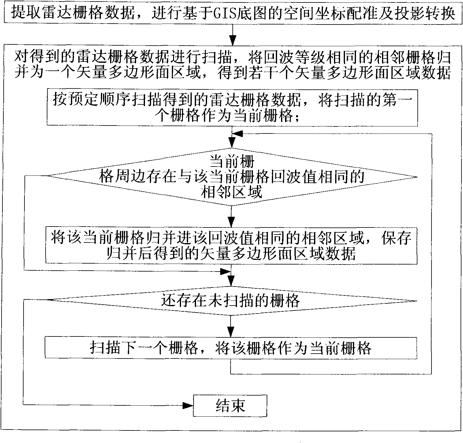
[0097] A. Extract radar raster data, and perform spatial coordinate registration and projection transformation based on GIS base map;

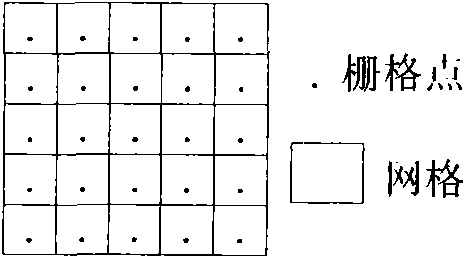
[0098] B. Scanning the radar grid data obtained in step A, merging adjacent grids with the same echo level into one vector polygon area, and obtaining several vector polygon area data.

[0099] In view of the above analysis, the data fusion technology of raster merging performed by the radar and geographic information data fusion device described in this embodiment is as follows: image 3 As shown, the radar and geographic information data fusion device is used to receive radar grid data and merge grids with the same echo level into one area. This operation will undoubtedly greatly reduce the number of generated polygonal areas.

[0100] Note that the method of data fusion in this embodiment is essentially different from the u...

Embodiment 2

[0124] Embodiment 2, a fusion device of radar and geographic information data, such as Figure 13 shown, including:

[0125] Extraction module, for extracting radar raster data;

[0126] A transformation module, used to carry out spatial coordinate registration and projection conversion based on the GIS base map to the radar raster data;

[0127] The fusion module is used to scan the radar grid data obtained by the conversion module, merge adjacent grids with the same echo level into one vector polygon area data, and obtain several vector polygon area data after the merging is completed.

[0128] In this embodiment, the fusion module such as Figure 13 As shown, it may specifically include: a scanning unit, a judging unit, and a merging unit.

[0129] The scanning unit is used to scan the radar grid data obtained by the conversion module in a predetermined order, and send the scanned first grid as the current grid to the judging unit; and when receiving an instruction to co...

Embodiment 3

[0140] Embodiment 3, a weather monitoring system; the weather monitoring system of this embodiment realizes the realization of spatial data processing, spatial analysis function, and spatial statistical function based on the technical solution of radar and geographic information data fusion in Embodiments 1 and 2 ; It can further integrate weather monitoring and early warning functions; basic geographic information data and radar image fusion data are displayed and processed according to geographic information technology means and methods in principle, so the spatial data component has full authority to perform data processing, distribution and other business functions, and the data is stored locally On the network server, the C / S frame structure can be adopted.

[0141] The weather monitoring system includes the radar and geographic information data fusion device, the storage device and the weather monitoring device in the second embodiment; it may further include a weather wa...


PUM


Abstract

The invention discloses a method and a device for integrating radar and geographic information data, and a weather monitoring system. The device comprises an extraction module, a conversion module and an integration module, wherein the extraction module is used for extracting radar raster data; the conversion module is used for the space coordinate registration and projection conversion of the radar raster data based on a GIS base map; and the integration module is used for scanning the acquired radar raster data of the conversion module and merging the adjacent rasters with the same echo grade into a vector polygonal surface area datum to acquire a plurality of vector polygonal surface area data after merging. The invention can increase the speed for generating, displaying and analyzing the integration data.

Description

technical field [0001] The invention relates to the field of space information technology, application of Doppler radar technology and disastrous weather monitoring and early warning, in particular to a method and device for fusion of radar and geographic information data, and a weather monitoring system. Background technique [0002] The combination of spatial information science and the development of computer software and hardware technology has prompted meteorologists to realize the important role of spatial information technology in weather and meteorological operations. Some meteorological and geographic information systems (see the Journal of Applied Meteorology, Volume 16, Issue 4, August 2005, pages 547 to 553, the article "Design and Implementation of Meteorological and Geographical Information Systems" by Liu Pingao, Jiang Jiang, Tan Ping, etc.) have come into operation one after another. It is born and plays a role in meteorological data processing and analysis. ...

Claims


Application Information

Patent Timeline
Patent Type & Authority Applications(China)
IPC IPC(8): G01S17/89G01W1/02
Inventor 扈海波
Owner 北京城市气象研究院
Why Eureka
Try Eureka