

Two-dimensional navigation path planning method based on vector electronic chart
An electronic chart and track planning technology, applied in the field of navigation and navigation, can solve problems such as inefficiency, and achieve the effect of speeding up efficiency and avoiding inefficiency
- Summary
- Abstract
- Description
- Claims
- Application Information
AI Technical Summary
Problems solved by technology
Method used
Image

Examples
Embodiment Construction
[0046] The present invention will be further described below in conjunction with the accompanying drawings and specific embodiments.
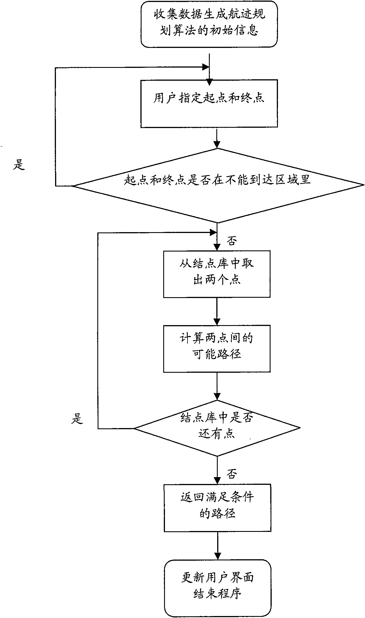
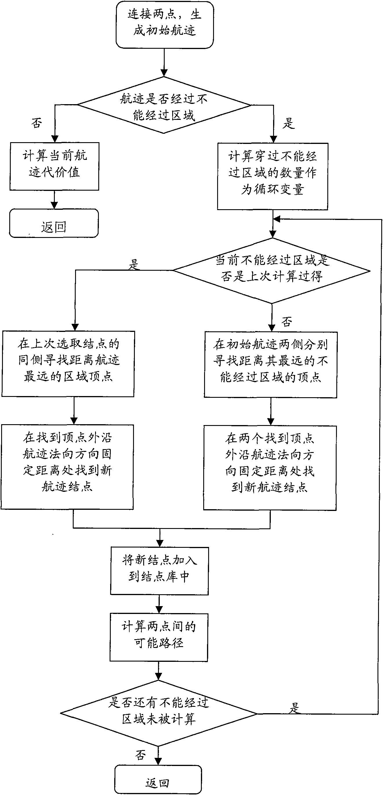
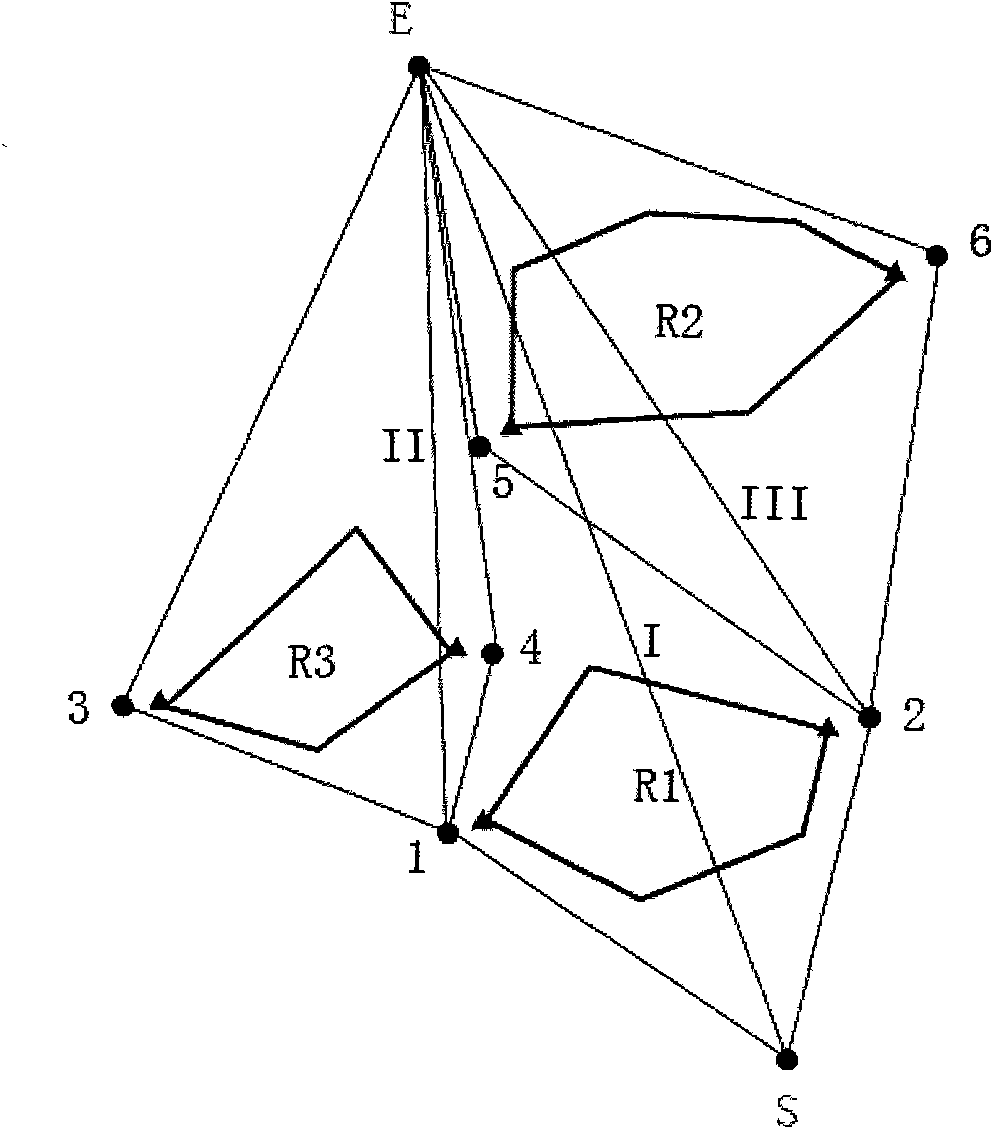
[0047] The work to be completed by the present invention is to design a track according to the needs of the navigator on the vector electronic chart with marine data and navigation data. In the present embodiment, take the vector electronic chart of the S57 standard as an example, refer to figure 1 and figure 2 , to illustrate the design process of the new trajectory.
[0048]The navigator first selects the sea area related to the track to be designed on the vector electronic chart, and obtains the marine data and navigation data of the selected sea area. The ocean data includes information such as water depth, ocean currents, and hidden reefs in the sea area, and the navigation data includes information such as channel division and indicator marks. According to the marine data on the vector electronic chart and the needs of navigators, dete...
PUM
 Abstract
Description
Claims
Application Information