Rice yield remote sensing estimation method based on MODIS data

A rice and data technology, applied in the field of rice yield remote sensing estimation based on MODIS data, can solve the problems of not being suitable for large-scale monitoring, low precision, low time and space resolution, etc., to improve monitoring precision, improve extraction precision, improve time-resolved effects

Inactive Publication Date: 2010-10-13
ZHEJIANG UNIV
View PDF4 Cites 35 Cited by
  • Summary
  • Abstract
  • Description
  • Claims
  • Application Information

AI Technical Summary

Problems solved by technology

[0003] In order to overcome the disadvantages of low time and space resolution and low precision of existing rice yield remote sensing estimation methods, which are not suitable for large-scale monitoring of rice yield, the present invention provides a relatively high time and space resolution and yield estimation accuracy, which is suitable for large-scale Remote Sensing Estimation Method of Rice Yield Based on MODIS Data for Range Monitoring of Rice Yield

Method used


Image

  • Rice yield remote sensing estimation method based on MODIS data
  • Rice yield remote sensing estimation method based on MODIS data
  • Rice yield remote sensing estimation method based on MODIS data

Examples


Embodiment Construction

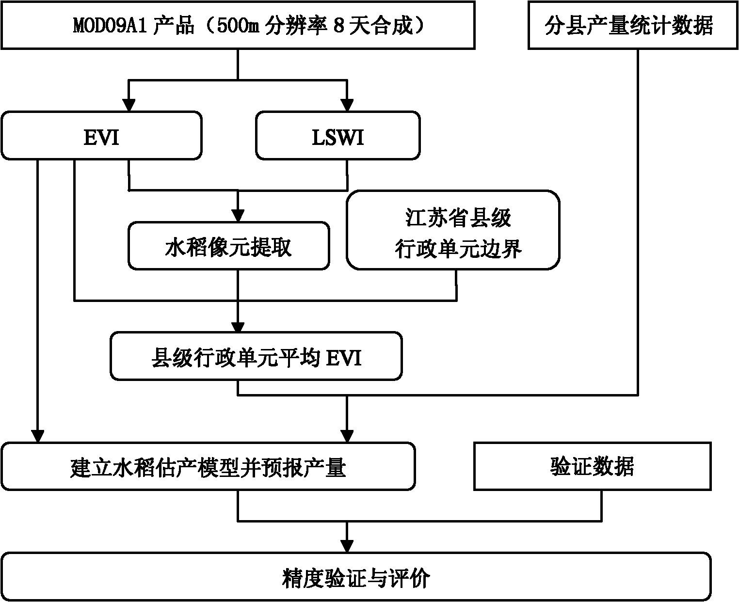
[0029] The present invention will be further described below in conjunction with the accompanying drawings.

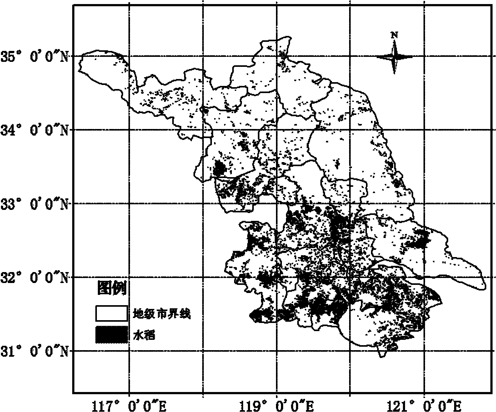
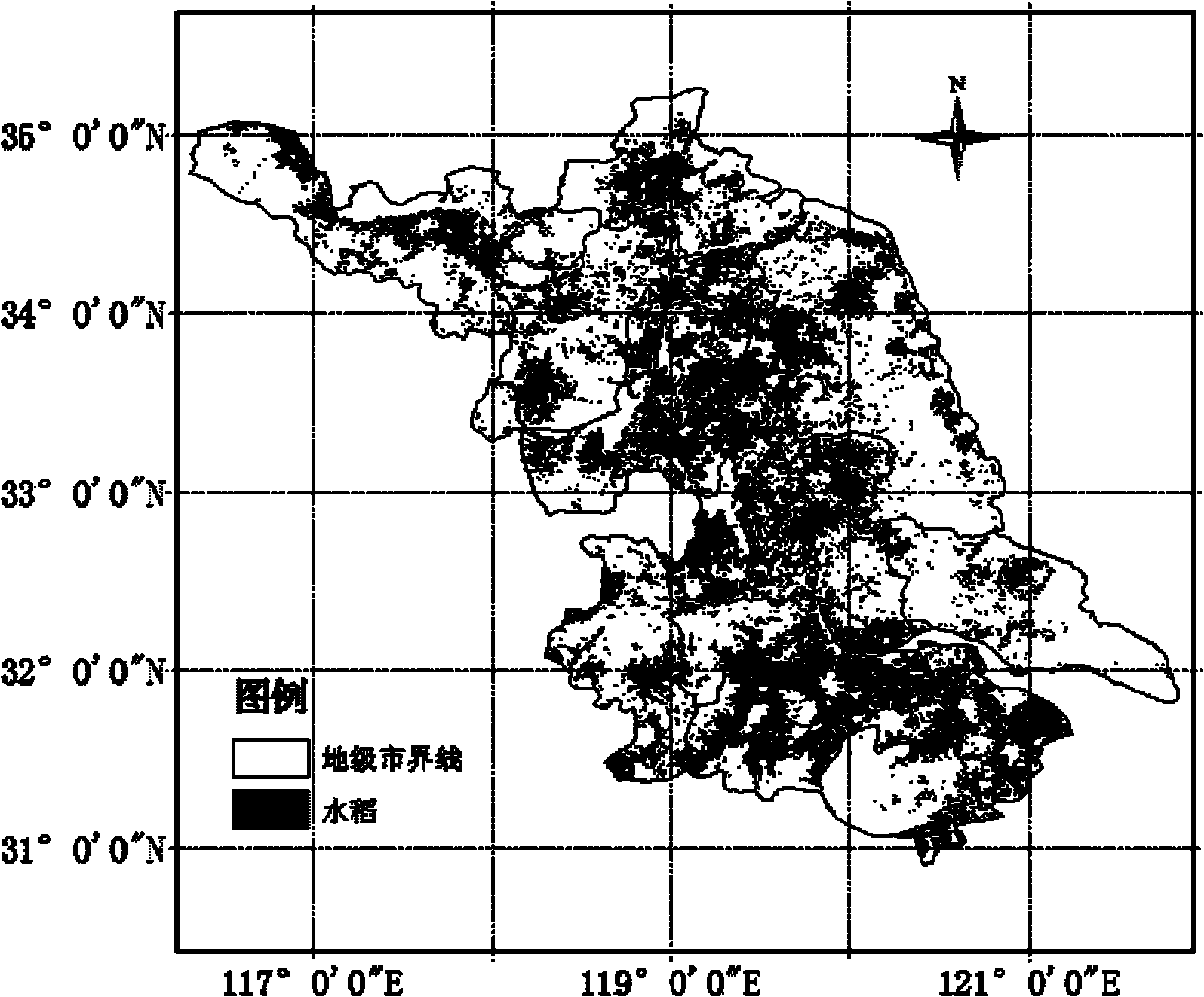
[0030] refer to Figure 1 to Figure 8 , a method for estimating rice yield per unit area remote sensing based on MODIS data, the estimating method comprising:

[0031] 1), obtain the MODIS09 remote sensing data in the rice growth and development process of the region to be monitored, the region to be monitored is composed of a plurality of set administrative units, and the MODIS09 remote sensing data includes the surface reflectance of the red band and the surface reflectance of the near red band , surface reflectance in the blue band, and reflectance in the near-infrared and short-wave infrared bands;

[0032] Calculate the vegetation index EVI and water index LSWI, where the vegetation index EVI is calculated according to the following formula (1):

[0033] EVI = 2.5 × NIR - RE...


PUM


Abstract

The invention discloses a rice yield remote sensing estimation method based on MODIS data, which comprises: 1) acquiring the MODIS09 remote sensing data in the growth process of the rice in the region to be monitored, and calculating an vegetation index EVI and a water index LSWI; 2) extracting a rice pixel based on the relation between the water index LSW1 and the vegetation index EVI; 3) acquiring the vegetation index EVI corresponding to the rice in different stages; 4) calculating the average of the vegetation indexes EVIs of different set administrative regions in different stages to acquire the average EVI of the set administrative regions; 5) establishing a statistical model for the average EVI of the set administrative regions and the rice yield; and 6) estimating the rice yields of the set administrative regions using the vegetation index EVI in the growth period of rice in the year to be estimated, and calculating the rice yield of the region to be monitored. The temporal resolution, the spatial resolution and the estimation precision of the invention are relatively high, and the invention is applicable to monitoring rice yield in a large scale.

Description

technical field [0001] The invention relates to the application of satellite remote sensing and earth observation to the field of rice per unit yield, in particular to a method for estimating rice per unit yield by remote sensing based on MODIS data. Background technique [0002] Traditional rice production estimation is slow, heavy workload and high cost. At present, the channels for obtaining rice production data can be summarized as follows: statistical departments at all levels calculate data based on crop yield sampling surveys and general survey data, agricultural sector general survey data, and meteorological departments calculate based on previous meteorological conditions and forecast models production data. Compared with conventional statistical methods, remote sensing technology has unique advantages in extracting rice planting area and estimating yield. Remote sensing technology has the characteristics of multi-spectrum, multi-temporal and macro characteristics...

Claims


Application Information

Patent Timeline
Patent Type & Authority Applications(China)
IPC IPC(8): G01S7/48G01S17/02
Inventor 王福民黄敬峰孙华生
Owner ZHEJIANG UNIV
Why Eureka
Try Eureka