
Off road navigation system

A navigation system and off-road driving technology, applied in navigation calculation tools, road network navigators, etc., can solve problems such as impossible realization and difficulty

Inactive Publication Date: 2011-01-05
DENSO CORP +1
View PDF4 Cites 7 Cited by
  • Summary
  • Abstract
  • Description
  • Claims
  • Application Information

AI Technical Summary

Problems solved by technology

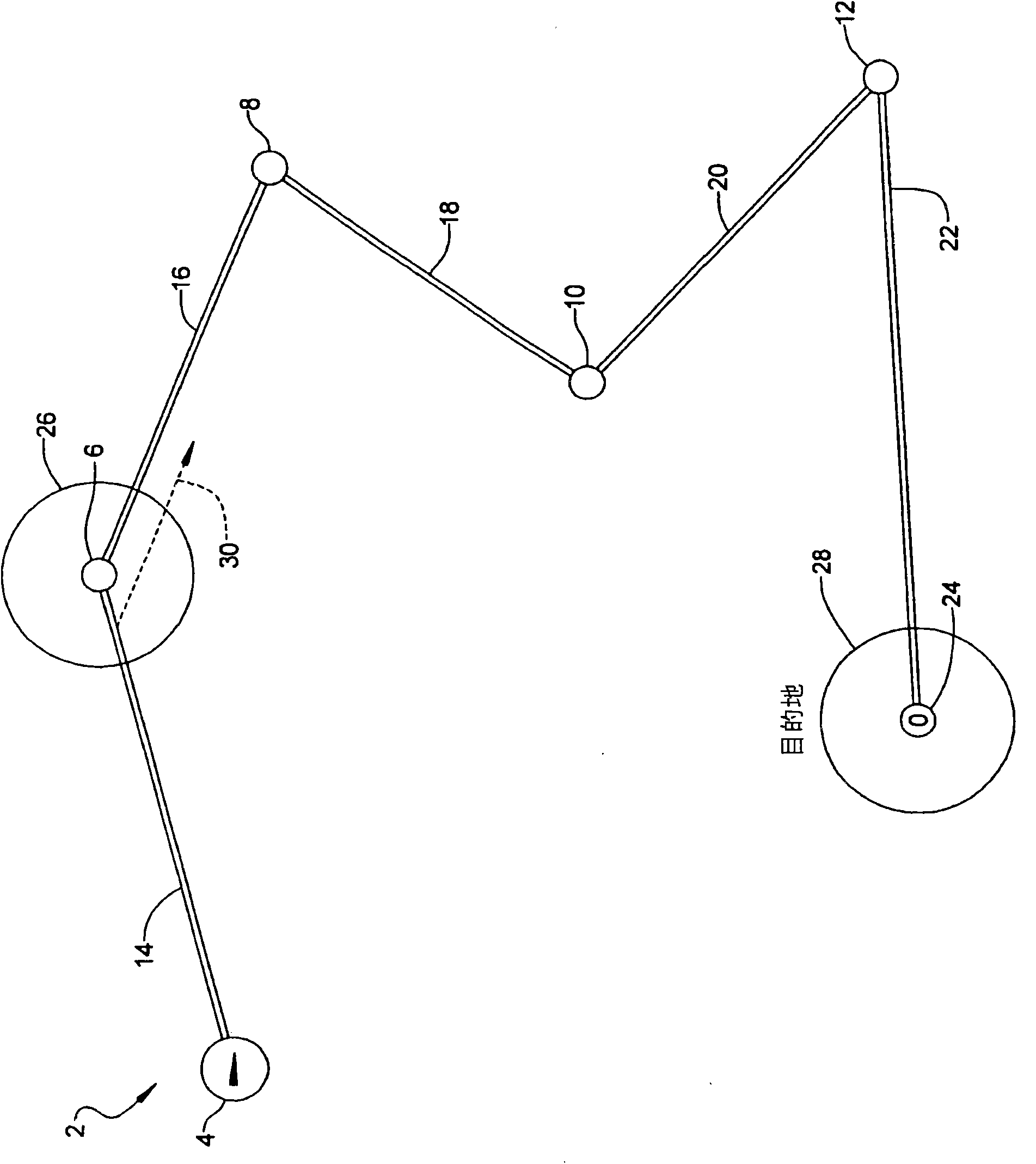
If the driver of the vehicle followed this voice direction, it would be difficult or impossible to reach the area 28 around the destination 24.

Method used


Image

  • Off road navigation system
  • Off road navigation system
  • Off road navigation system

Examples


Embodiment Construction

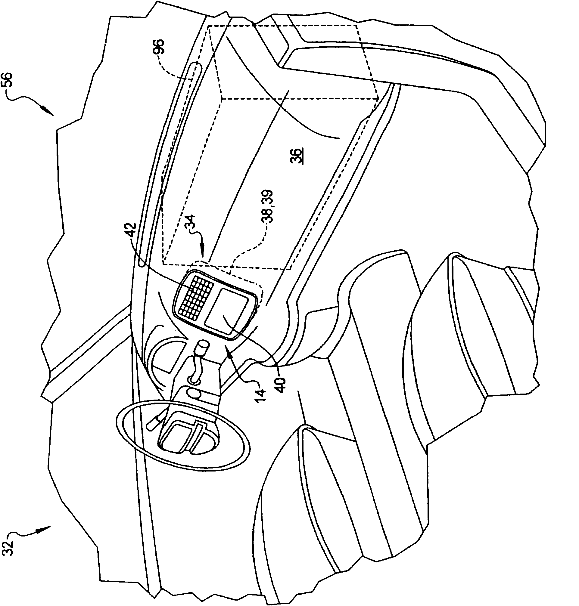
[0020] Now refer to the attached Figure 2-8 to more fully describe example embodiments. figure 2 A vehicle 32 is depicted using a navigation system 34 which may be mounted in a control panel 36 inside the vehicle. The navigation system 34 may use a navigation control unit 38 that calculates route (eg, the route the vehicle is traveling or is recommended to travel) data and displays such route data on a display 40 . Navigation control unit 38 may determine the location of vehicle 32 relative to the destination address and provide visual driving directions on display 40 and audible driving directions that may explain to the driver how to navigate to the destination address. The navigation control unit 38 may also include a memory 39 having memory characteristics that allow the driver of the vehicle to store frequently used destination addresses (eg, home, business, or work addresses). These stored addresses can be seen temporarily on the display 40 when accessing or using me...


PUM


Abstract

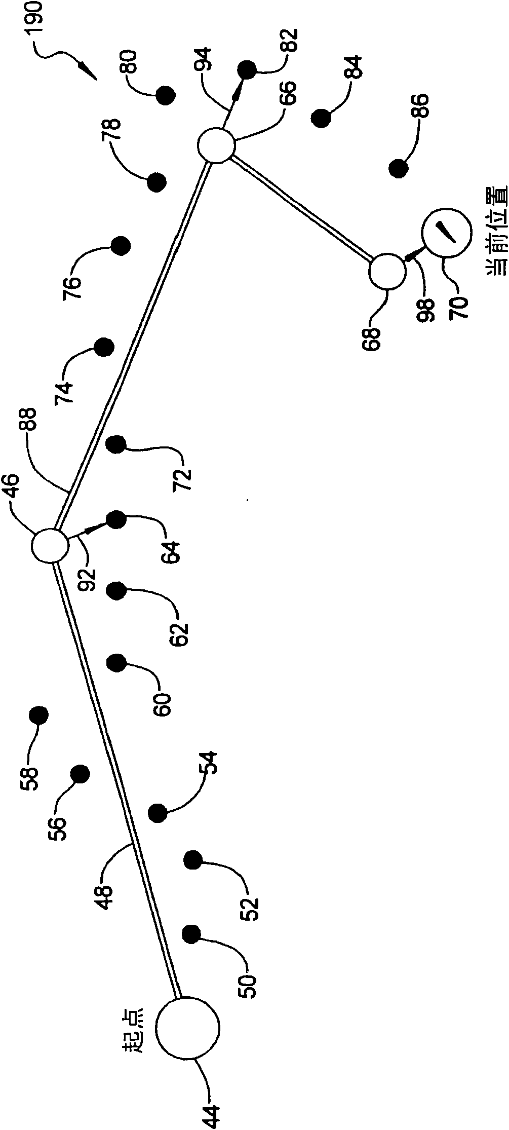
A method of operating a navigation system in a vehicle may include invoking an off-road mode of the navigation system; displaying an off-road terrain on a navigation system display; displaying a present location of the vehicle on the display, inputting a user-input off-road destination into the navigation system; inputting a user-input off-road waypoint into the navigation system; displaying straight line trajectories between the start point, the user-input off-road waypoint and the destination on a display of the navigation system and displaying a real-time path of on-screen breadcrumbs as the vehicle travels off-road in current or real-time; shifting on the display, each user-entered off-road waypoint to a closest on-screen breadcrumb of the real-time path; shifting on the display, the user-entered destination to the closest on-screen breadcrumb; and storing the real-time path in a memory of a navigation control unit.

Description

technical field [0001] The present disclosure relates to a method for calculating and displaying an off-road route on a navigation system of an off-road vehicle. Background technique [0002] This section provides background information related to the present disclosure which is not necessarily prior art. Some modern navigation systems have an off-road mode that can display a route to a selected destination; however, such navigation systems have some limitations. [0003] As an example, figure 1 is a prior art plan view of off-road navigation route 2 that distinguishes current vehicle position 4, route waypoints 6, 8, 10, 12 and recommended trajectories 14, 16, 18, 20, 22 or off-road vehicle travel route. Specifically, trajectory 14 is the recommended travel route from the original or current vehicle position 4 to the first waypoint 6, trajectory 16 is the recommended travel route between the first waypoint 6 and the second waypoint 8, and trajectory 18 is the recommende...

Claims


Application Information

Patent Timeline
Patent Type & Authority Applications(China)
IPC IPC(8): G01C21/34
CPCG01C21/20
Inventor 坂下尚广
Owner DENSO CORP
Learn More