Microstation v8i-based city rapid-modeling method

A modeling method and fast technology, applied in 3D modeling, image data processing, instruments, etc.

Inactive Publication Date: 2011-04-13
XIAN MEIHANG INFORMATION IND
View PDF2 Cites 16 Cited by
  • Summary
  • Abstract
  • Description
  • Claims
  • Application Information

AI Technical Summary

Problems solved by technology

[0003] The technical problem to be solved by the present invention is to provide a rapid urban modeling method based on Microstation v8i in view of the deficiencies in the above-mentioned prior art. Accurate and effective. Existing urban 3D geometric model modeling methods have various defects and deficiencies such as large amount of collected data, high labor intensity, low efficiency, and long cycle.

Method used


Image

  • Microstation v8i-based city rapid-modeling method
  • Microstation v8i-based city rapid-modeling method
  • Microstation v8i-based city rapid-modeling method

Examples


Embodiment Construction

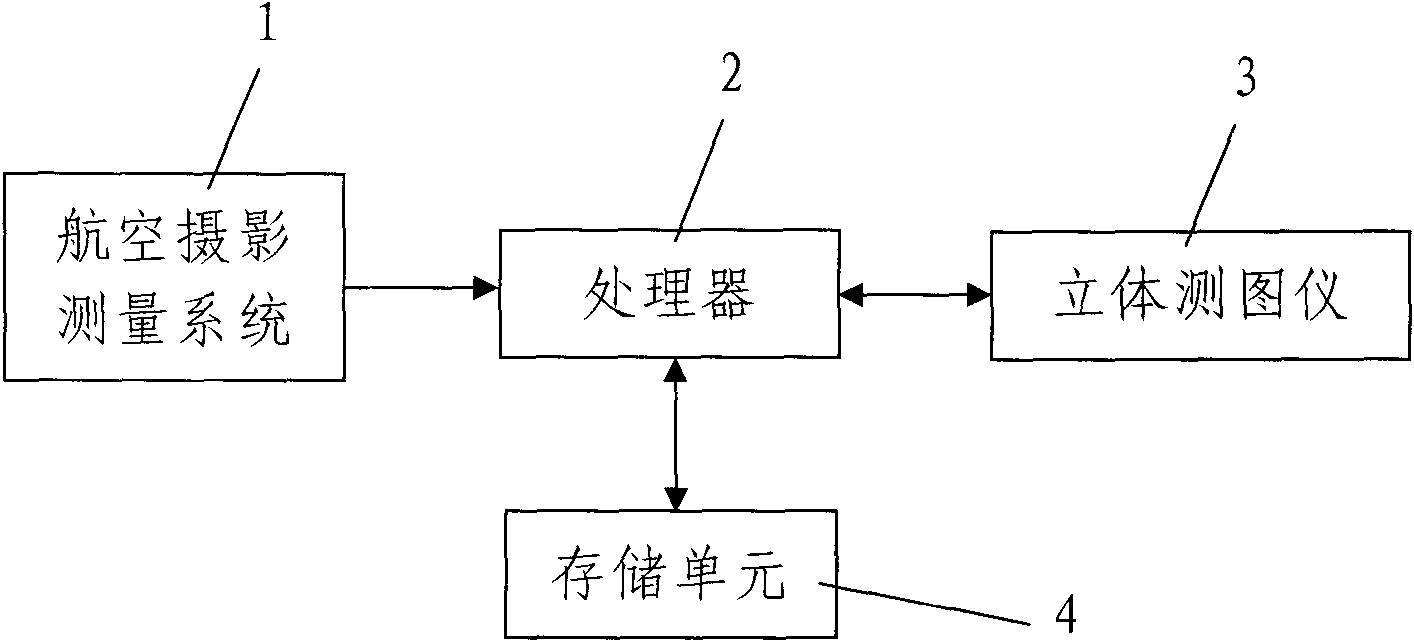
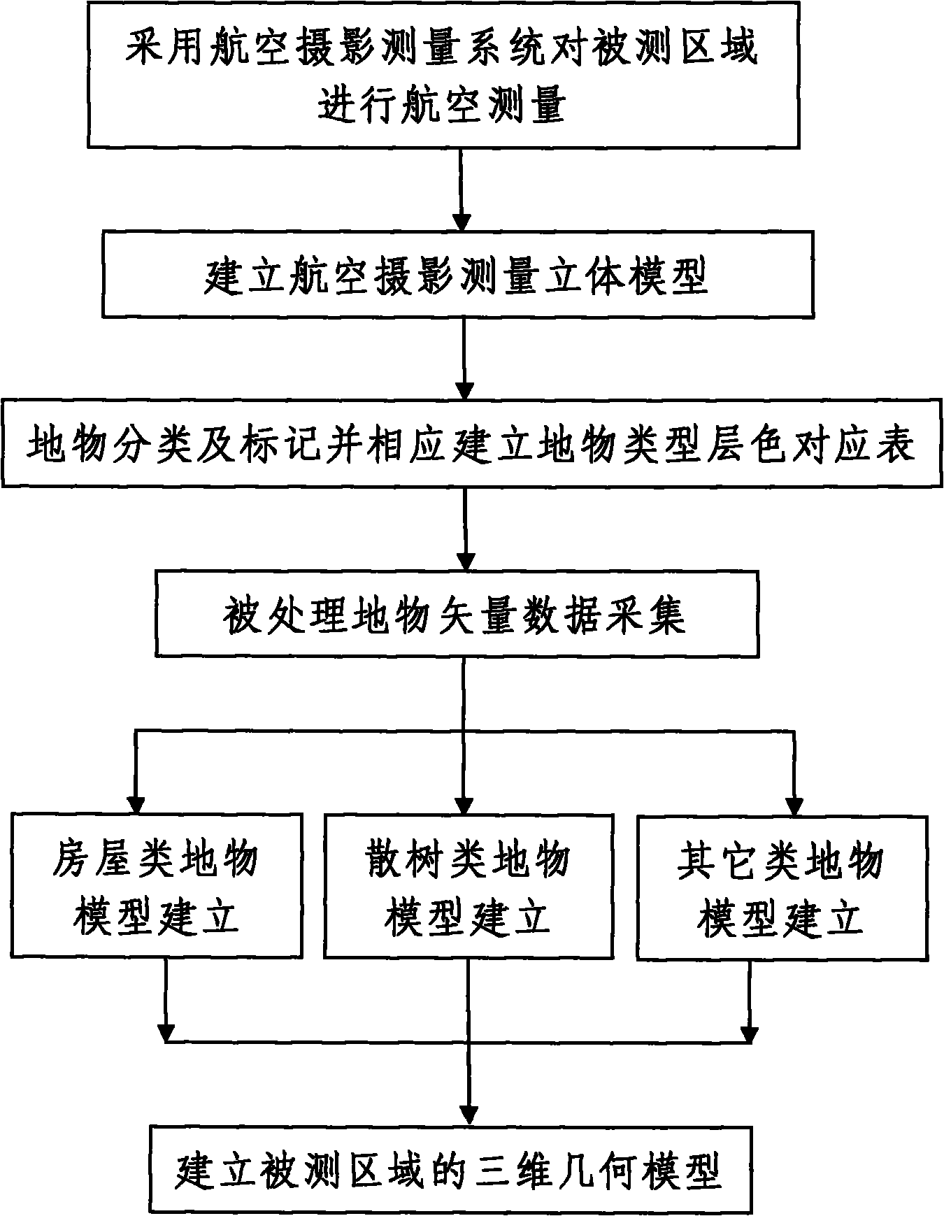
[0052] like figure 1 , figure 2 Shown, the rapid city modeling method based on Microstation v 8i of the present invention comprises the following steps:

[0053] Step 1: Use the aerial photogrammetry system 1 to conduct aerial surveys on the area to be measured according to the conventional aerial photogrammetry method, and transmit the captured aerial photographs to the processor 2 synchronously through the data line.

[0054] Step 2, described processor 2 analyzes and processes aerial photographs under Microstation v8i software environment, and correspondingly sets up the three-dimensional geometric model of measured area, and the analysis process of described processor 2 is as follows:

[0055] 201. Establishing an aerial photogrammetry stereo model: the processor 2 invokes the stereo mapper 3 connected to it to process the aerial photographs, and correspondingly establishes an aerial photogrammetry stereo model of the measured area; The plotter 3 synchronously transmits...


PUM


Abstract

The invention discloses a Microstation v8i-based city rapid-modeling method, which comprises the following steps of: performing an aerial survey on a tested area according to a conventional aerial photogrammetric survey method by adopting an aerial photogrammetric survey system; and 2, performing analysis processing on aerial survey data in a Microstation v8i software environment by using a processor, namely, establishing a three-dimensional aerial photogrammetric survey model, performing land feature classification and marking, correspondingly establishing a land feature type layer-color mapping table, performing vector data acquisition, establishing models of houses, scattered trees and land features of other types respectively, processing all the land features in the tested area respectively, and obtaining three-dimensional geometric models of all the land features in the tested area.

Description

technical field [0001] The invention relates to a rapid modeling method for a three-dimensional model, in particular to a rapid urban modeling method based on Microstation v8i. Background technique [0002] With the continuous development of science and technology and the continuous progress of society, the two-dimensional planar map has gradually failed to meet the needs. Recently, the three-dimensional modeling technology of digital city has appeared and is more and more popular among people, and has become a hot topic at present. With the continuous growth and development of Bentley, the fields involved are more and more extensive. The corresponding software released by the company is also constantly upgraded, and its functions are becoming more and more powerful. However, Microstation V8 and previous versions of the software do not provide the function of data 3D modeling, and urban modeling cannot be realized. However, MicrostationV8i version began to appear tools and ...

Claims


Application Information

Patent Timeline
Patent Type & Authority Applications(China)
IPC IPC(8): G06T17/00
Inventor 高鹏吴晓燕刘敏李政
Owner XIAN MEIHANG INFORMATION IND
Why Eureka
Try Eureka