Grassland satellite remote sensing monitoring system and method
A technology for satellite remote sensing and monitoring systems, applied in special data processing applications, instruments, electrical digital data processing, etc., and can solve problems such as inability to directly apply
- Summary
- Abstract
- Description
- Claims
- Application Information
AI Technical Summary
Problems solved by technology
Method used
Image
Examples
Embodiment Construction
[0072] The technical solutions of the present invention will be further described in more detail in conjunction with the accompanying drawings and specific embodiments.
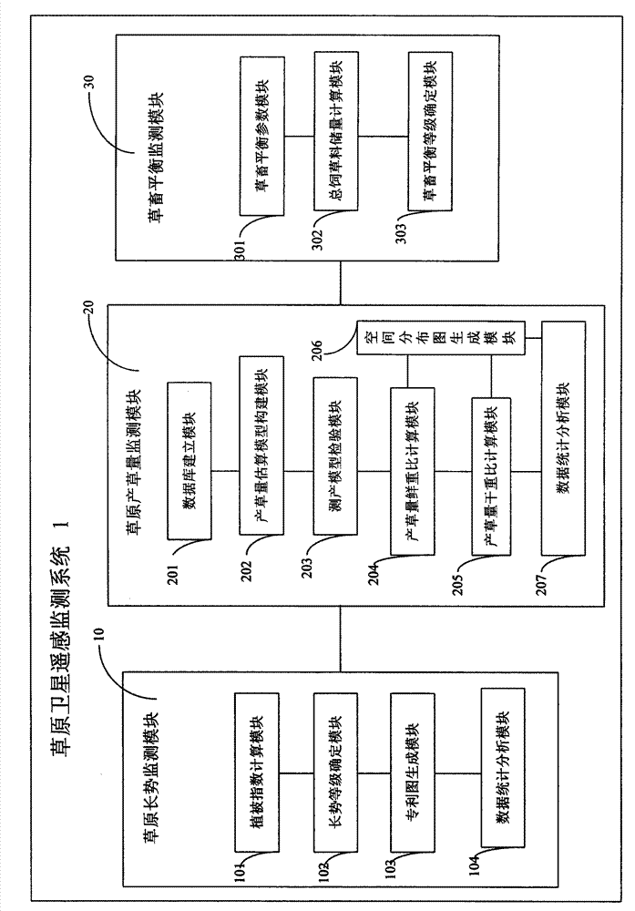
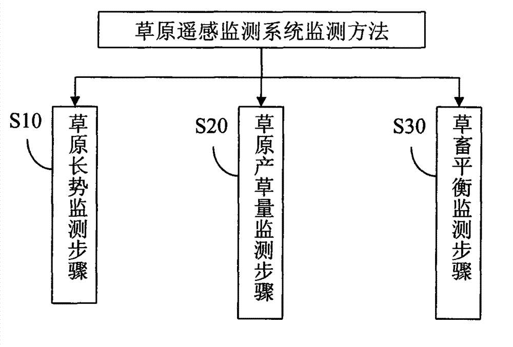
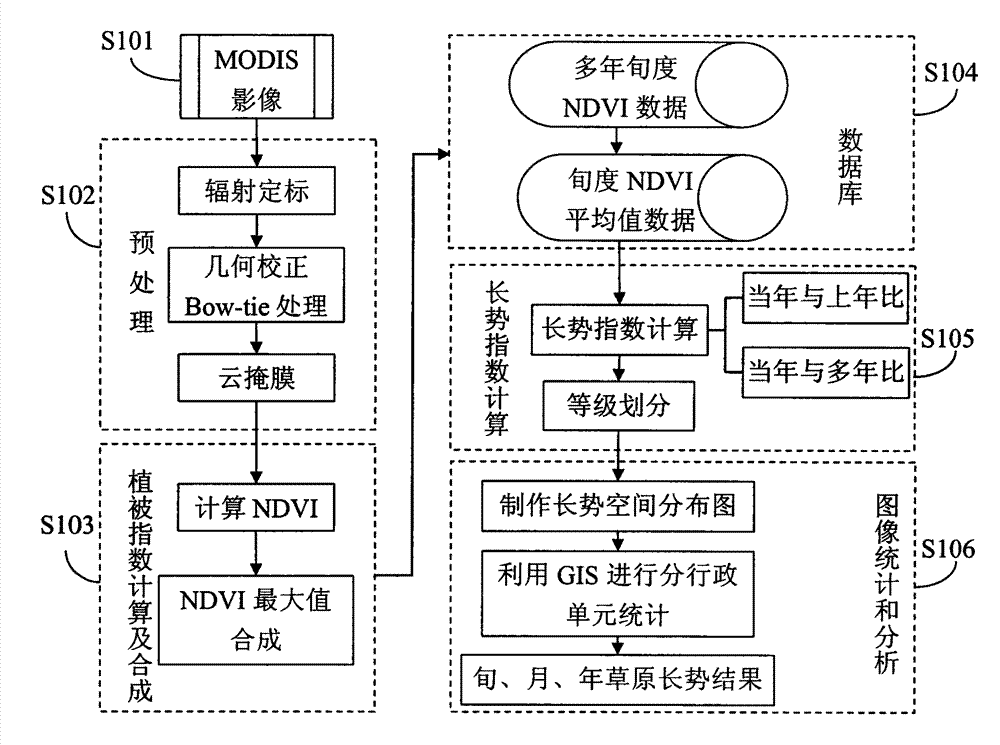
[0073] figure 1 It is the structural block diagram of the grassland satellite remote sensing monitoring system of the present invention, refer to figure 1 The grassland satellite remote sensing system 1 includes a grassland growth monitoring module 10 , a grassland grass yield monitoring module 20 , and a grassland-livestock balance monitoring module 30 . Among them, the grassland growth monitoring module 10 is used to obtain the grassland vegetation index NDVI and the grassland growth index GI through the satellite remote sensing MODIS data processing in different periods according to the relationship between the remote sensing information and the grassland vegetation status, so as to reflect the grassland vegetation growth; Quantity monitoring module 20, is used for through satellite remote sensing MODIS i...
PUM
 Abstract
Description
Claims
Application Information
 - R&D
- Intellectual Property
- Life Sciences
- Materials
- Tech Scout
- Unparalleled Data Quality
- Higher Quality Content
- 60% Fewer Hallucinations
Browse by: Latest US Patents, China's latest patents, Technical Efficacy Thesaurus, Application Domain, Technology Topic, Popular Technical Reports.
© 2025 PatSnap. All rights reserved.Legal|Privacy policy|Modern Slavery Act Transparency Statement|Sitemap|About US| Contact US: help@patsnap.com


