
Method for determining optimum turning path for marine cable-towing exploration

A path and towline technology, applied in the field of determining the best turning path for offshore towline exploration, can solve the problems of lack of search methods and inability to find the best combination of towlines, so as to optimize seismic exploration acquisition construction, optimize route turning, and improve benefit effect

Active Publication Date: 2011-06-29
BC P INC CHINA NAT PETROLEUM CORP +1
View PDF0 Cites 7 Cited by
  • Summary
  • Abstract
  • Description
  • Claims
  • Application Information

AI Technical Summary

Problems solved by technology

[0003] At present, there are existing methods to optimize the route sequence of the towed ship, while the conventional turning path is determined by the navigator based on experience, which does not necessarily meet the minimum radius constraints, and the best combination cannot be found in complex situations. The turning path also lacks a fast and clear search method

Method used


Image

  • Method for determining optimum turning path for marine cable-towing exploration
  • Method for determining optimum turning path for marine cable-towing exploration
  • Method for determining optimum turning path for marine cable-towing exploration

Examples


example 2

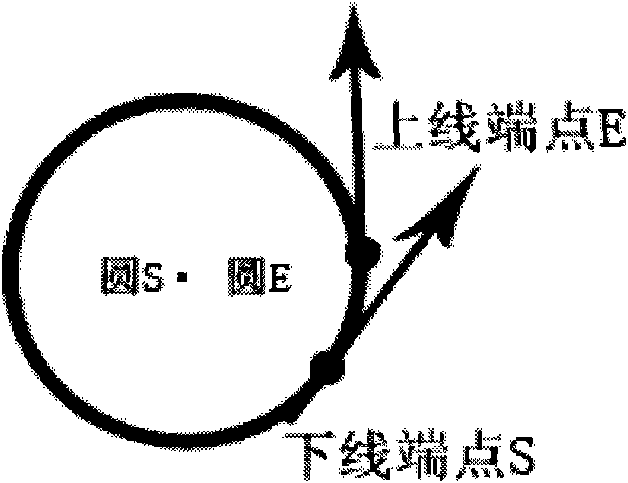
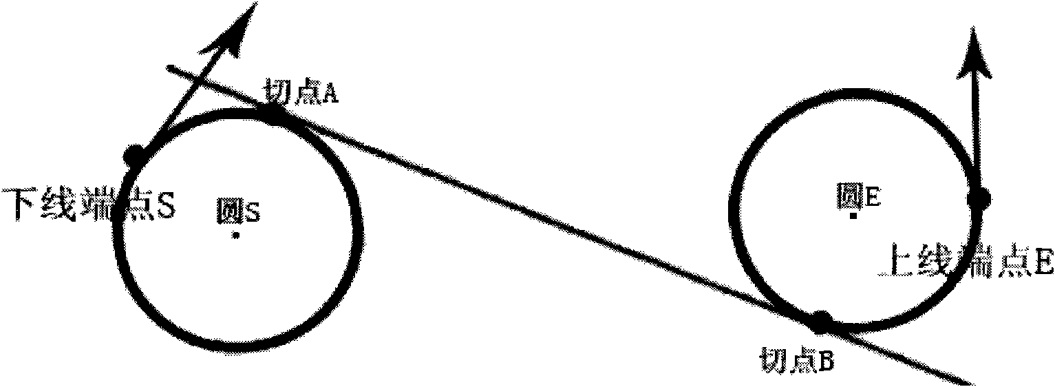
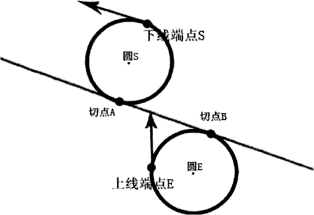
[0107] Figure 16 It is a schematic diagram of the turn of two collection routes in a certain work area. The north coordinate of the downline endpoint (S) is -11580.11m, the east coordinate is 848.32m, and the heading is 180° east of north; the north coordinate of the upper line endpoint (E) is -12995.72m, the east coordinate is 2102.02m, and the heading is 0° east of north ; The turning radius of the towboat is 1487.5m.

[0108] (1) Judging that the turning start point (S) is on the left side of the end point (E).

[0109] (2) The included heading angle is 180°, if it is greater than 90°, it is reverse planning.

[0110] (3) The north coordinate of the standard circle center on the left side of the downline endpoint is -11580.11m, the east coordinate is 2335.82m, and the north coordinate of the standard circle center on the left side of the upline endpoint is -12995.72m, and the east coordinate is 614.52m. have Figure 8 The path combination mode in which the standard cir...


PUM


Abstract

The invention relates to a marine cable-towing exploration technology, in particular to a method for determining an optimum turning path for marine cable-towing exploration aiming at the turning characteristic of a cable-towing boat. The method comprises the following steps: according to objects and data for deep-ocean exploration and in compliance with the range and accuracy of marine cable-towing exploration, predetermining different navigation paths of the cable-towing boat; preselecting the plurality of paths for the cable-towing boat which passes through standard arcs and common tangent segments at downline end points, passes through next standard arc and then reaches an upline end points; calculating the lengths of different paths; determining the shortest path for turning distance; and a deep-ocean survey method is adopted for exploration, and the cable-towing boat tows cables to navigate along the shortest path to work. In the method, necessary means are provided for improving the marine acquisition construction benefit, the turning of the navigation route can be optimized, and a result can be fast obtained, so that the acquisition construction for marine cable-towing seismic exploration can be optimized.

Description

technical field [0001] The invention relates to sea towline exploration technology, in particular to a method for determining the best turning path of sea towline exploration according to the turning characteristics of towline ships. Background technique [0002] Streamer exploration is an important method for deep-sea exploration of oil and gas resources. The typical acquisition method is to conduct air gun detection by working ships along hundreds of routes. Among them, the construction voyage of the towboat is an important factor affecting the collection cost and construction time. The voyage of the towboat mainly includes two parts: the effective construction voyage on the collection route and the turning voyage between the routes. The effective construction distance on the collection route is fixed, so reducing the cost by shortening the voyage can only reduce the turning distance of the towboat. Specifically, it adopts a reasonable route collection sequence and the b...

Claims


Application Information

Patent Timeline
Patent Type & Authority Applications(China)
IPC IPC(8): G01C21/00
Inventor 张虎
Owner BC P INC CHINA NAT PETROLEUM CORP
Learn More