Method and device for calculating normal vector in three-dimensional terrain modeling process

A modeling process and three-dimensional terrain technology, applied in the field of GIS, can solve problems such as poor three-dimensional stereo effect, and achieve the effect of increasing the three-dimensional effect, improving the display effect, and enhancing the effect better.

Inactive Publication Date: 2011-07-06
CHINA DIGITAL VIDEO BEIJING
View PDF2 Cites 2 Cited by
  • Summary
  • Abstract
  • Description
  • Claims
  • Application Information

AI Technical Summary

Problems solved by technology

[0005] However, when using D3D to render 3D terrain, if you directly use the normal vector calculated from the height data for rendering, the rendered 3D effect will be very poor.

Method used


Image

  • Method and device for calculating normal vector in three-dimensional terrain modeling process
  • Method and device for calculating normal vector in three-dimensional terrain modeling process
  • Method and device for calculating normal vector in three-dimensional terrain modeling process

Examples


Embodiment Construction

[0043] In order to make the above objects, features and advantages of the present invention more comprehensible, the present invention will be further described in detail below in conjunction with the accompanying drawings and specific embodiments.

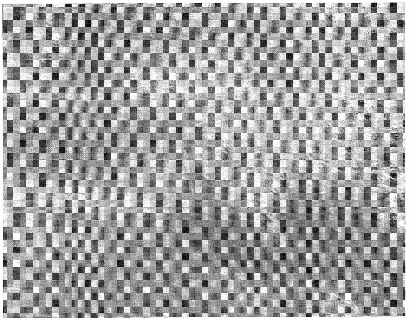
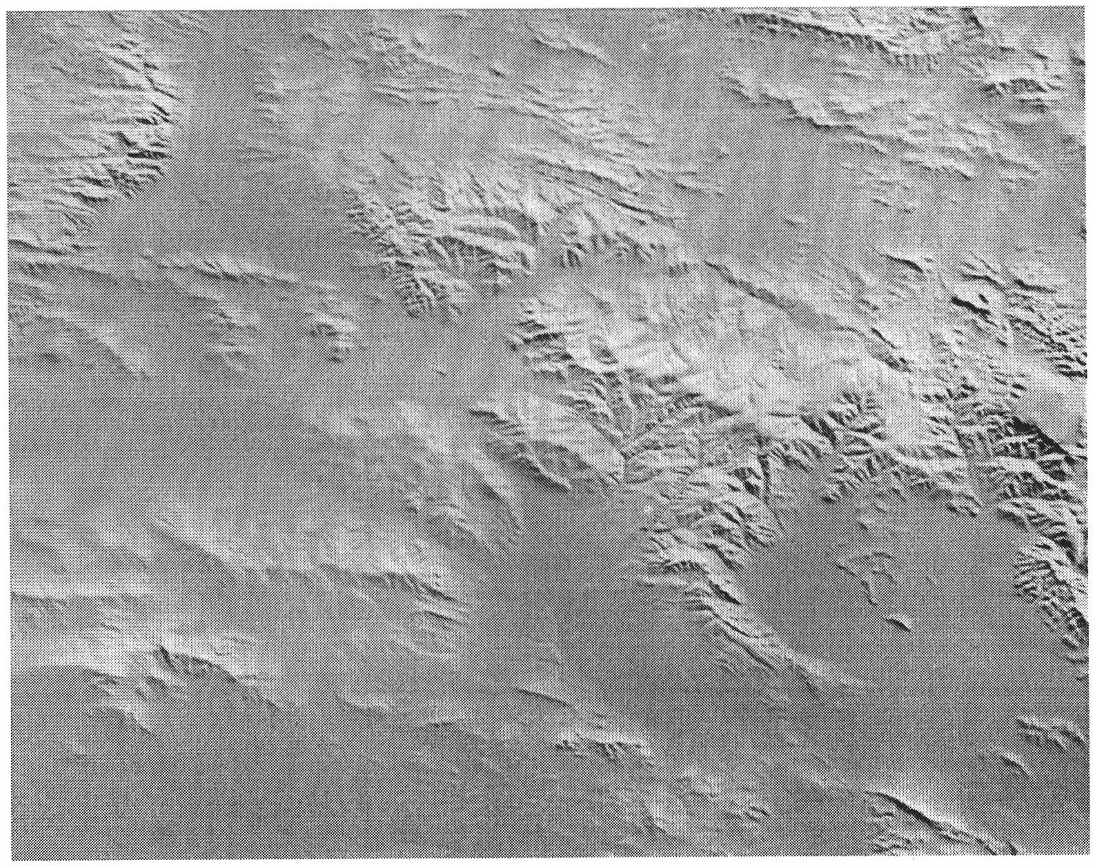
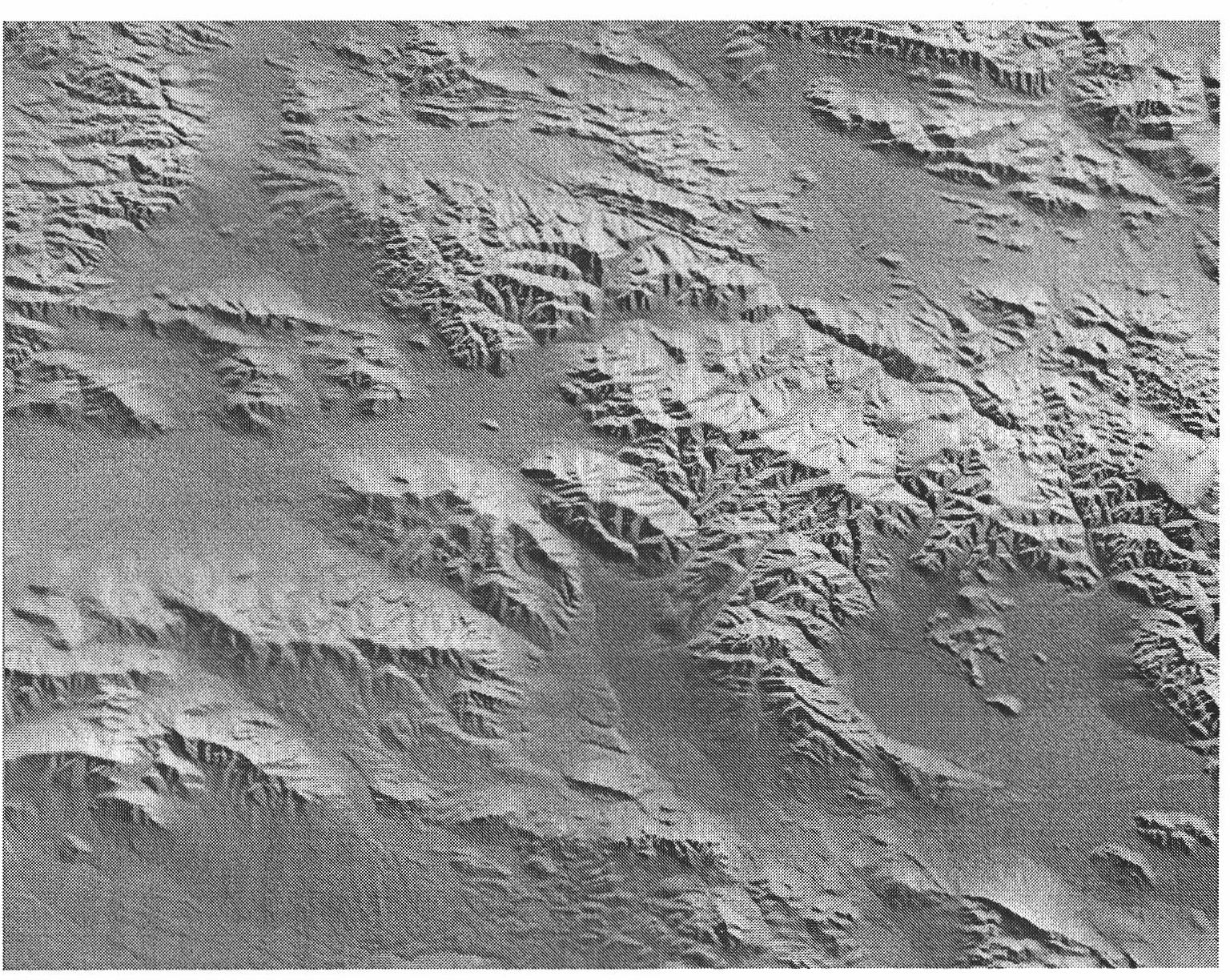
[0044] In the process of 3D terrain modeling, for the method of rendering directly using the data point normal vector calculated from the height data, the reason why figure 1 The rendering result shown is because the height fluctuation of the surface is much smaller than the distance on the ground. For example, Mount Tai is more than 200 kilometers long, and its highest point is only more than 1500 meters, which leads to the excessive x and y components of the calculated normal vector. Small. Although the existing technology calculates the real value of the normal vector through the height data, the rendering effect is not good, so it is necessary to properly enhance the x component and the y component of the normal vector.

[00...


PUM


Abstract

The invention provides a method and a device for calculating a normal vector in a three-dimensional terrain modeling process. The method comprises the following steps of: calculating the normal vector of a data point by using height data; and enhancing an x component and a y component of the normal vector, thereby enhancing a third dimension and bettering a display effect. Moreover, the invention also provides two enhancement methods which are a linear enhancement method and an index enhancement method respectively, and a better enhancement effect can be achieved by the index enhancement method.

Description

technical field [0001] The invention relates to the technical field of GIS, in particular to a method and device for calculating normal vectors in the process of three-dimensional terrain modeling. Background technique [0002] A 3D model is a 3D polygonal representation of an object, usually displayed on a computer or other video device. The objects shown are real-world entities or fictional things, and can be as small as atoms or as large as gigantic dimensions. Anything that exists in physical nature can be represented by a three-dimensional model. 3D models are widely used in any place where 3D graphics are used, such as in geographic information data processing in many fields such as oil field development and geological research. [0003] There are many methods of 3D modeling, among which the D3D 3D engine provides modeling, lighting and other simulations, which well meet the requirements of making 3D terrain. [0004] Direct 3D (D3D) is a display program developed b...

Claims


Application Information

Patent Timeline
Patent Type & Authority Applications(China)
IPC IPC(8): G06T17/00
Inventor 胡守刚
Owner CHINA DIGITAL VIDEO BEIJING
Why Eureka
Try Eureka