Method for establishing dynamic effect model (DEM) based on multi-resolution remote sensing image discrete point fusion

A remote sensing image and multi-resolution technology, applied in 3D modeling, image data processing, instruments, etc., can solve problems such as long-sequence time coverage and spatial resolution limitations, so as to improve spatial distribution imbalance and improve elevation The effect of improving precision and efficiency

Inactive Publication Date: 2013-09-25
NANJING UNIV
View PDF6 Cites 0 Cited by
  • Summary
  • Abstract
  • Description
  • Claims
  • Application Information

AI Technical Summary

Problems solved by technology

[0007] The purpose of the present invention is to overcome the disadvantages in the prior art that a single medium spatial resolution remote sensing image cannot meet the requirements of long-sequence time coverage, and the spatial resolution of a single low spatial resolution remote sensing image is limited, and provide remote sensing based on multi-resolution The DEM construction method of image discrete point fusion divides the discrete points of the water edge extracted from all remote sensing images into grids according to the resolution of low spatial resolution images, and divides the discrete points according to the grid for low spatial resolution remote sensing images , marking, and extracting the median; for medium spatial resolution remote sensing images, the grid without discrete point data is filled with low spatial resolution median filtered data, and then the fused discrete points are interpolated to achieve the construction Purpose of DEM

Method used


Image

  • Method for establishing dynamic effect model (DEM) based on multi-resolution remote sensing image discrete point fusion
  • Method for establishing dynamic effect model (DEM) based on multi-resolution remote sensing image discrete point fusion
  • Method for establishing dynamic effect model (DEM) based on multi-resolution remote sensing image discrete point fusion

Examples


Embodiment

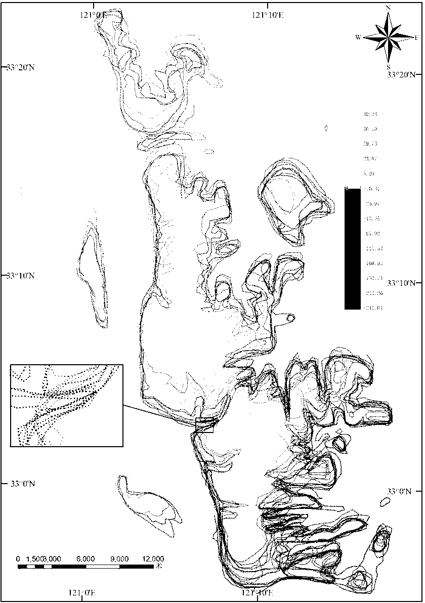
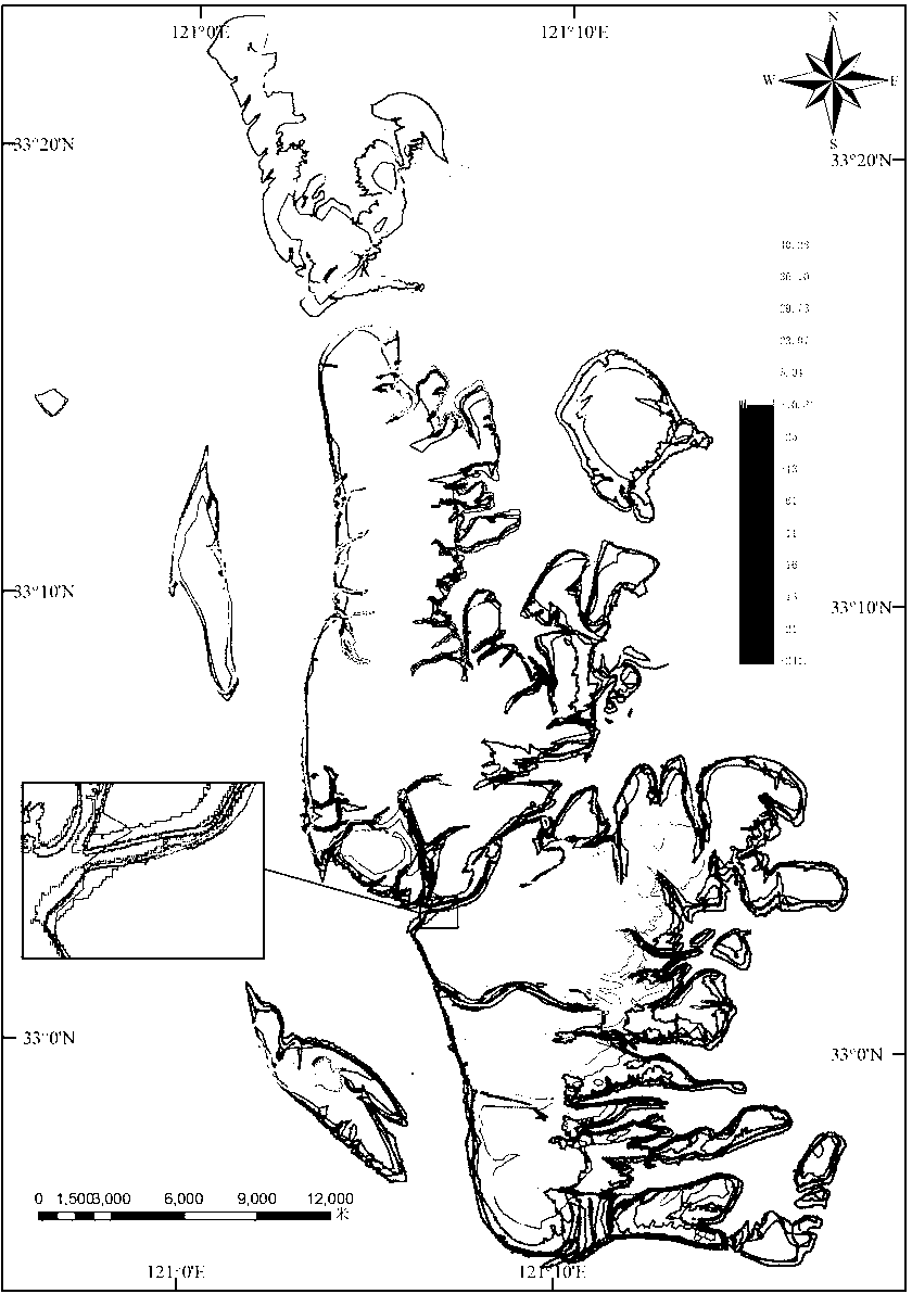
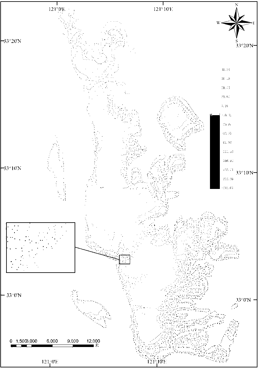
[0036] The five steps of this method are realized under the platform of Visual Studio 2008 by using C# programming language, and the read and write operations of vector data are realized by the open source geographic data format conversion class library GDAL 1.60 and ArcEngine.

[0037] step 1: The tide time and tide height observation data of daily high and low tides at Chenjiawu Tide Gauge Station are collected, and the tide level information at the satellite imaging time is obtained by interpolation; combined with the vector waterline extracted at the discrete satellite imaging time, the waterside line at the satellite imaging time is calculated according to The resolution of the remote sensing image is separated at equal intervals to obtain a series of discrete points at equal intervals, and the tide level information at the time of satellite imaging obtained from the above calculation is assigned to the discrete points, and the above steps are repeated until all waterline...


PUM


Abstract

The invention discloses a method for establishing a dynamic effect model (DEM) based on multi-resolution remote sensing image discrete point fusion and belongs to the field of establishment of DEM. The method comprises the following steps of: (1) performing equal interval discretization on a water line at a satellite imagery moment according to a remote sensing image resolution of the water line; (2) respectively merging discrete equal-distance tide points, and establishing a reference grid according to a low-spatial resolution remote sensing image resolution; (3) traversing all grids in low-spatial resolution images to perform median filtering; (4) filling by utilizing low-spatial resolution image discrete points subjected to the median filtering in a corresponding grid, and finally realizing fusion in an Arc geographic information system (ArcGIS); and (5) establishing a final DEM result by utilizing linear interpolation. By the method, an accuracy rate of establishing the conventional medium- and low-resolution remote sensing image discrete point DEM is improved, temporal and spatial resolutions of establishing the DEM are improved simultaneously, a precise DEM can be rapidly and accurately established from multi-period water line data, the update cost of a basic geographic information database is reduced, and the data update efficiency is improved.

Description

Technical field [0001] The present invention involves a DEM construction method based on discrete dots fusion. More specifically, it is a DEM construction method based on multi -resolution remote sensing image discrete dots. Background technique [0002] High -end information is one of the basic data of local studies. The rapid obtaining and high -programs in the anti -discovery area have always been a hot spot for remote sensing information.On the one hand, for areas with rapid changes in surface forms, analyzing the high -prime changes in the landform in different time periods can obtain the evolution characteristics and laws of regional landforms, and can provide a scientific decision -making basis for the coordinated development of the economy and society and the natural environment.On the other hand, due to the muddy of the beach, dense tidal sulcus, changing tidal beaches, and complex sea conditions, the high -program measurement of coastal tidal beach has become a recogniz...

Claims


Application Information

Patent Timeline
Patent Type & Authority Patents(China)
IPC IPC(8): G06T17/05
Inventor 刘永学李满春程亮李真陈焱明胡炜童礼华蔡文婷杨康张雯
Owner NANJING UNIV
Why Eureka
Try Eureka