Processing method and processing device of remote sensing image data
A remote sensing image and processing device technology, applied in the field of remote sensing, can solve the problems of difficult object discrimination, no effective solution proposed, limited application of remote sensing image data, etc., to achieve the effect of removing shadows and restoring the texture of objects
- Summary
- Abstract
- Description
- Claims
- Application Information
AI Technical Summary
Problems solved by technology
Method used
Image
Examples
Embodiment Construction
[0021] It should be noted that, in the case of no conflict, the embodiments in the present application and the features in the embodiments can be combined with each other. The present invention will be described in detail below with reference to the accompanying drawings and examples.
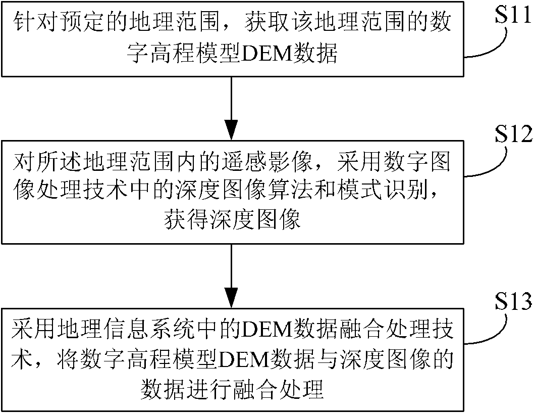
[0022] figure 1 is a schematic diagram of the basic steps of the remote sensing image data processing method according to the embodiment of the present invention. Such as figure 1 As shown, the method mainly includes the following steps:
[0023] Step S11: For a predetermined geographic range, acquire digital elevation model DEM data of the geographic range.
[0024] Step S12: For the remote sensing image within the geographical range, adopt the depth image algorithm and pattern recognition in the digital image processing technology to obtain the depth image;
[0025] Step S13: Using the DEM data fusion processing technology in the geographic information system, the digital elevation model ...
PUM
 Abstract
Description
Claims
Application Information
 - R&D
- Intellectual Property
- Life Sciences
- Materials
- Tech Scout
- Unparalleled Data Quality
- Higher Quality Content
- 60% Fewer Hallucinations
Browse by: Latest US Patents, China's latest patents, Technical Efficacy Thesaurus, Application Domain, Technology Topic, Popular Technical Reports.
© 2025 PatSnap. All rights reserved.Legal|Privacy policy|Modern Slavery Act Transparency Statement|Sitemap|About US| Contact US: help@patsnap.com


