Three-dimensional reconstruction method based on meteorological radar base data
A technology of three-dimensional reconstruction and weather radar, which is applied in the field of meteorology to achieve the effect of intuitive data display
- Summary
- Abstract
- Description
- Claims
- Application Information
AI Technical Summary
Problems solved by technology
Method used
Image
Examples
Embodiment Construction
[0040] The steps of the present invention are:
[0041] 1. Extraction and sampling of fault contour lines, including binarization of images, open operation for boundary smoothing, area marking for small area removal, boundary tracking for boundary extraction and chord sampling for boundary sampling.
[0042] 2. 3D modeling of a single body, including correspondence between fault contours, inter-fault contour splicing, inter-fault interpolation and bifurcation processing.
[0043] 3. Three-dimensional rendering and display based on OpenGL, including drawing of triangles, lighting and color settings, coordinate transformation and transparent display by color mixing.
[0044] Below in conjunction with accompanying drawing and specific embodiment further describe the present invention in detail:
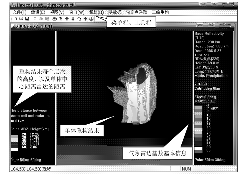
[0045] figure 1 The middle menu bar and tool bar show the intermediate operation process of 3D reconstruction; the right sub-window shows the relevant information of weather radar base...
PUM
 Abstract
Description
Claims
Application Information
 - R&D
- Intellectual Property
- Life Sciences
- Materials
- Tech Scout
- Unparalleled Data Quality
- Higher Quality Content
- 60% Fewer Hallucinations
Browse by: Latest US Patents, China's latest patents, Technical Efficacy Thesaurus, Application Domain, Technology Topic, Popular Technical Reports.
© 2025 PatSnap. All rights reserved.Legal|Privacy policy|Modern Slavery Act Transparency Statement|Sitemap|About US| Contact US: help@patsnap.com


