A geography fence based on geography mark media

A geo-tagging and geo-fencing technology, which is applied in the direction of electrical digital data processing, special data processing applications, satellite radio beacon positioning systems, etc., and can solve problems such as non-existence

Inactive Publication Date: 2013-02-13
MICROSOFT TECH LICENSING LLC
View PDF6 Cites 40 Cited by
  • Summary
  • Abstract
  • Description
  • Claims
  • Application Information

AI Technical Summary

Problems solved by technology

However, in order to create geofences based on photo locations, existing techniques must use sev

Method used


Image

  • A geography fence based on geography mark media
  • A geography fence based on geography mark media
  • A geography fence based on geography mark media

Examples


Embodiment Construction

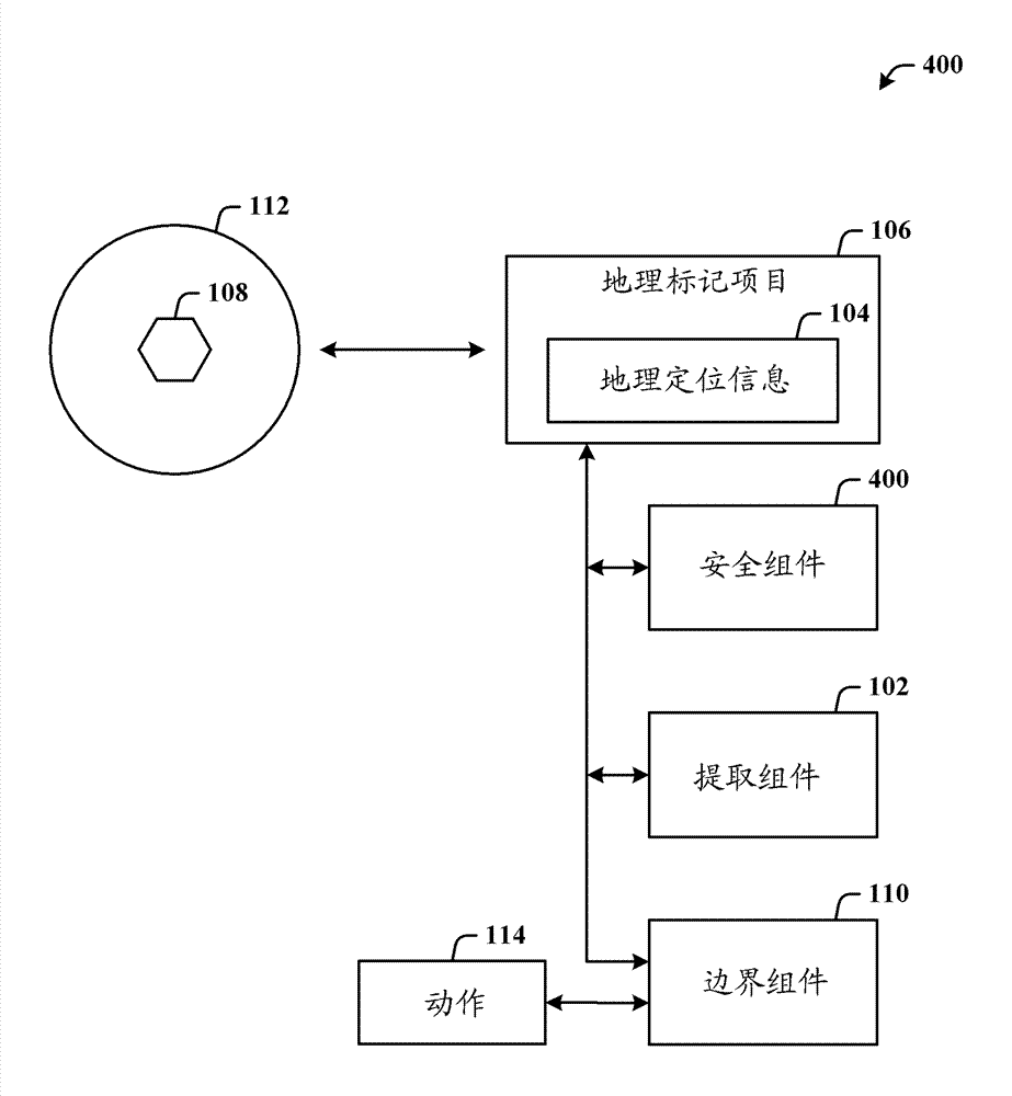
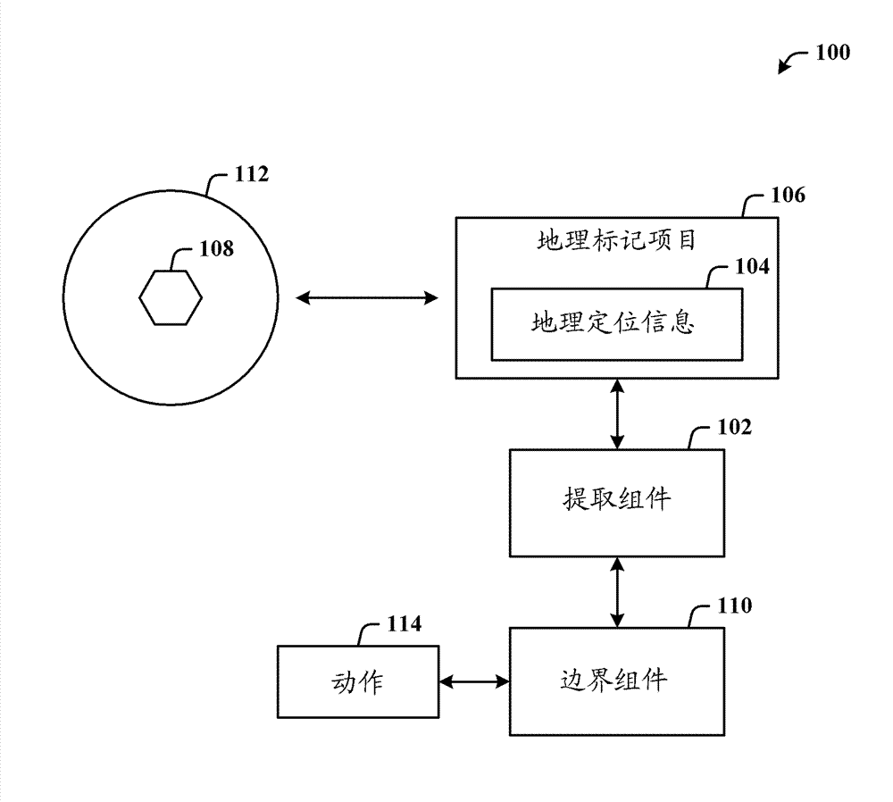
[0017] Geofencing is a virtual perimeter or boundary created in association with a geographic location. Geofences can be generated dynamically (for example, a radius around a store), or can be a predefined set of boundaries. When a user's location-aware device in connection with a location-based business operation crosses or engages a geofence, a notification may be generated and sent to the user (eg, via a phone call, email, etc.).

[0018] The exposed architecture facilitates the creation of geofences in a single step based on geotagged items such as photos. Further, geotagging items can be used to share geofences between people using all the methods currently used to share digital photos. By extracting geolocation information from a geotagged item, a geofence can be created for that location.

[0019] Referring now to the drawings, wherein like reference numerals are used to refer to like elements throughout. In the following description, for purposes of explanation, num...


PUM


Abstract

A framework is used for creating a geography fence based on geography mark items (such as a photo).The geography mark items can be used for sharing virtual boundary (such as a geography fence) between users via a conventional method sharing digital media (such as an e-mail). An extracting assembly is used for extracting geography positioning information (such as coordinates of latitude and longitude, elevation, direction, distance, and place name or the like) of the geography mark items. The geography positioning information may relate to geographic position performing geographic mark on the items. A boundary assembly then creates a virtual boundary (such as a geography fence) which relates to the geographic position and which is based on the geography positioning information. Thereafter, virtual boundary and attached action are activated when the user spans the boundary (such as connection, and cross). The mark items can be shared with another user, and when processed, the virtual boundary of the another user is created.

Description

Background technique [0001] Geo-tagging is the process of adding identifying geographic metadata (eg, latitude and longitude coordinates) to media from a geographic positioning system such as GPS (Global Positioning System). Cameras and mobile devices (eg, mobile phones) are capable of taking geotagged photos, which include the geographic coordinates of the physical location where the photo was taken. Additionally, geo-fences are becoming more popular as a mechanism for initiating alerts relative to certain geographic locations. However, in order to create geofences based on photo locations, existing techniques must use several separate tools—there is no one-step solution for creating geofences from geotagged photos. Contents of the invention [0002] The following presents a simplified summary in order to provide a basic understanding of some of the novel embodiments described herein. This summary is not an extensive overview and it does not intend to identify key / princip...

Claims


Application Information

Patent Timeline
IPC IPC(8): G06F17/50
CPCG06F17/50G01S19/14G06F17/30265G06F16/58G06F9/44G06F17/00
Inventor S.亚哈罗姆E.阿克塞尔罗德
Owner MICROSOFT TECH LICENSING LLC
Why Eureka
Try Eureka