Method and system for displaying archive catalogue information on map

A technology for displaying archives and geographic information, applied in the field of geographic coordinate surveying and mapping, can solve problems such as time-consuming, untimely engineering information, and cost

Active Publication Date: 2013-04-03
FUJIAN YIRONG INFORMATION TECH +1
View PDF3 Cites 6 Cited by
  • Summary
  • Abstract
  • Description
  • Claims
  • Application Information

AI Technical Summary

Problems solved by technology

[0002] The existing geographic coordinate technology fails to effectively associate and dynamically identify the location of the project archives storage unit, and cannot automatically model and describe the line characteristics of the project construction
Therefore, the project’s special file information is scattered among various units. It is difficult to fully understand all the information of the project. It takes a certain amount of manpower and material resources to collect it from multiple sources, which takes a long time, and there is a problem of untimely understanding of project information.

Method used


Image

  • Method and system for displaying archive catalogue information on map

Examples


Embodiment Construction

[0025] Technical solution one:

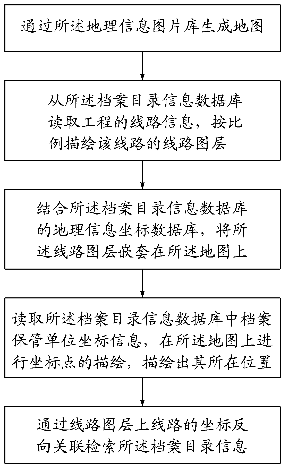
[0026] see figure 1 , a method for displaying archive directory information on a map, the method is applicable to a geographic information picture library and an archive directory information database; the geographic information image library is a picture library in GIF format that includes geographical information, and the archive directory information database Contains geographic information coordinate database, line information of project, file directory information, coordinate information of file storage unit and corresponding relationship between project and file, file and storage unit; said method includes the following steps:

[0027] Step 1, generating a map through the geographic information picture library;

[0028] Step 2, read the line information of the project from the archive directory information database, and draw the line layer of the line in proportion; the line information of the project also includes coordinate information...


PUM


Abstract

The invention provides a method and a system for displaying archive catalogue information on a map. The system comprises a geographical information picture gallery, an archive catalogue information database and a geographical coordinate surveying tool. The method comprises the following steps of firstly, reading line information of the engineering from the archive catalogue information database by the geographical coordinate surveying tool, and drawing the line layer of the line in proportion; then, combining a geographical information coordinate database of the archive catalogue information database, and embedding the line layer onto the map; reading the coordinate information of an archive keeping unit in the archive catalogue information database, and drawing the position of the archive keeping unit; and finally, reversely correlating and searching the archive catalogue information through the coordinates of the line on the line layer. The cross-regional line project sections, bypass convertor stations, substations and the like are modeled and drawn on the map by the geographical coordinate technique, and the original disperse archive information distributed in each unit is drawn on the map in a general, accurate and lively way.

Description

【Technical field】 [0001] The invention relates to a geographical coordinate surveying and mapping method, in particular to a method and a system for displaying archive directory information on a map. 【Background technique】 [0002] The existing geographic coordinate technology fails to effectively associate and dynamically identify the location of the project archives storage unit, and cannot automatically model and describe the route characteristics of the project construction. Therefore, the project’s special archive information is scattered among various units. It is difficult to fully understand all the project information. It takes a certain amount of manpower and material resources to collect it from multiple sources, which takes a long time, and there is a problem of untimely understanding of project information. 【Content of invention】 [0003] One of the technical problems to be solved by the present invention is to provide a method for displaying archive directory...

Claims


Application Information

Patent Timeline
Patent Type & Authority Applications(China)
IPC IPC(8): G06F17/30
Inventor 林振天方镇林冯兰贤
Owner FUJIAN YIRONG INFORMATION TECH
Why Eureka
Try Eureka