Geological radar chromatographic detection method for disaster source in mine recovery area
A technology of geological radar and detection method, which is applied in the direction of electric/magnetic detection, electric/magnetic exploration, geophysical measurement, etc. for well logging records, and can solve the problem that is slow and cannot be used to detect disasters in modern coal mining areas source, difficulty in delineating the scope of water-rich areas, etc.
- Summary
- Abstract
- Description
- Claims
- Application Information
AI Technical Summary
Problems solved by technology
Method used
Image

Examples
Embodiment 1
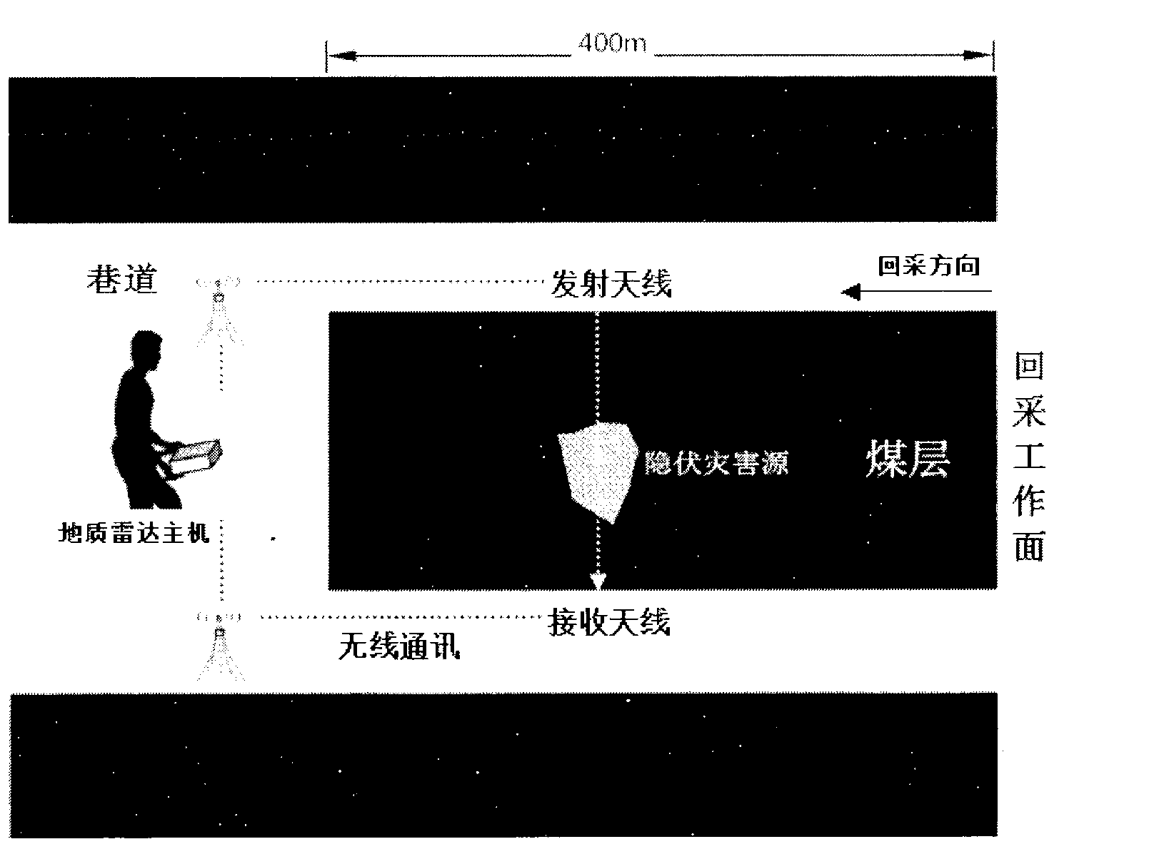
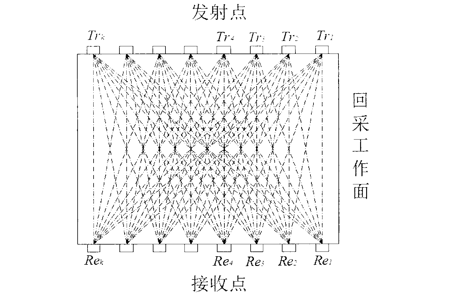
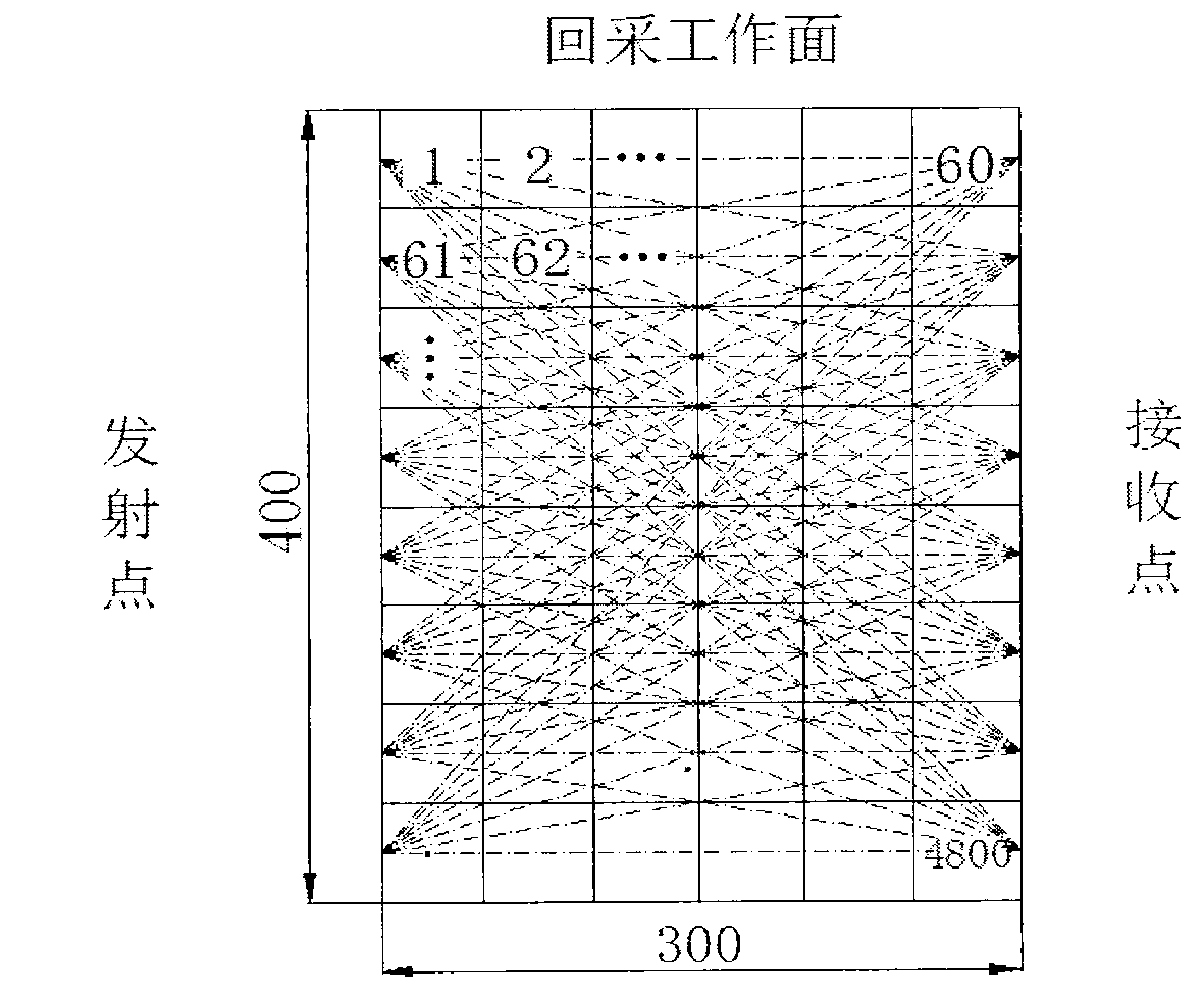
[0018] Example 1: In an underground mining area in Northwest my country, the vertical distance between the roadways is 300 meters, the length of the roadways on both sides is 400 meters, the height of the coal seam is 4 meters, and the specified detection accuracy is 5 meters. The specific implementation details of each step are as follows:
[0019] a. Determine the location of the launch point and the receiving point: along the mining direction of the mine, select the area within 400 meters of the vertical distance from the working face as the detection area; arrange two roadways along the two sides of the detection area with a length of 400 meters and a height of 400 meters from the ground of the roadway. 2-meter survey line; divide each survey line into 80 segments equidistantly, and each segment has a side length of 5 meters; select any survey line, arrange a total of 80 launch points at the midpoint of each segment, and line, lay out 80 receiving points in the same way, a...
PUM
 Abstract
Description
Claims
Application Information
 - R&D Engineer
- R&D Manager
- IP Professional
- Industry Leading Data Capabilities
- Powerful AI technology
- Patent DNA Extraction
Browse by: Latest US Patents, China's latest patents, Technical Efficacy Thesaurus, Application Domain, Technology Topic.
© 2024 PatSnap. All rights reserved.Legal|Privacy policy|Modern Slavery Act Transparency Statement|Sitemap