A method of geotechnical engineering investigation
A technology of geotechnical engineering and engineering, applied in the field of geotechnical engineering investigation, to achieve the effect of wide application prospect, simple steps and high investigation accuracy
- Summary
- Abstract
- Description
- Claims
- Application Information
AI Technical Summary
Problems solved by technology
Method used
Image
Examples
Embodiment Construction
[0025] The present invention will be described in further detail below in conjunction with the accompanying drawings and specific embodiments.
[0026] A specific embodiment of the present invention is: a geotechnical engineering survey method, characterized in that it comprises the following steps:
[0027] (1) Divide the geotechnical survey area into several working sections along the project direction;
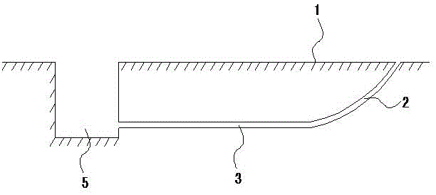
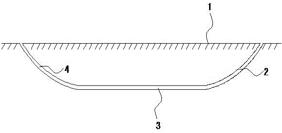
[0028] refer to figure 1 As shown, the geotechnical survey area is divided into several working sections along the engineering construction direction. The length of the working section can be hundreds of meters to several thousand meters. The starting position and ending position of horizontal directional drilling for each working section are required There is a working environment suitable for horizontal directional drilling operations, and a working pit 5 can be set between the two working sections, which is conducive to subsequent piping and information collection opera...
PUM
 Abstract
Description
Claims
Application Information
 - R&D
- Intellectual Property
- Life Sciences
- Materials
- Tech Scout
- Unparalleled Data Quality
- Higher Quality Content
- 60% Fewer Hallucinations
Browse by: Latest US Patents, China's latest patents, Technical Efficacy Thesaurus, Application Domain, Technology Topic, Popular Technical Reports.
© 2025 PatSnap. All rights reserved.Legal|Privacy policy|Modern Slavery Act Transparency Statement|Sitemap|About US| Contact US: help@patsnap.com


