Aerial dynamic large-scale vegetation coverage acquisition system
A vegetation coverage and acquisition system technology, applied in the field of large-scale vegetation coverage aerial dynamic acquisition system, can solve the problems of poor model portability, high spatial resolution requirements of remote sensing data, and a large amount of measured data
- Summary
- Abstract
- Description
- Claims
- Application Information
AI Technical Summary
Problems solved by technology
Method used
Image
Examples
Embodiment Construction
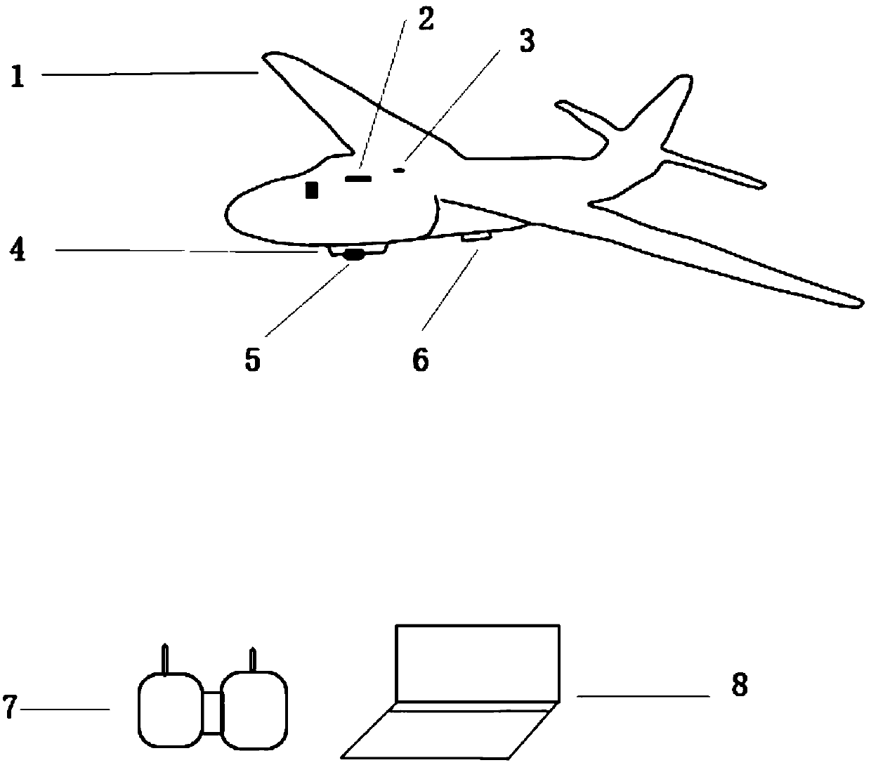
[0022] See figure 1 , The present invention is an aerial dynamic acquisition system (VC-ADAD) of vegetation coverage, which is composed of two main parts: hardware and software. The hardware mainly includes: UAV platform 1, automatic navigator 2, GPS receiver 3, aerial photography fixture 4, digital aerial photography instrument 5, wireless digital image transmission system 6, navigation controller 7 and notebook computer 8. The position connection relationship between them is: automatic navigator 2, GPS receiver 3, aerial photography fixed device 4, wireless digital image transmission system 6 are installed on UAV platform 1, and digital aerial photography instrument 5 is installed on aerial photography fixed On the device 4; the navigation controller 7 is placed on the ground and operated by the drone operator; the notebook computer 8 is placed on the ground, and the aerial photography task flight management and control system and the vegetation coverage dynamic acquisition ...
PUM
 Abstract
Description
Claims
Application Information
 - R&D
- Intellectual Property
- Life Sciences
- Materials
- Tech Scout
- Unparalleled Data Quality
- Higher Quality Content
- 60% Fewer Hallucinations
Browse by: Latest US Patents, China's latest patents, Technical Efficacy Thesaurus, Application Domain, Technology Topic, Popular Technical Reports.
© 2025 PatSnap. All rights reserved.Legal|Privacy policy|Modern Slavery Act Transparency Statement|Sitemap|About US| Contact US: help@patsnap.com

