
Spatial point event grouping mode excavating method based on Delaunay triangulation network

A pattern mining and spatial point technology, applied in special data processing applications, instruments, electrical digital data processing, etc.

Inactive Publication Date: 2014-07-23
CENT SOUTH UNIV
View PDF0 Cites 3 Cited by
  • Summary
  • Abstract
  • Description
  • Claims
  • Application Information

AI Technical Summary

Problems solved by technology

[0005] In view of the defects existing in the existing technology, solve the technical problems encountered in the mining of spatial point event aggregation patterns in the discovery of different densities and different forms of spatial aggregation patterns

Method used


Image

  • Spatial point event grouping mode excavating method based on Delaunay triangulation network
  • Spatial point event grouping mode excavating method based on Delaunay triangulation network
  • Spatial point event grouping mode excavating method based on Delaunay triangulation network

Examples


Embodiment 1

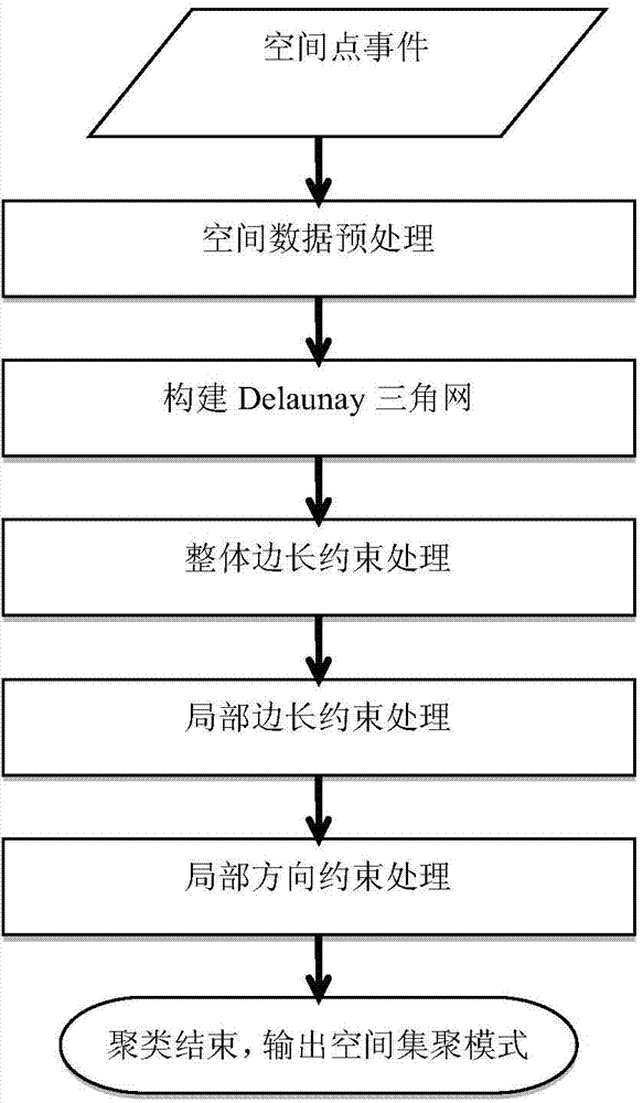
[0057] The specific implementation of the present invention consists of the following steps:

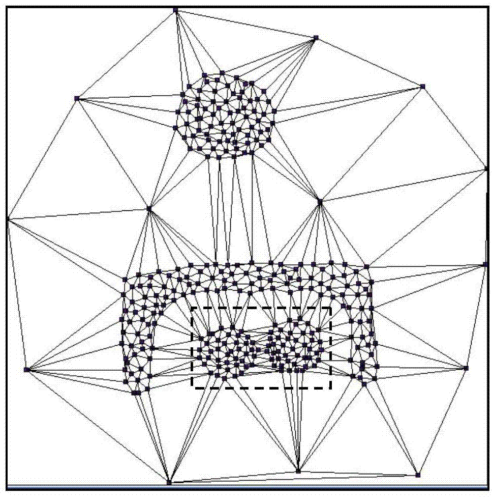
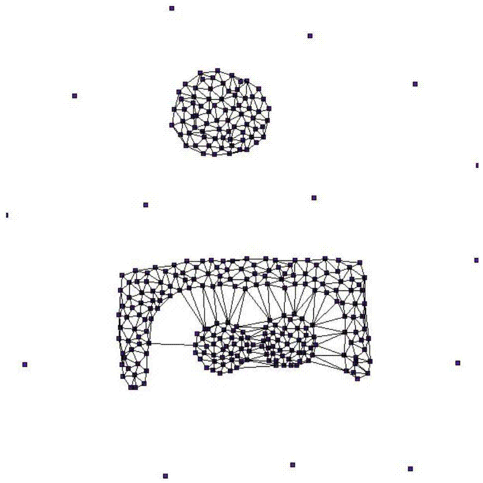
[0058] 1) Spatial data preprocessing. The Delaunay triangulation is a collection of triangles that are connected but not overlapped by spatial entities. The circumcircle of each triangle does not contain other spatial entities. In order to avoid errors in the construction of the Delaunay triangulation, this step first preprocesses the spatial data, uses spatial interpolation to repair or delete the missing parts of the spatial data, and cleans up duplicate records; for example, figure 2 As shown, a Delaunay triangulation formed by entities in spatial data, each point represents a spatial point event, and also a vertex in the Delaunay triangulation. Each straight line segment represents an edge of the Delaunay triangulation. The vertices form a graph.

[0059] 2) According to the overall side length constraint, delete all the lengths greater than C in the Delaunay triangulation Global Th...


PUM


Abstract

The invention discloses a spatial point event grouping mode excavating method based on the Delaunay triangulation network. The Delaunay triangulation network is established according to spatial coordinates of spatial point events, and the Delaunay proximity relation is used for restraining the spatial adjacency relation for establishing the spatial point events. According to the strategy from integrity to local, three different Delaunay triangulation network side length constraint statistical magnitudes are adopted to extract grouping modes of the spatial point events from the Delaunay triangulation network. A space cluster is formed by all the spatial point events connected through the Delaunay triangulation network. The spatial point event grouping mode excavating method has the advantages that not much user input parameters such as the number of spatial grouping modes is needed in the spatial grouping mode finding process, the spatial point event grouping modes with different shapes and densities can be found out, the found spatial grouping modes can be visualized, and the grouping result can be output.

Description

Technical field [0001] The invention belongs to the technical field of spatial data mining and spatial analysis, and relates to a method for mining a spatial point event aggregation pattern based on a Delaunay triangulation network. Background technique [0002] In the real world, many geographic phenomena can be abstracted in the form of spatial point events, such as infectious cases, crime incidents, traffic accidents, ecological species distribution, earthquakes, and public facility locations. Space point event analysis is one of the main research contents of space analysis, which aims to analyze and describe the spatial distribution pattern contained in space point events. The spatial point event clustering mode is usually manifested as a high-density continuous area composed of a series of abnormally clustered spatial point events, which usually contains the special laws of the development and change of geographic phenomena. Spatial point event cluster pattern detection has...

Claims


Application Information

Patent Timeline
IPC IPC(8): G06F17/30
CPCG06F16/248
Inventor 刘启亮邓敏石岩唐建波梅小明徐枫
Owner CENT SOUTH UNIV
Learn More