Monitoring system based on geographical information control and building method thereof

A technology of geographic information and monitoring system, applied in the monitoring system based on geographic information control and its construction field, can solve the problems of inconvenient operation, inability to know video blind spots, inability to monitor position control, etc., to achieve the effect of convenient operation and reduction of blind spots

Inactive Publication Date: 2014-10-08
LIUZHOU ZHIYE SCI & TECH
View PDF9 Cites 8 Cited by
  • Summary
  • Abstract
  • Description
  • Claims
  • Application Information

AI Technical Summary

Problems solved by technology

[0004] The present invention aims at the defects that the existing monitoring system cannot control the monitoring position on a large scale, the operation is inconvenient, and the blind area of ​​the video cannot be known, and provides a geographic information monitoring system and its construction method to solve the above problems

Method used


Image

  • Monitoring system based on geographical information control and building method thereof
  • Monitoring system based on geographical information control and building method thereof

Examples


Embodiment Construction

[0024] The present invention is described below in conjunction with the accompanying drawings and embodiments, and the following embodiments are explained with the best effect of the invention.

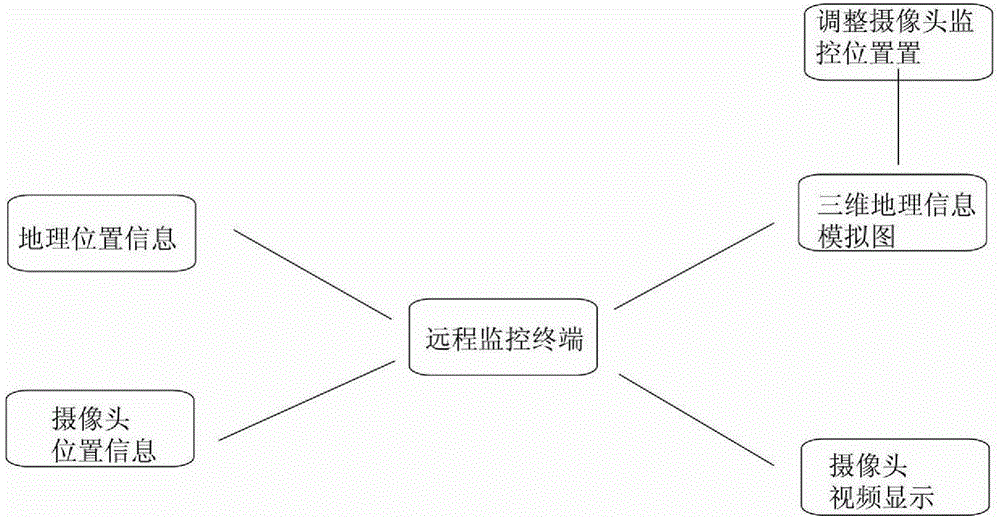
[0025] Such as figure 1 , is the structural principle diagram of the monitoring system based on geographic information control in the present invention, the system includes a remote monitoring terminal and a camera 2, and the remote monitoring terminal display screen shows a three-dimensional geographic information simulation map of the monitored area of ​​the camera 2; the camera 2 is installed on On the cloud platform, there is a compass and a vertical angle measuring instrument in the camera platform.

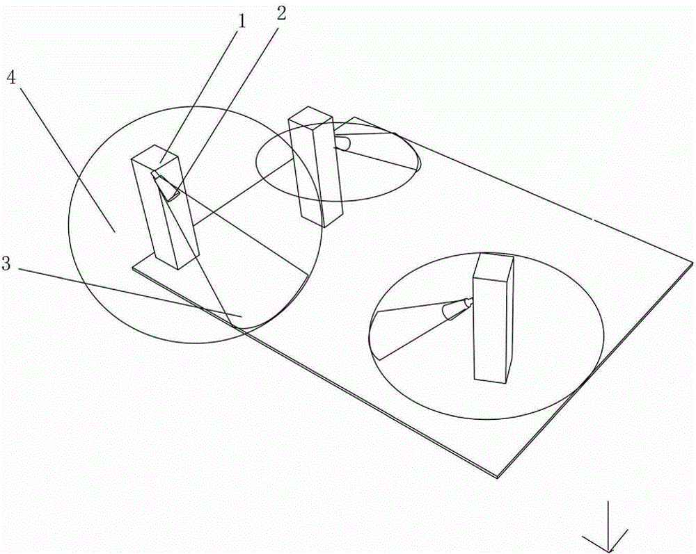
[0026] Such as figure 2 As shown, it is a schematic structural diagram of a three-dimensional geographic information simulation map. In the three-dimensional geographic information simulation map, a three-dimensional simulation image is drawn according to the monitoring area of ​​...


PUM


Abstract

The invention discloses a monitoring system based on geographical information control. The system comprises a remote monitoring terminal and cameras, and the cameras are arranged on pan-tilts. The system is characterized in that a three-dimensional geographical information simulated diagram of areas monitored by the cameras is displayed on a display screen of the remote monitoring terminal; when a specific area is clicked in the three-dimensional geographical information simulated diagram, the remote monitoring terminal calculates the included angle of the pan-tilt of the camera monitoring the area and the magnetic north and the vertical included angle between the pan-tilt and the ground according to the coordinate of the clicked area, information is sent to the pan-tilt of the specific camera so that the camera can rotate to the specific area, and monitored images are transmitted into a displayer.

Description

technical field [0001] The invention relates to a monitoring system, in particular to a monitoring system based on geographic information control and a construction method thereof. Background technique [0002] Video surveillance systems are widely used. In conventional video surveillance, due to the increasing number of cameras, it is very cumbersome for users to know and mark and understand the specific location of each camera. In the existing technology, the user generally completes the geographic location marking of the camera through the following process, for example, the construction personnel mark the location during installation, and learn the basic camera location through the control unit. However, the above method is extremely inconvenient, and the position of the camera cannot be adjusted conveniently, so that people can monitor the position they want to monitor. [0003] With the development of Beidou technology, our country gradually has the method of using Be...

Claims


Application Information

Patent Timeline
Patent Type & Authority Applications(China)
IPC IPC(8): H04N7/18G08B21/00
Inventor 刘治业
Owner LIUZHOU ZHIYE SCI & TECH
Why Eureka
Try Eureka