A Trans-sea Elevation Transfer Measurement Method
A measurement method and technology of elevation measurement, applied in the directions of height/level measurement, measurement device, mapping and navigation, etc., to achieve the effect of improving accuracy and speed, reducing adverse effects, and solving technical problems
- Summary
- Abstract
- Description
- Claims
- Application Information
AI Technical Summary
Problems solved by technology
Method used
Image
Examples
Embodiment 1
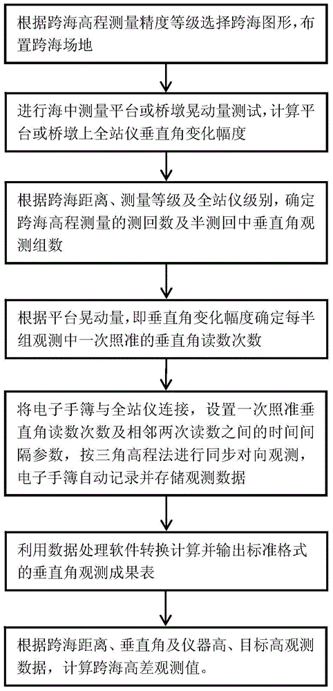
[0021] refer to figure 1 , the specific steps of the cross-sea elevation measurement process are as follows:
[0022] 1) Select cross-sea graphics according to the accuracy level of cross-sea elevation measurement, and arrange cross-sea sites;
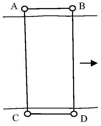
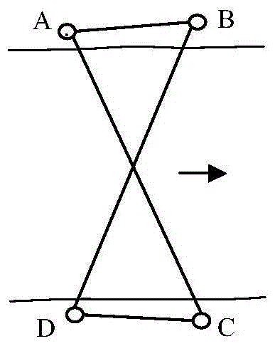
[0023] The two sea-crossing stations are located on the survey platform in the sea, which is convenient for frequently changing the position of the instrument for multiple rounds of observation. Figure 2a ] or an isosceles trapezoid [see Figure 2b ] method to arrange the cross-sea site, using two total stations for synchronous observation; third and fourth-class cross-sea elevation measurement, according to the parallelogram [see Figure 2a ] or an isosceles trapezoid [see Figure 2b ] way to arrange the cross-sea site, using two total stations for synchronous opposite observation; or according to the zigzag [see Figure 2c ] Set up a cross-sea site and use 1 instrument for observation.
[0024] The four sea-crossing points A, B...
Embodiment 2
[0083] Embodiment 2, with embodiment 1, difference is,
[0084] 1) Select cross-sea graphics according to the accuracy level of cross-sea elevation measurement, and arrange cross-sea sites;
[0085] One end of the station is located on the survey platform in the sea, which is convenient for changing the position of the instrument for multi-round observation, and the other end is located on the top of the pier in the sea with a narrow space, which is not convenient for frequently changing the position of the instrument for multi-round observation. according to Figure 2a parallelogram or Figure 2b The cross-sea site is arranged in an isosceles trapezoidal manner. Place the instrument at points A and D, and place the measurement target at points B and C. The cross-sea line-of-sight length (AC, BD) is about 2.1km, measured according to the national second-class cross-sea elevation measurement accuracy.
[0086] The length of each side and the height difference between sea-cr...
PUM
 Abstract
Description
Claims
Application Information
 - R&D
- Intellectual Property
- Life Sciences
- Materials
- Tech Scout
- Unparalleled Data Quality
- Higher Quality Content
- 60% Fewer Hallucinations
Browse by: Latest US Patents, China's latest patents, Technical Efficacy Thesaurus, Application Domain, Technology Topic, Popular Technical Reports.
© 2025 PatSnap. All rights reserved.Legal|Privacy policy|Modern Slavery Act Transparency Statement|Sitemap|About US| Contact US: help@patsnap.com


