
Natural road sign recognition based on real-time local characteristic description

A local feature and natural technology, applied in character and pattern recognition, computer components, instruments, etc.

Inactive Publication Date: 2015-07-15
HARBIN UNIV OF SCI & TECH
View PDF0 Cites 4 Cited by
  • Summary
  • Abstract
  • Description
  • Claims
  • Application Information

AI Technical Summary

Problems solved by technology

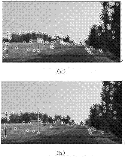
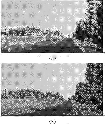
However, the corner points extracted by the above three methods are not evenly distributed in outdoor applications.

Method used


Image

  • Natural road sign recognition based on real-time local characteristic description
  • Natural road sign recognition based on real-time local characteristic description
  • Natural road sign recognition based on real-time local characteristic description

Examples


Embodiment Construction

[0044] 1. Natural landmark recognition based on real-time local feature description, which is characterized by: using improved feature point extraction based on curvature, the method of feature point extraction based on curvature is simple to calculate, and the extracted feature points have rotation invariance, and are resistant to noise and brightness The changes also have good robustness, and the feature points are evenly distributed, and more importantly, quantitative feature points can be extracted. This method mainly judges whether it is a corner point by the change of gray level. When a small shift of a certain point along any direction in the image will produce a large change in gray level, the point is considered to be a corner point.

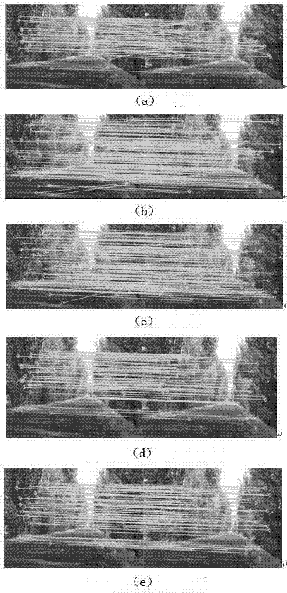
[0045] 2. Natural landmark recognition based on real-time local feature description, which is characterized by: using an improved binary feature description algorithm and binary string descriptor, which reduces the dimension of the descr...


PUM


Abstract

The invention adopts a characteristic extracting technology of a local characteristic matching technology and performs characteristic matching by using a method combining characteristic extraction and binary characteristic description based on a curvature in accordance with road sign matching scene application requirements of outdoor scenes. An algorithm utilizes reasonable characteristic of characteristic distribution based on a curvature algorithm and solves the problem that the distribution of characteristics is uneven, the defect that the real-time capability of other algorithms is weaker is overcome through the binary description algorithm, and finally the validity and the real-time capability of the algorithm are contrasted through experiments. Results indicate that the algorithm can ensure the real-time capability, at the same time, effective even characteristic points are extracted, and the algorithm has better practicality and robustness.

Description

Technical field: [0001] The invention patent relates to natural landmark recognition based on real-time local feature description. Background technique: [0002] Positioning is one of the most basic functions of mobile robots. The main problem to be solved by the present invention is the positioning problem. The earliest positioning research results are mainly through the internal sensors of the robot, such as stopwatches, inertial meters and other facilities to achieve positioning. 1. The accumulation of errors caused by rough and uneven ground often leads to inaccurate positioning results, and it is not suitable to navigate alone for a long time. However, if GPS positioning or my country's Beidou navigation system is used for positioning, the positioning system will fail in places with poor signals such as occluded areas. Therefore, people gradually use external sensors to assist positioning. Such as infrared and visual sensors. [0003] Among them, the visual sensor ...

Claims


Application Information

Patent Timeline
Patent Type & Authority Applications(China)
IPC IPC(8): G06K9/00G06K9/46
Inventor 王燕清石朝侠
Owner HARBIN UNIV OF SCI & TECH
Learn More