Traffic guidance system constructing method suitable for large-screen high-definition display

A traffic command and large-screen technology, applied in the field of information management system, can solve the problems of the commander's urban traffic status monitoring and joint command influence, the reduction of displayed information, and the small amount of information, etc., to achieve optimized display efficiency, clear picture effect, The effect of improving access efficiency

Inactive Publication Date: 2015-09-23
CHINA CHANGFENG SCI TECH IND GROUPCORP
View PDF0 Cites 9 Cited by
  • Summary
  • Abstract
  • Description
  • Claims
  • Application Information

AI Technical Summary

Problems solved by technology

If you continue to enlarge the display area of ​​the large screen for viewing convenience, for example, adjust to the figure 2 In the size shown, the display area fills the entire splicing large screen. At this time, the resolution of the display area is 14000*5250. Obviously, the graphics card of the seat computer cannot reach this resolution, causing the low-resolution seat computer interface to be displayed on the high-resolution splicing large screen. , resulting in distorted and unclear pictures in the display area, insufficient application of large screen resolution, and a relatively reduced amount of displayed information
[0005] Especially in the traffic command system, map-based road condition display technology is widely used. The system software is generally developed based on the graphics card resolution of the seat computer in the command hall. When the map data is displayed on a large screen with a lower resolution, the road surface Vehicles, road conditions, individual soldiers, etc. are not displayed clearly on the large screen, and the amount of information is relatively small, so that the commander has a certain impact on the monitoring of urban traffic conditions and joint command

Method used


Image

  • Traffic guidance system constructing method suitable for large-screen high-definition display
  • Traffic guidance system constructing method suitable for large-screen high-definition display
  • Traffic guidance system constructing method suitable for large-screen high-definition display

Examples


Embodiment Construction

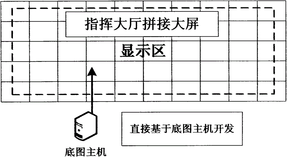
[0020] The present invention is a method for building a system based on a large-screen high-definition base map host.

[0021] In the splicing large-screen system in the command center, there will be a background interface for initializing full-screen display, also called the base map. The resolution of this screen is the same as that of the large screen display after splicing. This screen comes from the base map host in the background of the large-screen system , the host generally adopts virtualization and other methods to realize the high-resolution base map display on the large screen, so it constitutes an ideal system display platform. In the process of building a map-based traffic command system, the system interface can be built based on the base map host, and the display area of ​​the high-definition large screen can be fully utilized.

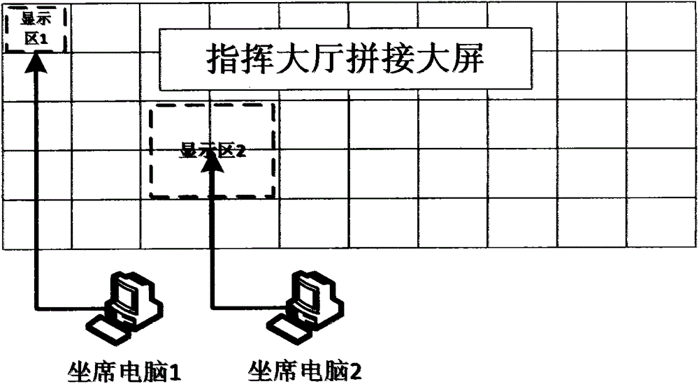
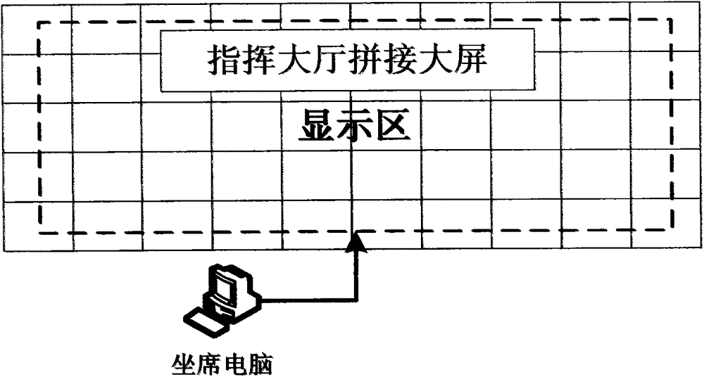
[0022] Due to the large gap between the resolution of the large screen and the resolution of the seat computer, a large amount of inf...


PUM


Abstract

The invention provides a traffic guidance system constructing method suitable for large-screen high-definition display. The method includes the steps of: (1) obtaining a large-screen base map host environment and various system interfaces; (2) determining a realization effect, large-screen split windows and display content; (3) determining an operational process, and adjusting a software interface according to screen resolution; (4) performing map cutting operation on a map according to the resolution of a display area, optimizing map display according to the resolution of the display area after determining a system interface, accessing the map in a B/S mode, and performing high-definition large-picture display while avoiding resource occupation and improving access efficiency; and (5) adjusting various map icons according to a display area effect after mapping cutting is performed on the map, optimizing system display efficiency, and enabling a picture effect to be clear and the sizes of the icons to be suitable for watching.

Description

technical field [0001] The invention relates to an information management system, in particular to a map-based command system displayed on a high-definition large screen in a command center in the traffic field. Background technique [0002] The map-based traffic command system is an indispensable information-based auxiliary tool in the modern urban traffic management business. With the rapid increase of urban vehicles, traffic congestion gradually intensifies, making it difficult for citizens to travel and causing various traffic accidents. In order to meet the needs of traffic management, an intelligent traffic command system has been developed, which is used in the management of traffic organization, investigation of traffic violations, detection of traffic cases, traffic flow analysis and judgment, real-time road condition monitoring and information release during daily and major events. At the same time, higher requirements are put forward for the clear display of road ...

Claims


Application Information

Patent Timeline
Patent Type & Authority Applications(China)
IPC IPC(8): G08G1/09G08G1/13
Inventor 鲍海涛孙震宇范亚琼张林杰
Owner CHINA CHANGFENG SCI TECH IND GROUPCORP
Why Eureka
Try Eureka