

Object-oriented multiple scale mountainous city land coverage information obtaining method
A land-covering, object-oriented technology, applied in the field of image processing, can solve the problems of seldom using texture and geometric features of ground objects, difficult to obtain satisfactory results, single spectral features, etc., achieve fast and high-precision extraction, improve classification effect, high precision effect
- Summary
- Abstract
- Description
- Claims
- Application Information
AI Technical Summary
Problems solved by technology
Method used
Image

Examples
Embodiment Construction
[0037] The following will clearly and completely describe the technical solutions in the embodiments of the present invention with reference to the accompanying drawings in the embodiments of the present invention. Obviously, the described embodiments are only some, not all, embodiments of the present invention. Based on the embodiments of the present invention, all other embodiments obtained by persons of ordinary skill in the art without making creative efforts belong to the protection scope of the present invention.
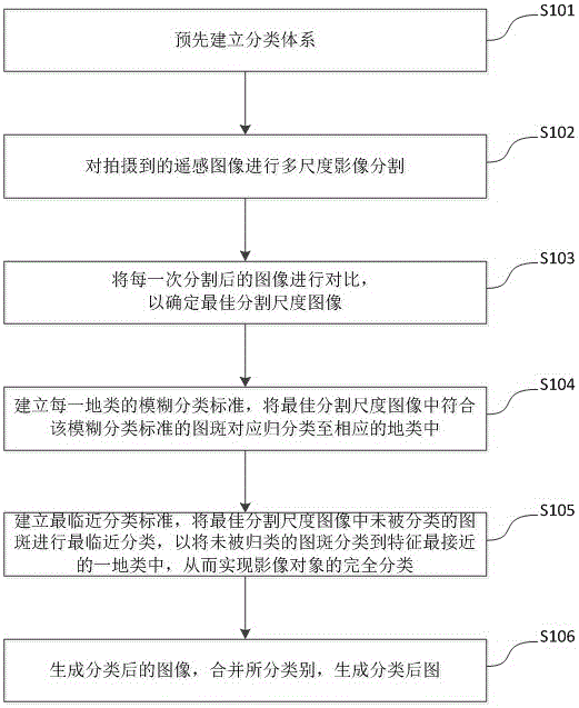
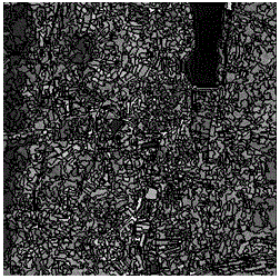
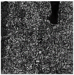
[0038] See figure 1 , figure 1 It is a flow chart of the first embodiment of the object-oriented multi-scale mountainous city land cover information acquisition method of the present invention. The method for obtaining land cover information based on object-oriented multi-scale mountainous cities of the present embodiment comprises the following steps:
[0039] S101. Establish a classification system in advance, wherein the classification system includes at ...
PUM
 Abstract
Description
Claims
Application Information