
Open-pit mine typical ground object classification method based on UAV image

A technology for surface feature classification and open-pit mines, which is applied to computer parts, instruments, character and pattern recognition, etc., can solve the problem that the difference between ground features is not obvious, the classification method is not very universal, and the complexity of mine features is strong to achieve high-precision classification, improve efficiency and classification accuracy, and avoid misclassification and incomplete ground objects.

Inactive Publication Date: 2016-01-13
王植
View PDF2 Cites 11 Cited by
  • Summary
  • Abstract
  • Description
  • Claims
  • Application Information

AI Technical Summary

Problems solved by technology

For high-resolution images, the differences between different objects are gradual, and the internal spectral values ​​of the same object are not very consistent, which makes the objects more detailed, and the spectra of each object overlap, so the spectral distribution is more accurate. Although the object-oriented classification method can basically solve these problems at present, the classification method is not very universal. It requires a lot of experiments by operators to determine the most suitable classification characteristics and thresholds, and it is suitable for unmanned open-pit mines. However, the existing object-oriented classification methods are not completely suitable for the classification of typical ground features in open-pit mines in UAV images.

Method used


Image

  • Open-pit mine typical ground object classification method based on UAV image
  • Open-pit mine typical ground object classification method based on UAV image
  • Open-pit mine typical ground object classification method based on UAV image

Examples


Embodiment 1

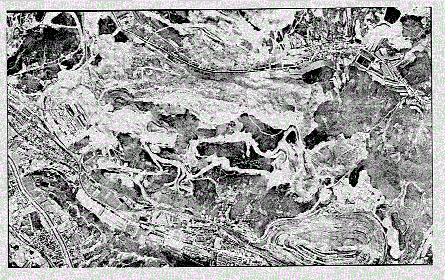
[0037] Taking the UAV aerial image of an open-pit mine in August 2014 as the data source, an experiment of the invention's method for classifying typical surface features in an open-pit mine based on UAV images was carried out. The original image of the experimental area is as figure 2 shown.

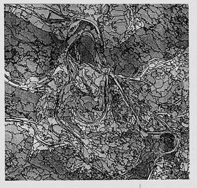
[0038] A) First, multi-scale segmentation is performed on the image, and the segmentation scales are respectively set to 80, 100, 130, 150, 200, and 250. The resulting segmentation results are shown in Figure 3, and the segmentation results of different segmentation scales are compared from the segmentation results It can be found that when the scale parameter is set to 80, the area of ​​the segmented object is small, and the segmentation of the ground object is too fine, which is not conducive to the complete extraction of the ground feature; when the scale parameter is set to 100, 130, the segmentation effect on the road Better, it divides the road into small objects very well, and ...


PUM


Abstract

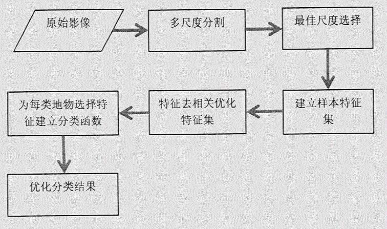
The present invention discloses an open-pit mine typical ground object classification method based on a UAV image. According to the method, firstly the image is subjected to multi-scale segmentation to obtain an object layer suitable for different ground object extraction, then the features (including a spectrum feature, a texture feature, a morphological feature, and a customized feature) of a typical ground object are subjected to correlation analysis, a feature with large correlation is excluded, at the same time the dimension reduction of a feature space is carried out, thus a feature set with the most facilitation of classification is obtained, finally five features are selected from the feature set according to the concrete feature of each type of ground object, and a classification result is obtained and then postprocessing (category merging, edge smoothing and misclassification category adjustment) is carried out to optimize the classification result. The method has the advantages of high accuracy, high degree of automation and simple processing process, the bare soil and stope confusion problem in an open-pit mine can be effectively solved, and the method has a very important significance in open-pit mine ground object typical ground object feature classification.

Description

technical field [0001] The invention relates to the field of open-pit mine production, and is an object-oriented classification method for typical surface objects in open-pit mines based on drone images. Background technique [0002] With the rapid development of remote sensing technology, computer technology and related technologies, images obtained by various sensors flying at high altitudes have greatly improved in terms of time resolution and spatial resolution. In recent years, the rapid development of UAV remote sensing It is a good supplement and enrichment to satellite remote sensing. Compared with the traditional aerospace remote sensing system, the UAV remote sensing system has many remarkable characteristics, such as flexible maneuverability, low operating cost, convenient portability, and wide application, making the UAV remote sensing system quickly become a national emergency relief, land and resources monitoring, and mine survey. , digital city construction a...

Claims


Application Information

Patent Timeline
Patent Type & Authority Applications(China)
IPC IPC(8): G06K9/62
CPCG06F18/211G06F18/24
Inventor 王植
Owner 王植
Learn More