A Fitting Method of Mileage and Geospatial Coordinates of Pipeline Ontology Data
A geospatial and mileage technology, applied in special data processing applications, geographic information databases, structured data retrieval, etc., can solve problems such as inability to accurately calibrate pipeline direction, defect location, etc.
- Summary
- Abstract
- Description
- Claims
- Application Information
AI Technical Summary
Problems solved by technology
Method used
Image
Examples
Embodiment Construction
[0033] The invention provides a method for fitting the mileage and geographic space coordinates of pipeline body data to solve the technical problems in the prior art that the direction of the pipeline cannot be accurately calibrated and the location of defects.
[0034] The technical solution in the embodiment of the present application is to solve the above-mentioned technical problems, and the general idea is as follows:
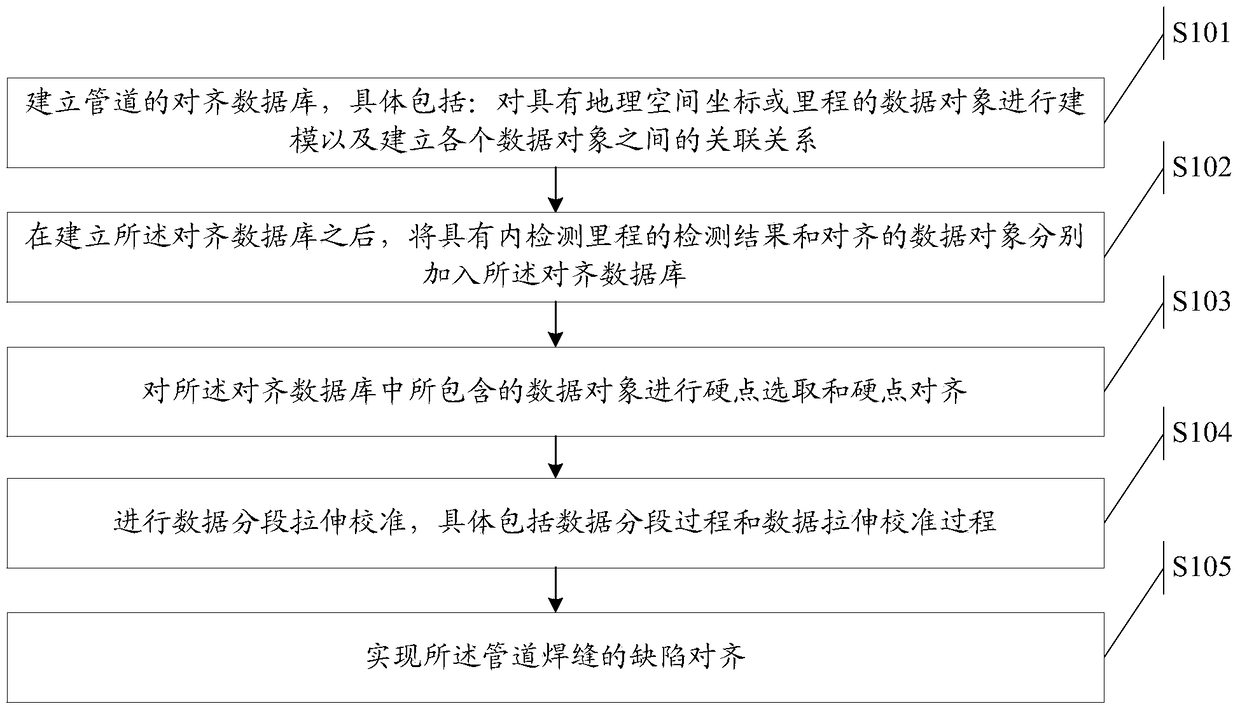
[0035] Establishing the alignment database of the pipeline specifically includes: modeling the data objects with geospatial coordinates or mileage and establishing the association relationship between each data object; after the alignment database is established, the detection results and Aligned data objects are respectively added to the alignment database; hard point selection and hard point alignment are performed on the data objects contained in the alignment database, wherein the data objects in the alignment database include two types, the first data...
PUM
 Abstract
Description
Claims
Application Information
 - R&D
- Intellectual Property
- Life Sciences
- Materials
- Tech Scout
- Unparalleled Data Quality
- Higher Quality Content
- 60% Fewer Hallucinations
Browse by: Latest US Patents, China's latest patents, Technical Efficacy Thesaurus, Application Domain, Technology Topic, Popular Technical Reports.
© 2025 PatSnap. All rights reserved.Legal|Privacy policy|Modern Slavery Act Transparency Statement|Sitemap|About US| Contact US: help@patsnap.com


