Method and apparatus for classifying and displaying photos based on latitudes and longitudes
A technology of longitude, latitude, and photos, applied in electrical components, transmission systems, etc., can solve problems such as incomplete experience, and achieve the effect of enhancing interaction and increasing fun.
- Summary
- Abstract
- Description
- Claims
- Application Information
AI Technical Summary
Problems solved by technology
Method used
Image

Examples
Embodiment Construction
[0038] Embodiments of the present invention will be described in detail below in conjunction with the accompanying drawings.
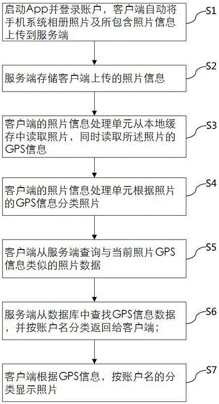
[0039] Such as figure 1 as shown, figure 1 It is a flowchart of a method of classifying and displaying photos according to latitude and longitude, including:
[0040] S1. Start the App and log in to the account, the client will automatically upload the photos in the mobile phone system album and the photo information contained therein to the server;
[0041] S2. The server stores the photo information uploaded by the client;
[0042] S3. The photo information processing unit 22 of the client reads the photo from the local cache, and simultaneously reads the GPS information of the photo;
[0043] S4, the photo information processing unit 22 of the client classifies the photos according to the GPS information of the photos;
[0044] S5. The client queries the photo data similar to the GPS information of the current photo from the server;
[0045] S6...
PUM
 Abstract
Description
Claims
Application Information