
Circumferential scanning imaging detection method of geological reflector around wellbore

A technology of scanning imaging and detection methods, which is applied in seismology for logging records, seismic signal processing, special data processing applications, etc., can solve the problem of not being able to truly and comprehensively restore downhole reflectors, and not be able to reflect multiple reflectors at the same time Orientation information, inapplicability and other issues

Active Publication Date: 2018-02-13
CHINA UNIV OF PETROLEUM (EAST CHINA)
View PDF3 Cites 2 Cited by
  • Summary
  • Abstract
  • Description
  • Claims
  • Application Information

AI Technical Summary

Problems solved by technology

When there are multiple and multi-directional geological reflectors around the well, the above optimization method cannot reflect the orientation information of multiple reflectors at the same time, so the processing results cannot truly and comprehensively restore the situation of downhole reflectors, and the above method cannot be applied

Method used


Image

  • Circumferential scanning imaging detection method of geological reflector around wellbore
  • Circumferential scanning imaging detection method of geological reflector around wellbore
  • Circumferential scanning imaging detection method of geological reflector around wellbore

Examples


Embodiment Construction

[0042] In order to facilitate the further understanding of the method of the present invention and the effect achieved, the preferred embodiments are now described in detail as follows in conjunction with the accompanying drawings.

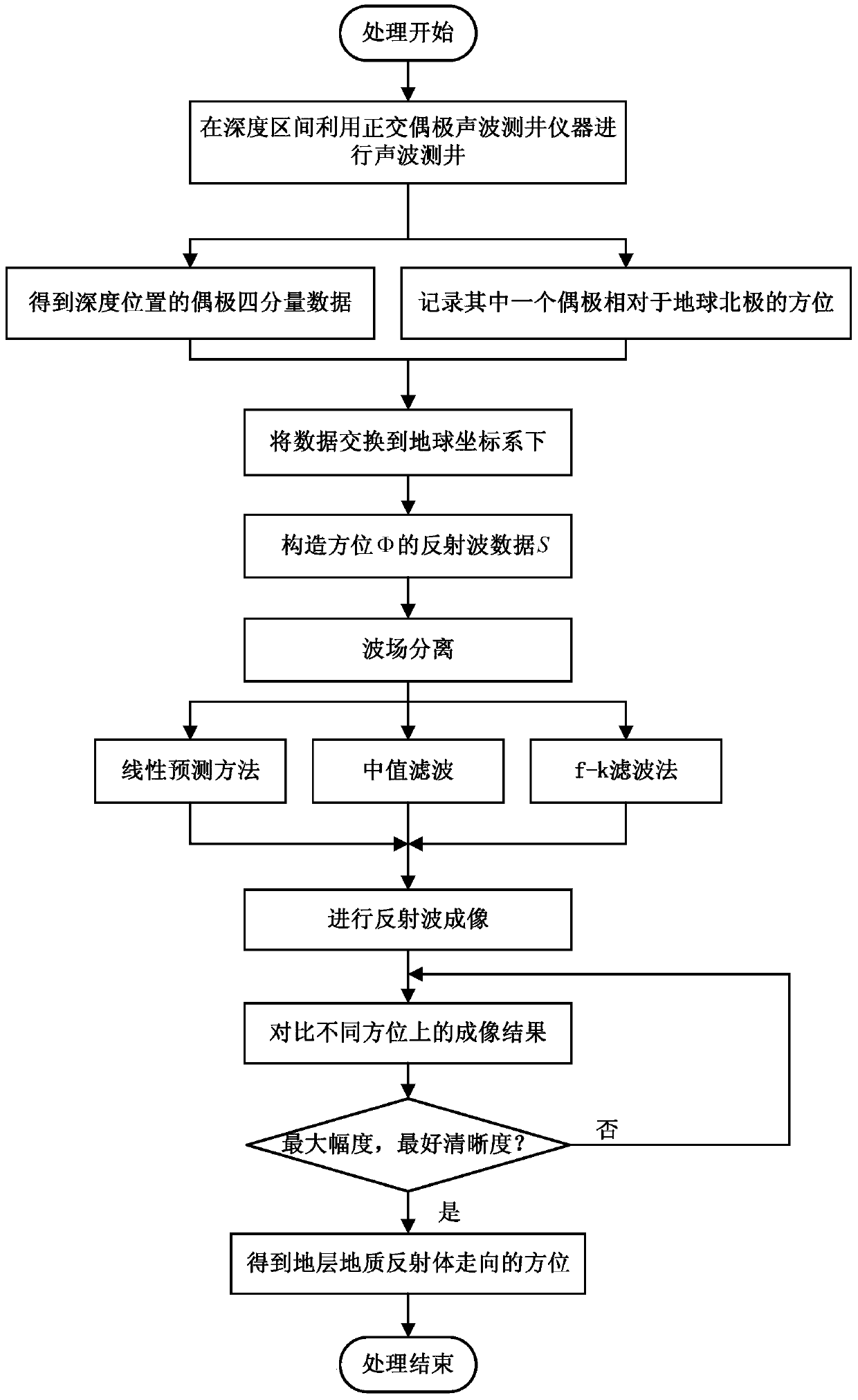
[0043] like figure 1 As shown, the present invention provides a detection method for circumferentially scanning and imaging a geological reflector around a borehole by using a four-component dipole shear wave, and the work flow is as follows:

[0044] Step 1. Use the orthogonal dipole acoustic logging tool to perform acoustic logging at each depth position within the detection depth interval

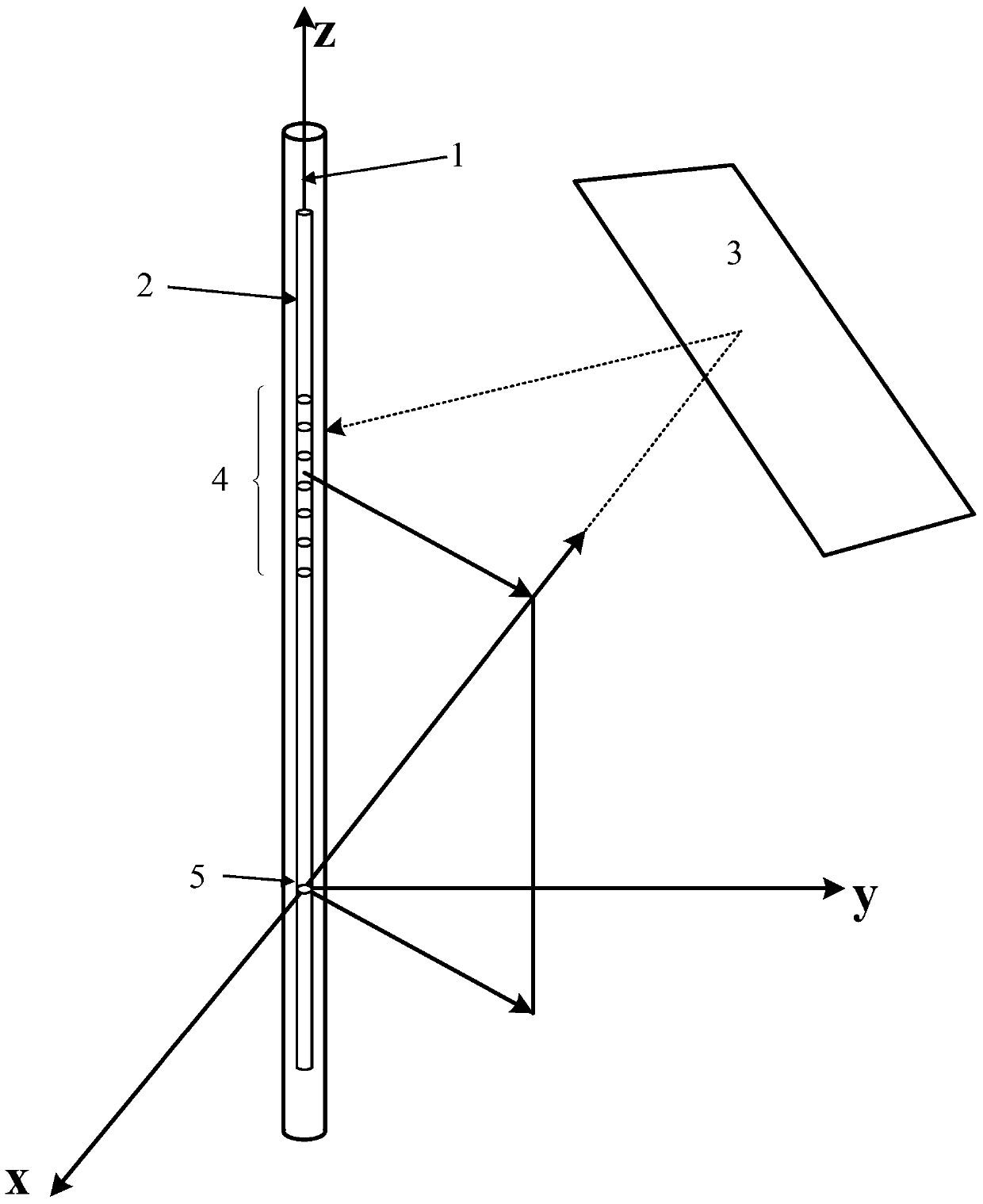
[0045] Acoustic logging is carried out by using orthogonal dipole acoustic logging tools to ensure that there are two sets of orthogonal systems for the dipole transmitting and receiving of the tool.

[0046] Step 2: Obtain the dipole four-component data of each depth position in Step 1, and record the orientation of one of the dipoles at each depth positio...


PUM


Abstract

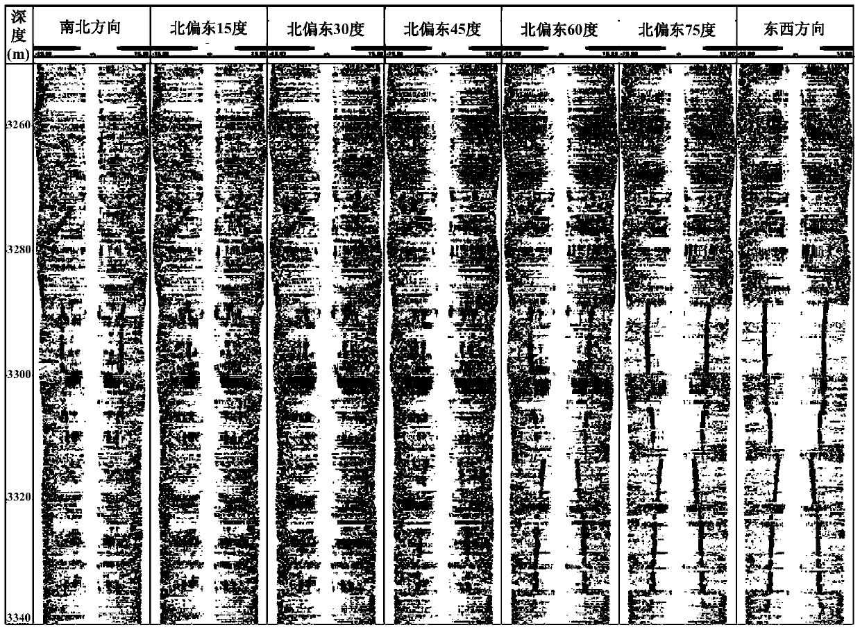
The invention discloses a detection method for circumferential scanning imaging of a geological reflector around a well, which comprises the following steps: step 1, using an orthogonal dipole acoustic logging instrument to perform acoustic logging at each depth position within a detection depth interval; Step 2. Obtain the dipole four-component data at each depth position in step 1, and record the orientation of one of the dipoles at each depth position relative to the North Pole of the Earth; Step 3. Convert the four-component data from the instrument coordinate system to the earth coordinate Next; step 4, constructing reflected wave data S in different directions; step 5, performing wave field separation, using the method of wave field separation to extract the reflected wave; step 6, performing reflected wave imaging; step 7, comparing the selected The amplitude and definition of imaging in a series of azimuths, the imaging azimuth with the largest amplitude and best definition is the azimuth of the geological reflector in the formation.

Description

technical field [0001] The invention relates to an applied geophysical logging method, in particular to a detection method for circumferentially scanning and imaging a geological reflector around a well by using a four-component dipole shear wave. Background technique [0002] At present, in the exploration and development of oil and gas reservoirs around drilling, it is necessary to measure the reservoir structure, the shape and orientation of geological bodies. For example, for the fracture system next to the well, the information on its direction determines the trajectory of the next drilling, or the engineering design of hydraulic fracturing. [0003] The currently developed four-component dipole shear wave far-detection imaging technology has been used for the above measurement (Tang X.M.and Patterson D.Single-well S-wave imaging using multi-component dipole acoustic-log data [J]. Geophysics, 2009,74 (6): WCA211-WCA223.), (Tang Xiaoming, Wei Zhoutuo, Long-range detecti...

Claims


Application Information

Patent Timeline
Patent Type & Authority Patents(China)
IPC IPC(8): G01V1/40G01V1/50G06F19/00
Inventor 唐晓明苏远大庄春喜
Owner CHINA UNIV OF PETROLEUM (EAST CHINA)
Learn More