

City hot spot identification method based on mobile signaling data
A mobile signaling and identification method technology, which is applied in the directions of location information-based services, electrical digital data processing, special data processing applications, etc., and can solve the problems of not considering the impact of clustering results, signal loss, data loss, etc.
- Summary
- Abstract
- Description
- Claims
- Application Information
AI Technical Summary
Problems solved by technology
Method used
Image

Examples
Embodiment Construction
[0029] The present invention will be specifically described below in conjunction with the examples, and the specific implementation modes of the present invention will be further described in detail. The following examples are used to illustrate the present invention, but are not intended to limit the scope of the present invention.
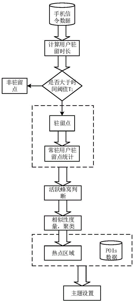
[0030] Such as figure 1 As shown, the present invention provides a kind of urban hot spot judgment method based on mobile signaling data, and its steps are:
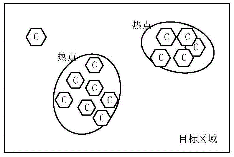
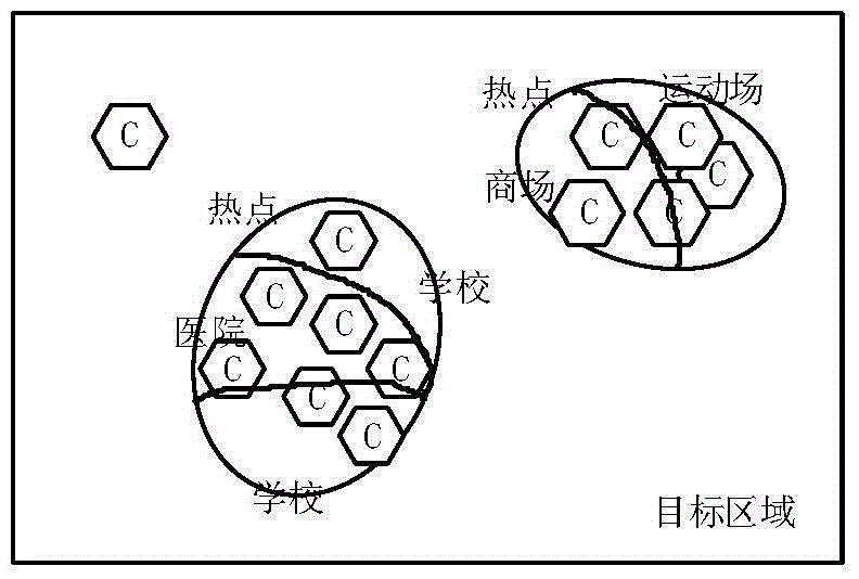
[0031] (1) Use the mobile signaling data to calculate the residence time T of the user in a single cell, and the time threshold T 1 Make a comparison to determine whether the area is a user's residence point, and count the number of resident users n in the area from all users N of the identified residence point, considering the uncertainty of resident users' activities in hotspot areas Introduce the attenuation factor λ (01 , it is determined that the cell is an active cell, otherwise it ...
PUM
 Abstract
Description
Claims
Application Information