Method for confirming and comparing geographical position information by using mobile terminal

A geographic location information and mobile terminal technology, applied in the field of geographic location determination, can solve problems such as fraudulently obtaining insurance or funding, and achieve the effects of preventing collection errors, great practicability, and clear and simple principles

Inactive Publication Date: 2016-09-14
上海博涵建筑设计有限公司
View PDF4 Cites 4 Cited by
  • Summary
  • Abstract
  • Description
  • Claims
  • Application Information

AI Technical Summary

Problems solved by technology

However, it is often encountered that someone registers housing information in a false location to defraud insurance or funding

Method used


Image

  • Method for confirming and comparing geographical position information by using mobile terminal

Examples


Embodiment Construction

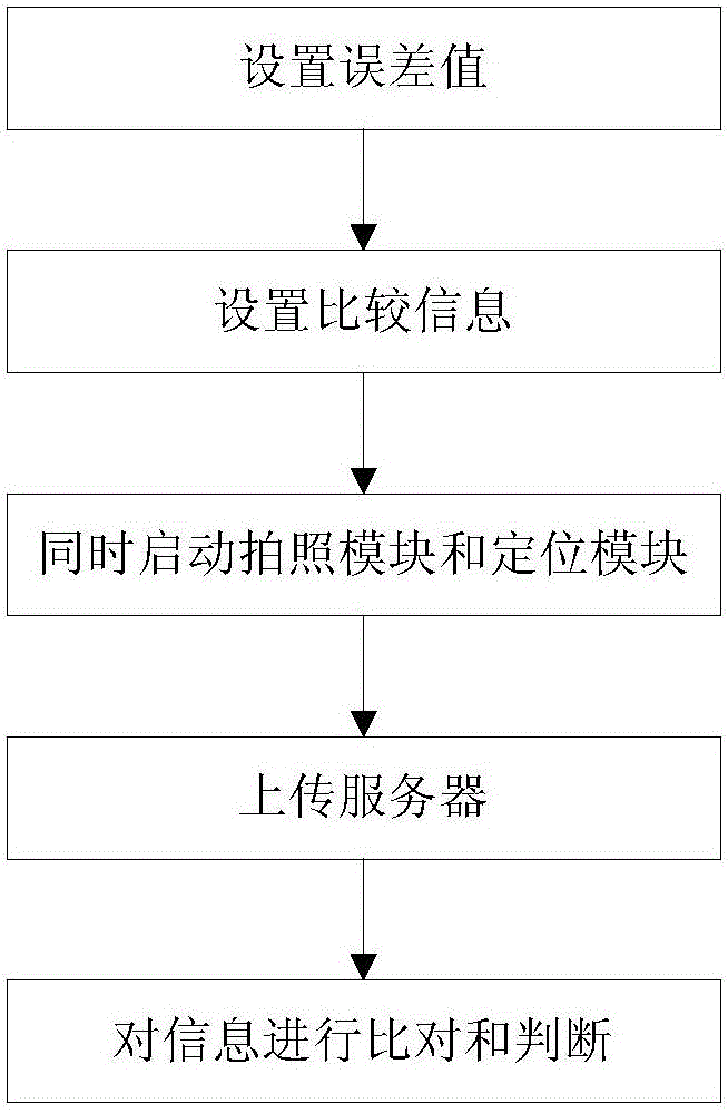
[0015] figure 1 is a flowchart of the present invention. like figure 1 Shown, the present invention comprises the following steps:

[0016] 1. A method for confirming and comparing geographic location information using a mobile terminal, comprising the following steps:

[0017] Step 1. The administrator sets acceptable information error values ​​in the system.

[0018] Step 2. The information collector inputs the geographic location information of the target building into the system as comparison information.

[0019] Step 3. The information collector turns on the image collection and camera module, and the GPS positioning module also starts to run in the background simultaneously.

[0020] Step 4, the information collector takes pictures of the target building; at the same time, the GPS positioning module records the geographic location of the information collector when taking pictures, as the collected information.

[0021] Step 5. The information collector uploads the ...


PUM


Abstract

The invention discloses a method for confirming and comparing geographical position information by using a mobile terminal. The method comprises the steps of: step 1, setting an information error value; step 2, inputting geographical position information of a target building to a system by an information gatherer as comparison information; step 3, opening a picture acquisition and photographing module by the information gatherer, and starting to run a GPS (Global Position System) positioning module in the background synchronously; step 4, photographing the target building by the information gatherer, and at the same time, recording a geographical position as acquisition information when the information gatherer photographs by the GPS positioning module; step 5, uploading a picture and the acquisition information of step 4 to a server together by the information gatherer; and step 6, comparing the acquisition information with the comparison information by the system. The scheme of the method provided by the invention can effectively prevent a geographical information acquisition error of the building from causing losses to government departments and insurance industries.

Description

technical field [0001] The invention relates to a method for determining geographic location, in particular to a method for confirming and comparing geographic location information using a mobile terminal. Background technique [0002] In the insurance industry or government-sponsored work, real estate, mainly houses, is sometimes involved in the registration of information. However, it is often encountered that someone registers housing information in a false location to defraud insurance or funding. How to avoid this phenomenon is an urgent problem to be solved. Contents of the invention [0003] Aiming at the deficiencies of the prior art, the invention discloses a method for confirming and comparing geographical location information by using a mobile terminal. [0004] Technical scheme of the present invention is as follows: [0005] A method for confirming and comparing geographic location information using a mobile terminal, comprising the following steps: [000...

Claims


Application Information

Patent Timeline
Patent Type & Authority Applications(China)
IPC IPC(8): H04M1/725G06F17/30
CPCG06F16/29H04M1/72457
Inventor 何柳包凌
Owner 上海博涵建筑设计有限公司
Why Eureka
Try Eureka