

Method of quantitatively restoring maximum paleo-water depth of lake basin through seismic profiling
A technology of seismic profile and water depth, applied in the field of geological exploration, can solve the problem of lack of reliability of ancient water depth, and achieve the effect of real and reliable calculation results
- Summary
- Abstract
- Description
- Claims
- Application Information
AI Technical Summary
Problems solved by technology
Method used
Image

Examples
Embodiment Construction
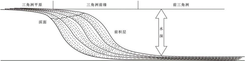
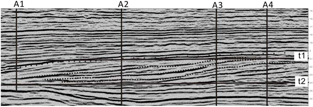
[0021] The invention provides a method for quantitatively restoring the maximum ancient water depth in the geological history period of continental lake basins by using three-dimensional seismic sections. The continental lacustrine delta deposits in the geological history period have the characteristics of obvious forward accumulation. After a long burial and compaction, there is an obvious foreset reflection structure on the seismic section along the direction of delta accumulation. The delta foreset reflection structure is characterized by obvious topset, foreset and bottom settress structures. On the seismic section, the delta foreset has an obvious "S-type" foreset reflection structure, and the thickness of the delta foreset during the depositional period It is approximately equal to the water depth at that time, and the maximum water depth of the lake basin at this time is at least greater than this water depth. Therefore, the maximum ancient water depth of the continental...
PUM
 Abstract
Description
Claims
Application Information