A Scanning Statistical Method for Geographic Spatial Anomaly Gathering Areas Based on Interaction Force

An interaction force and geospatial technology, applied in the field of scanning statistics of geospatial anomaly clusters based on interaction force, can solve problems such as not considering the interaction of geospatial objects, and achieve the effect of accurate detection and strong detection ability

Active Publication Date: 2018-05-11
CHINA UNIV OF PETROLEUM (EAST CHINA)
View PDF4 Cites 0 Cited by
  • Summary
  • Abstract
  • Description
  • Claims
  • Application Information

AI Technical Summary

Problems solved by technology

[0006] In reality, geospatial anomaly clusters have different shapes and most of them are irregular. Therefore, based on the Kulldorff circular and elliptical scanning statistical methods, existing research focuses on improving the detection ability of irregular areas, that is, scanning Optimizing methods, window shapes, etc., so that various irregular shapes of spatial anomaly clusters can be detected, but these studies have not considered the inherent interaction between geospatial objects

Method used


Image

  • A Scanning Statistical Method for Geographic Spatial Anomaly Gathering Areas Based on Interaction Force
  • A Scanning Statistical Method for Geographic Spatial Anomaly Gathering Areas Based on Interaction Force
  • A Scanning Statistical Method for Geographic Spatial Anomaly Gathering Areas Based on Interaction Force

Examples


Embodiment 1

[0129] Example 1: Simulation data set I

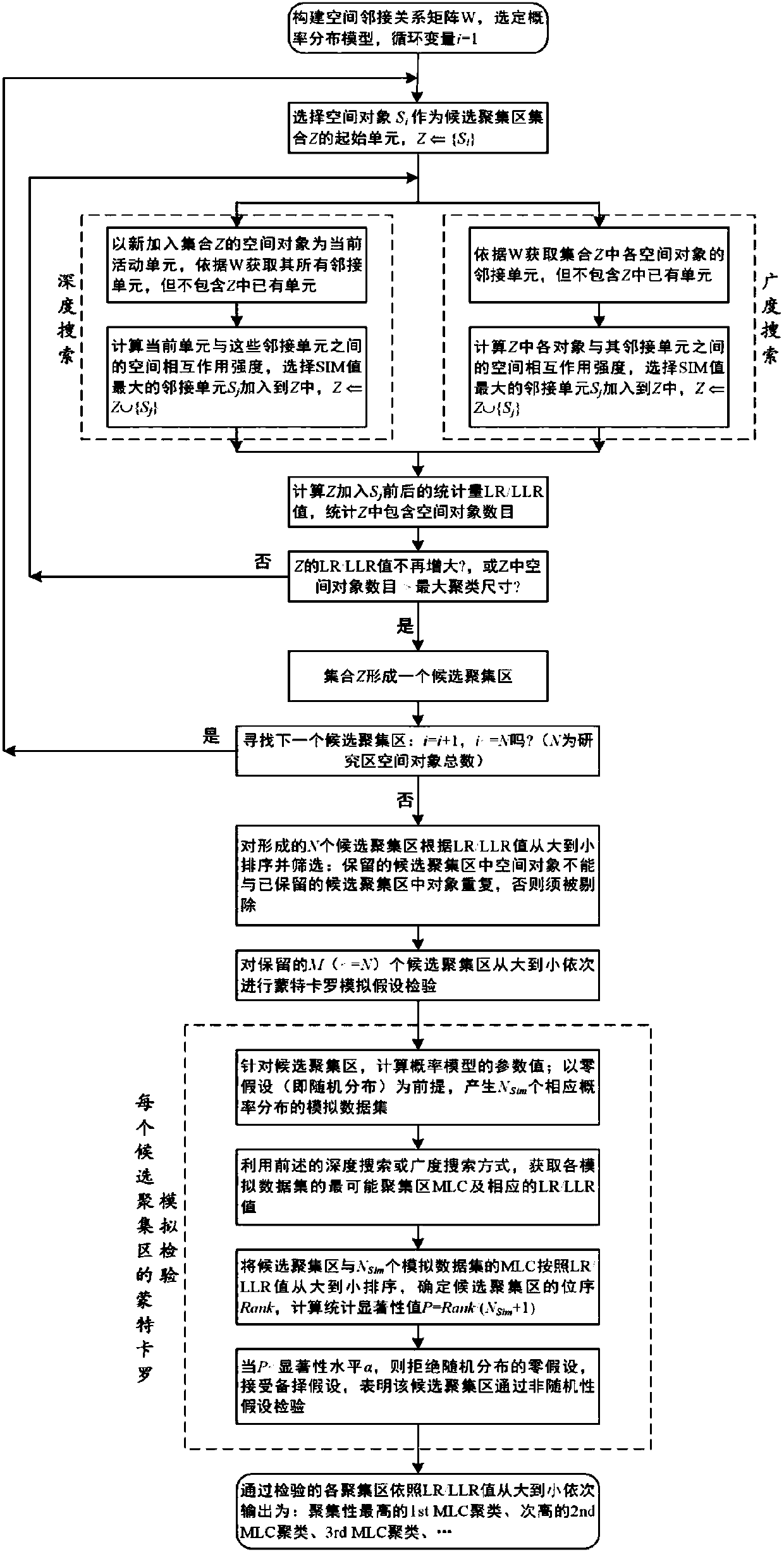
[0130] The simulated data set I includes 4 data sets, and each data set contains an MLC cluster of different shapes, such as band, S-shape, O-shape, and cross-shape, such as Figure 4(a) ~ 4(d) shown.

[0131] The total number of spatial units per data set N = 400, the overall attribute b of each unit i = 40, the instance attribute c of the unit in the cluster i = 20, the instance attribute c of the unit outside the cluster i = 10. The number of cluster space units in the four data sets are 40, 40, 80, 80 respectively, and the MLC cluster size ratio (referring to the ratio of the number of MLC cluster units to the total number of data set units N) is 0.1, 0.1, 0.2, 0.2.

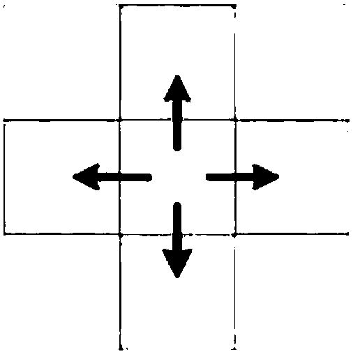
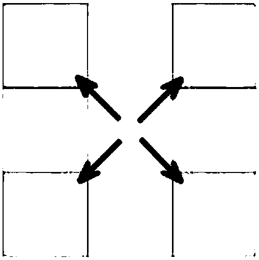
[0132] Spatial adjacency takes the form of queens whose common boundaries and vertices are directly adjacent. The parameters k and b of the spatial interaction SIM model take the value of 1, a takes the value of 2, and d adopts the ordinary Euclidean distance bet...

Embodiment 2

[0146] Example 2: Simulation Dataset II

[0147] The simulated data set II includes two data sets, each of which contains an MLC cluster with depressed units, and the shapes of the MLC clusters are bands and crosses, as shown in Figure 5(a) and Figure 6(a) , a depression unit refers to a cluster unit whose event rate is slightly higher than that of the units outside the cluster, but significantly lower than that of other units in the cluster. The existence of the depression unit increases the detection difficulty of the spatial scanning method , when the detection ability of the scanning method is weak, the clustering results may be interrupted here because the sunken units cannot be detected. The banded cluster contains 1 sunken unit, and the cross-shaped cluster contains 3 adjacent sunken units on the left and right sides. If no sunken unit is detected, a small number of cluster units isolated by the sunken unit (the banded cluster is isolated Open 1 unit, the left and righ...

Embodiment 3

[0154] Example 3: Simulation Dataset III

[0155] The simulated dataset III includes two datasets III(a) and III(b), each of which contains two MLC clusters of different shapes, such as Figure 7(a) , 7(b) shown. The total number of spatial units per data set N = 400, the overall attribute b of each unit i = 40, the instance attribute c of the unit in the cluster i = 20, the instance attribute c of the unit outside the cluster i =10.

[0156] Ⅲ(a) contains two clusters of O-shape and I-shape, the numbers of cluster space units are 80 and 40 respectively, the total number of cluster units is 120, and the ratio of the total size of clusters is 0.3. Ⅲ(b) contains two clusters of L-shape and S-shape, the numbers of cluster space units are 40 and 40 respectively, the total number of cluster units is 80, and the ratio of the total size of clusters is 0.2. These two data sets are used to compare and test the three methods of SIM depth scanning, SIM breadth scanning and Kulldorf...


PUM


Abstract

The invention discloses a method for scanning statistics of geographical space anomaly gathering areas based on interaction force, comprising the following steps: constructing a spatial adjacency relationship matrix based on a selected spatial adjacency type; using a spatial interaction model to measure the interaction strength between adjacent objects ;Based on the depth scanning method or the breadth scanning method, continuously select the adjacent objects with the greatest action intensity and add them to the candidate aggregation area until the likelihood ratio LR / log likelihood ratio LLR value corresponding to the high-value abnormal aggregation no longer increases or reaches a low value The likelihood ratio LR / log-likelihood ratio LLR value corresponding to abnormal aggregation no longer decreases or stops when the candidate aggregation area reaches the maximum specified size; Monte Carlo simulation is performed on multiple candidate aggregation areas formed to detect non-random Abnormal clusters for hypothesis testing. The present invention has stronger detection ability for irregularly shaped abnormal gathering areas, is easier to detect abnormal gathering areas containing weak connections, and does not include non-abnormal geographical objects in detected abnormal gathering areas.

Description

technical field [0001] The invention relates to the technical field of geospatial information processing, in particular to a scanning statistics method for geospatial anomaly gathering areas based on interaction force. Background technique [0002] Geospatial scan statistics are methods of geospatial clustering. Spatial clustering refers to grouping geographical objects into several categories according to spatial characteristics and attribute characteristics, so that the similarity between objects of the same type is the largest, the difference between objects of the same type is the largest, and objects of different types have obvious distinctions in spatial distribution. The purpose of spatial clustering is to discover geospatial distribution patterns, as well as potential interrelationships between geographic objects. Traditional spatial clustering methods can be divided into partition clustering, hierarchical clustering, density clustering, grid clustering and other ty...

Claims


Application Information

Patent Timeline
Patent Type & Authority Patents(China)
IPC IPC(8): G06F19/00G06K9/62
CPCG16Z99/00G06F18/23
Inventor 王海起董倩楠桂丽彭佳琦车磊陈冉刘玉曾喆翟文龙费涛闫滨
Owner CHINA UNIV OF PETROLEUM (EAST CHINA)
Why Eureka
Try Eureka