Multi-rotor unmanned aerial vehicle and calibrating method and system for electronic compass thereof

A multi-rotor unmanned aerial vehicle, electronic compass technology, applied in directions such as compass, measuring device, surveying and navigation, etc., can solve problems such as electronic compass calibration

Inactive Publication Date: 2016-11-23
SHANGHAI TOPXGUN ROBOT CO LTD
View PDF6 Cites 17 Cited by
  • Summary
  • Abstract
  • Description
  • Claims
  • Application Information

AI Technical Summary

Problems solved by technology

[0005] The purpose of the present invention is to provide a calibration method and system for a multi-rotor UAV and its electronic compass, to solve the problem that the electronic compass is not calibrated when the airborne equipment works to generate magnetic field interference

Method used


Image

  • Multi-rotor unmanned aerial vehicle and calibrating method and system for electronic compass thereof
  • Multi-rotor unmanned aerial vehicle and calibrating method and system for electronic compass thereof
  • Multi-rotor unmanned aerial vehicle and calibrating method and system for electronic compass thereof

Examples


Embodiment Construction

[0040] In order to enable those skilled in the art to better understand the technical solutions of the present invention, the present invention will be further described in detail below in conjunction with the accompanying drawings.

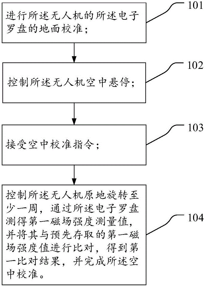
[0041] like figure 1 As shown, a method for calibrating an electronic compass of a multi-rotor drone provided in an embodiment of the present invention includes the following steps:

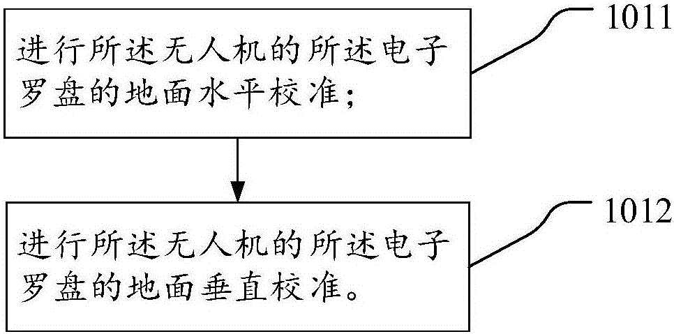
[0042] 101. Perform ground calibration of the electronic compass of the drone;

[0043] Specifically, the electronic compass is an azimuth identification device for the UAV, including three magnetoresistive sensors perpendicular to each other. The resistance sensor can detect the magnetic field strength in the body of the UAV. The ground calibration is through the up and down, left and right, and front and rear steering of the UAV when it is on the ground, so that the UAV can move according to the trajectory preset by the operator. During the process, the magnetic...


PUM


Abstract

The invention discloses a multi-rotor unmanned aerial vehicle and a calibrating method and system for an electronic compass thereof. The calibrating method comprises the following steps that ground calibration of the electronic compass of the unmanned aerial vehicle is conducted; the unmanned aerial vehicle is controlled to achieve hovering; an aerial calibration instruction of the unmanned aerial vehicle is received; the unmanned aerial vehicle is controlled to rotate in situ by at least one circle, a first magnetic field intensity measurement value is measured through the electronic compass and compared with a prestored first magnetic field intensity value, a first comparison result is obtained, and aerial calibration is completed. In the above-mentioned technical scheme, according to the calibrating method of the electronic compass, when the unmanned aerial vehicle achieves hovering, airborne equipment of the unmanned aerial vehicle is in a working state, at the moment, the unmanned aerial vehicle is controlled to rotate in situ by at least one circle, in this way, the electronic compass can be calibrated in the working state, and the possibility of a deviation which is generated when the electronic compass achieves orientation discrimination is removed.

Description

technical field [0001] The invention relates to unmanned aerial vehicle technology, in particular to a calibration method and system for a multi-rotor unmanned aerial vehicle and its electronic compass. Background technique [0002] In recent years, UAV technology has developed rapidly, among which multi-rotor UAV is one of the main types of UAV. The multi-rotor UAV relies on adjusting the speed of the motor to change the rotor speed and realize the change of lift force, so as to realize various flight modes of the UAV. [0003] In the prior art, multi-rotor UAVs use an electronic compass to identify the azimuth. Since the electronic compass is very sensitive to the magnetic field environment and is easily affected by the surrounding magnetic field, it needs to be calibrated before use. Generally, the electronic compass is calibrated on the ground, and the drone in the standby state is rotated horizontally and vertically to obtain different measured values ​​of magnetic fie...

Claims


Application Information

Patent Timeline
Patent Type & Authority Applications(China)
IPC IPC(8): G01C17/38
CPCG01C17/38
Inventor 尹亮亮李少斌高廉洁张羽
Owner SHANGHAI TOPXGUN ROBOT CO LTD
Why Eureka
Try Eureka