
Method for operating a navigation system of a motor vehicle and motor vehicle

A technology for navigation systems and motor vehicles, which is applied in the field of motor vehicles and can solve problems such as deviations

Active Publication Date: 2019-08-02
AUDI AG
View PDF5 Cites 0 Cited by
  • Summary
  • Abstract
  • Description
  • Claims
  • Application Information

AI Technical Summary

Problems solved by technology

[0007] Problems also arise in particular when there are no house numbers in the immediate vicinity of the street at the position of the shortest distance to the street, whereby the navigation target then only contains streets without house numbers as addresses and can be compared with the real Significant deviation from the target location

Method used


Image

  • Method for operating a navigation system of a motor vehicle and motor vehicle
  • Method for operating a navigation system of a motor vehicle and motor vehicle
  • Method for operating a navigation system of a motor vehicle and motor vehicle

Examples


Embodiment Construction

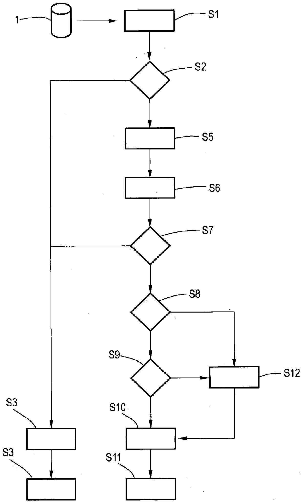
[0031] figure 1 A flow chart of an exemplary embodiment of the method according to the invention is shown in which, in step S1 , target data set 1 is transmitted from an Internet source to a navigation system of a motor vehicle in the present case. Destination data set 1 describes the destination point to which the driver of the motor vehicle is directed by means of the geodetic position and the address. A navigation target suitable for the navigation system should now be derived from the target data set, for which the method shown here is mainly used.

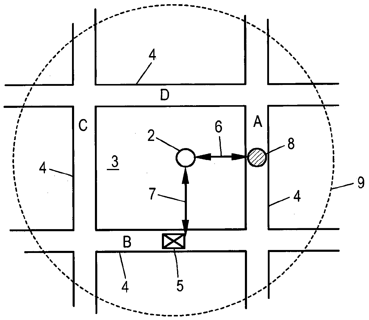
[0032] here in figure 2 The interrelationship is shown again in the schematic sketch of . The geodetic location 2 is here clearly located in a building block 3 , which is bounded by four streets 4 , which are also recorded in the digital map data of the navigation system. In the present case, simplified street markings are chosen in the example, whereby the street to the right of location 2 is A street, the street below lo...


PUM


Abstract

A method for operating a navigation system of a motor vehicle, wherein upon reception of a destination data record containing a geodetic position and a first address associated with the position. Based on digital map data stored in the navigation system test addresses are created and are geodetically assigned, wherein the test addresses contain at least a street name and are located in the destination region of the position. A second address is selected from the test addresses that with regard to at least one character string describing the test address deviates the least from said first address, wherein, after the level of discrepancy of the second address as compared to the first address is determined to be less than or equal to a maximum value, the navigation system navigates to the second address.

Description

technical field [0001] The invention relates to a method for operating a navigation system of a motor vehicle and to a motor vehicle. Background technique [0002] Navigation systems for motor vehicles are sufficiently known in the prior art. The current geodetic position of the motor vehicle can be determined with the aid of suitable position sensors, in particular GPS sensors. The user interface, the usual human-machine interface of most motor vehicles, allows the selection of a navigation target, after which an optimal route can be carried out in the controller of the navigation system according to certain criteria which can sometimes be changed by the user. The driver is guided to his navigation target by means of correspondingly output prompts. Fully autonomous guidance by means of a navigation system is also conceivable or conceivable for future semi-autonomous or fully autonomous motor vehicles. [0003] For object guidance, modern navigation systems use digital ma...

Claims


Application Information

Patent Timeline
Patent Type & Authority Patents(China)
IPC IPC(8): G01C21/36
CPCG01C21/362G01C21/3679
Inventor A·胡特
Owner AUDI AG
Learn More